DALLAS — Be sure to download the WFAA app to track the latest forecast and get alerts from our team.
We're entering what is typically the hottest time of the year, but thankfully Mother Nature has other plans!
Versión en Español: ¡Prepárese para un clima más seco y cálido durante la semana y el fin de semana!
Quick Notes:
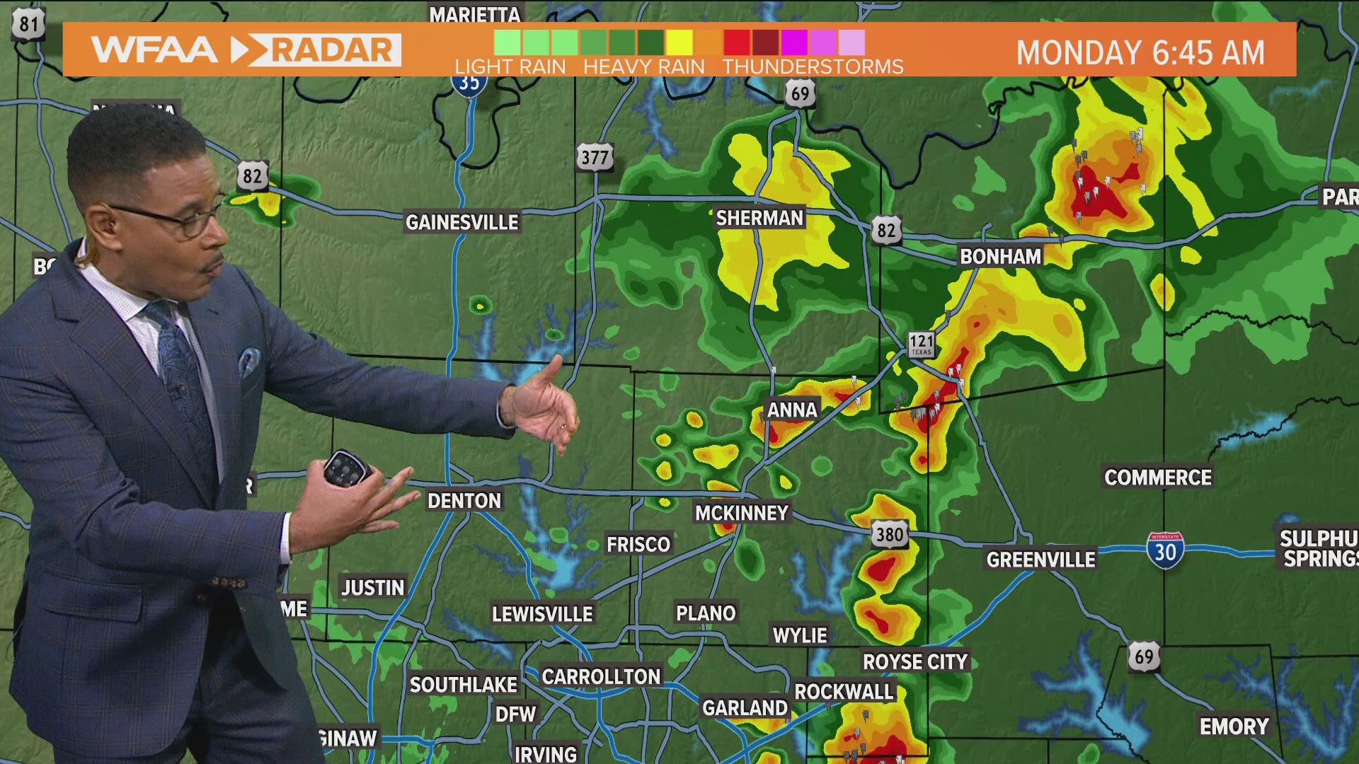
- On and off rain on Monday mainly south of I-20
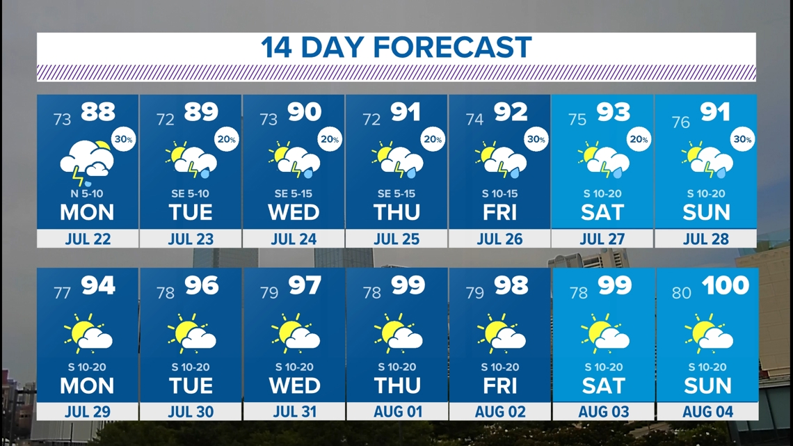
- Unsettled pattern this week with rain chances and below normal temps
- Typical summer heat will return
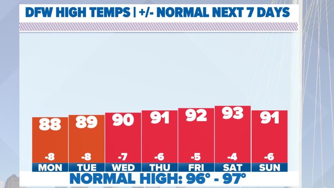
Below Normal Temperatures
Here's a bit of good news and something you might love to see in the middle to end of July: No 100° temps for at least a week or longer. While we will certainly be very warm at times, temperatures are actually expected to stay below normal for the next 7+ days. We are officially entering the (normally) hottest days of the year. The normal high by next Tuesday climbs to 97° which is the hottest we see in a year. The normal high starts to go back down starting Aug. 15. In the meantime, this is looking pretty good!

Rain Chances Return
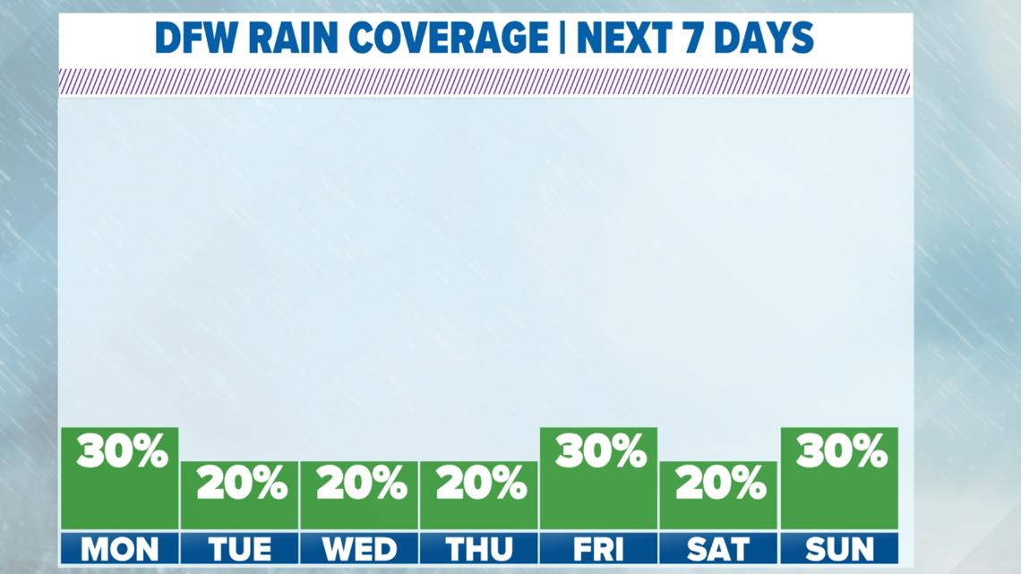
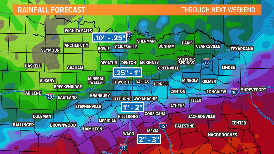
Each day this week will have showers and storms somewhere in North Texas with most areas seeing scattered rain. Overall, it looks like the highest coverage of rain this week will be in southern North Texas with a lower coverage for those along the Red River.

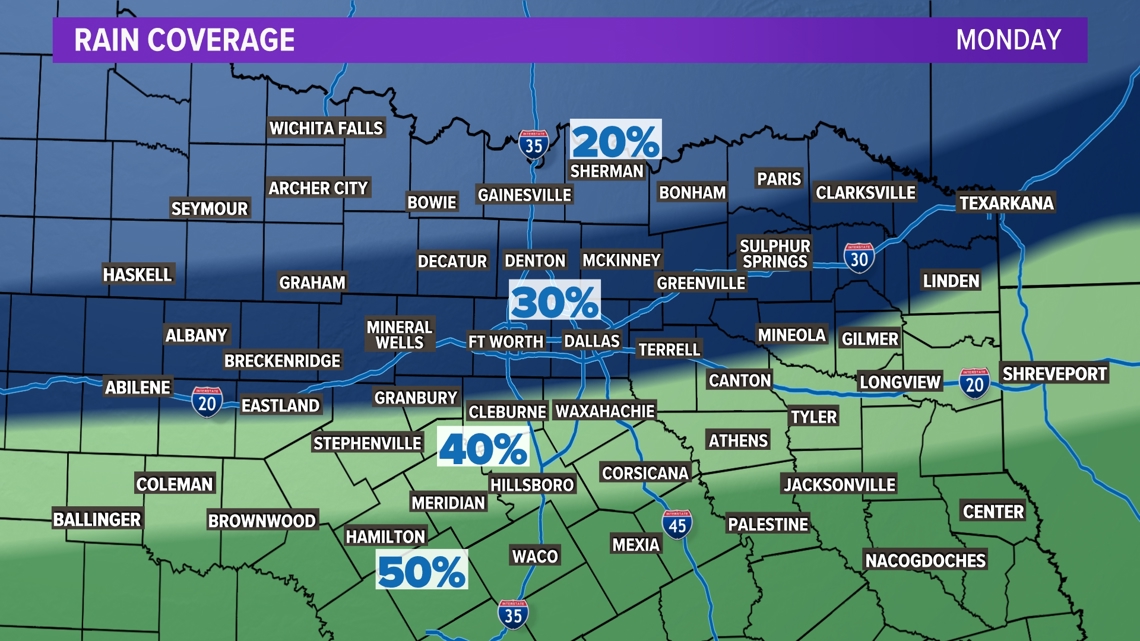

By the end of next weekend, totals will range from around .10-.25" in northern areas to 2-3" in southern areas.

14 Day Forecast

