DALLAS — Be sure to download the WFAA app to track the latest forecast and get alerts from our team.
Versión en Español: ¿Qué tan frío se pondrá DFW y cuándo? Último pronóstico aquí.
Here's a look at the forecast going into the weekend
Quick Facts:
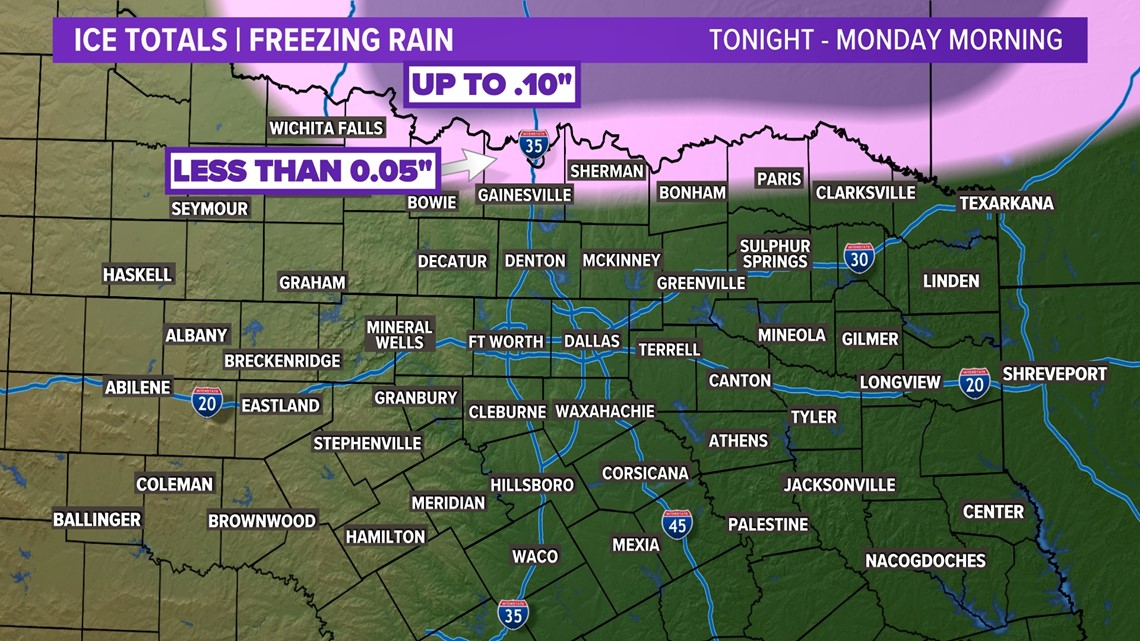
- Freezing rain possible Sunday night into Monday morning
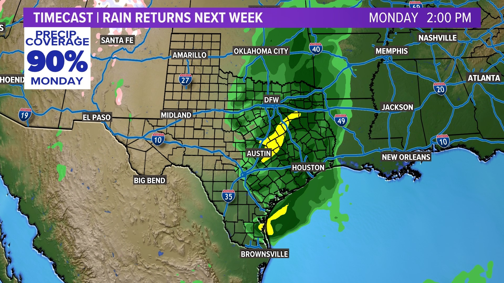
- Warming and rainy next week
- Significant amounts of rain expected
Monday morning
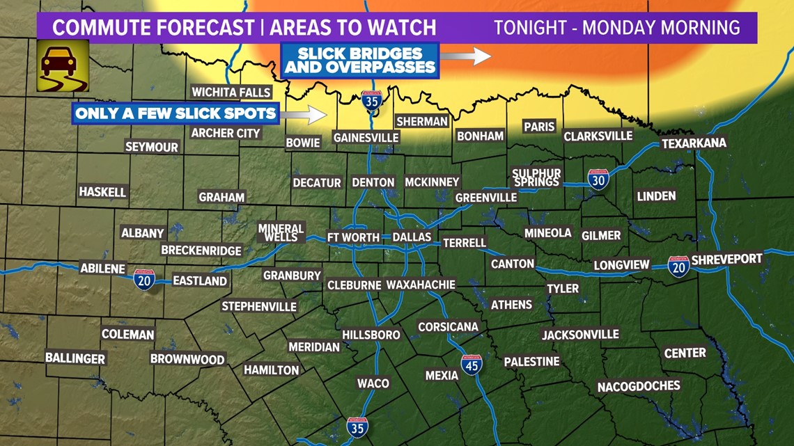
A majority of the precipitation looks like it will fall as rain as surface temps will be above freezing. However, if temps stay at or below freezing in some areas Sunday afternoon and evening, those places may have to contend with some light freezing rain. That chance is mainly along the Red River.
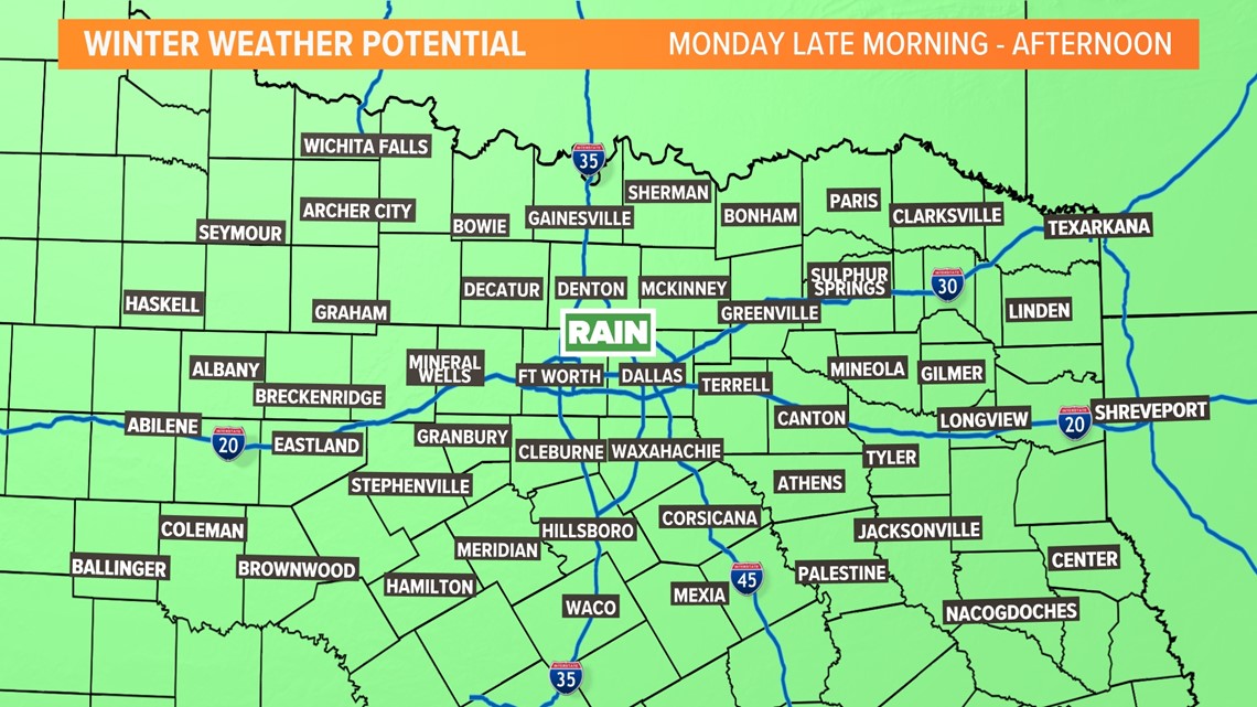
Whatever little bit falls will all melt late morning.
Again, the area with the highest potential for slick roads, bridges, and overpasses will be areas closer to the Red River as well as western North Texas. There's a good chance DFW never drops below freezing.
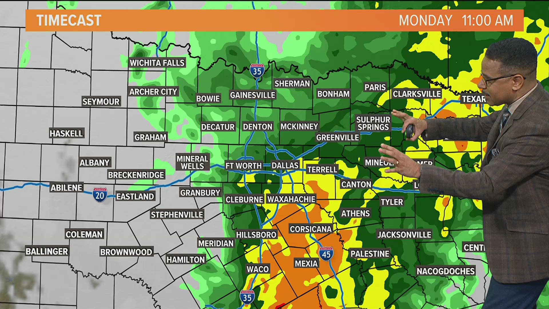
The transition to all rain (for those seeing any frozen precip) will happen by mid to late morning. Highs will climb into the 40s and low 50s by the afternoon.



Rest of next week
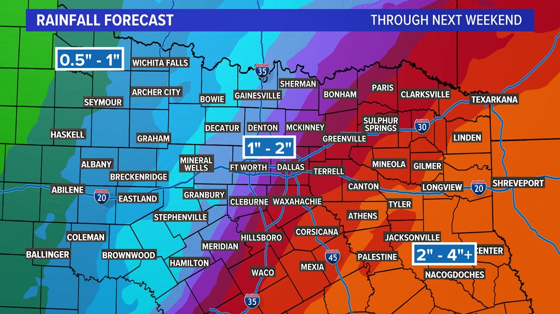
Daily chances of rain remain in the forecast next week. The rain will come in waves, so not every hour of every day will be rainy. There will be plenty of dry hours, and some days have better chances than others. But there is at least a chance of rain each day next week. Total accumulations are expected to be in the 1"-2" range. Some areas southeast of the metroplex could even pick up 4" or more.

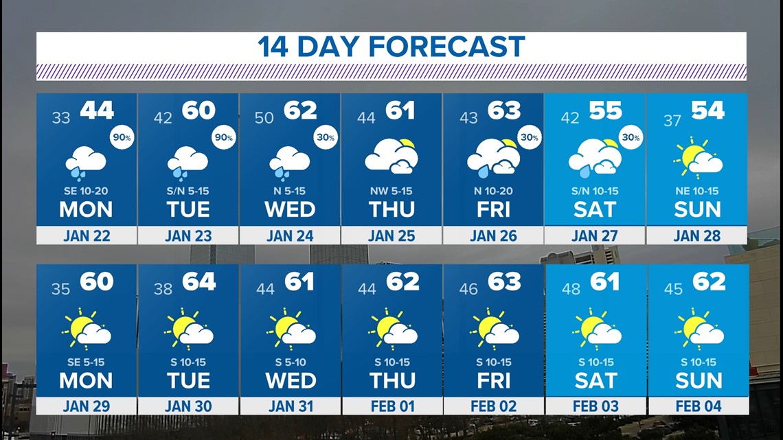
14 Day
Mild days ahead!
Look at how the month of January ends and February begins. Pretty nice!

