DALLAS — Versión en Español: El verdadero clima de otoño llega esta semana
The scattered rain and thunderstorms Wednesday night caused delays, cancellations and early closures. And at one point, a Tornado Warning was issued for Dallas and Ellis counties.
As of 5:30 a.m. Thursday, at least 34,000 customers are without power across the state, according to the Oncor Outage Map.
Quick facts:
- Severe Thunderstorm Watch for all of North Texas has expired
- Widespread storms arrived Wednesday night
- Much cooler temps late week and especially this weekend
Severe Thunderstorm Watch
A Severe Thunderstorm Watch has expired for North Texas.
Tornado warning
A Tornado Warning was issued for Southern Dallas and Northern Ellis counties around 9:40 p.m. Residents were urged to seek shelter. The warning was in effect until 10:30 p.m. Wednesday No active warnings in place.
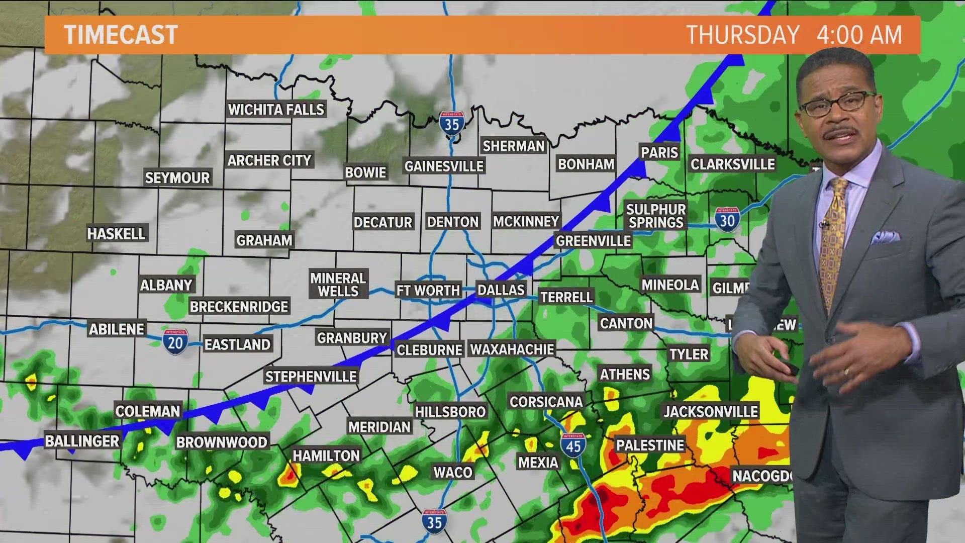
Storm timing
Storms moved into most of DFW after 8 p.m. Wednesday.
Round of storms kept moving south arriving in southern and southeastern North Texas during the late night hours into early Thursday morning.
Rain will continue to move out over the next few hours.
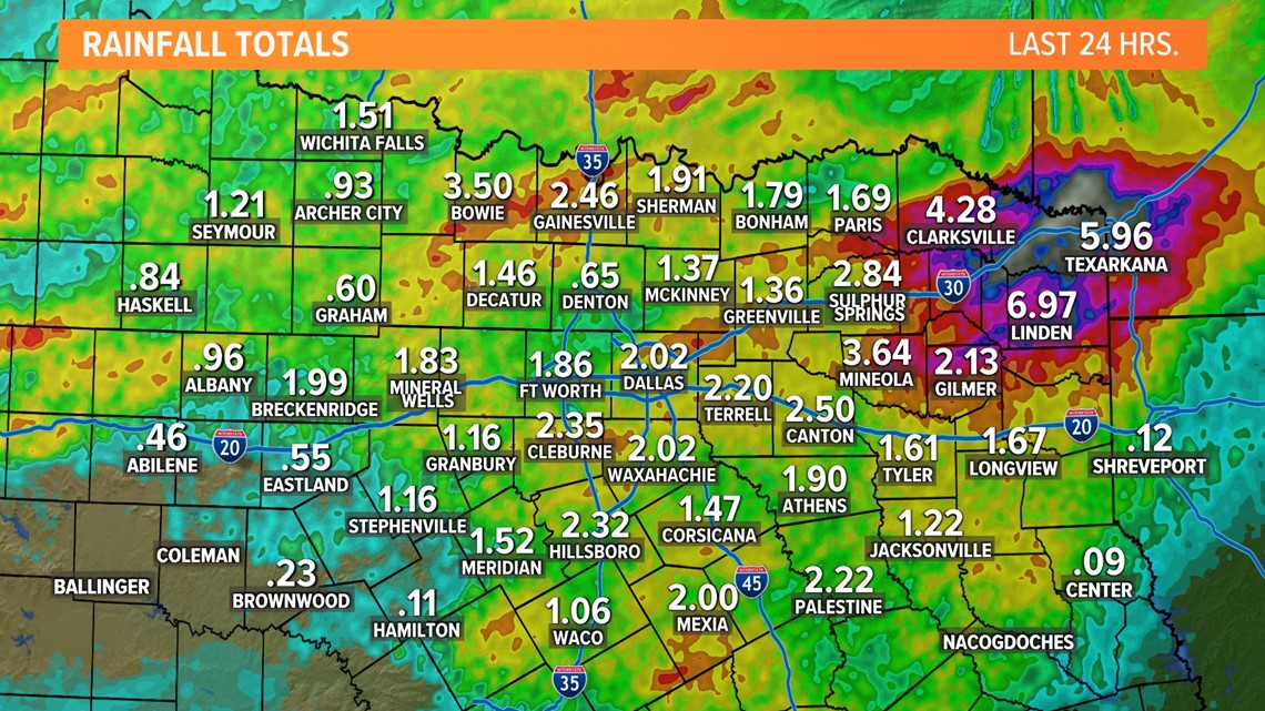
Rainfall totals
Highest rainfall totals through Thursday morning look to be in northeastern North Texas. That's where 2in to 4in of rain fell with isolated higher amounts.
Because of the threat of higher rain totals, a Flood Watch was issued for those areas. Instances of flooding are possible especially in low-lying and typical flood-prone locations.
Outside of the Flood Watch totals of around 1in to 2in are possible with some places seeing more and some places seeing less. Can't rule out some isolated flooding issues, but a lower threat than areas under the Flood Watch.


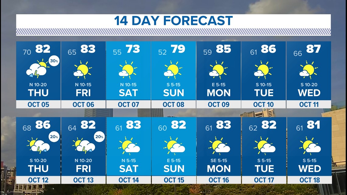
14-Day Forecast
Rain will clear out through the day on Thursday with most places dry through the afternoon into evening.
Cooler air will arrive as well with highs in the low 80s both Thursday and Friday. Even cooler air arrives this weekend with the nicest weekend and coolest temps we have seen in months!


