DALLAS — Be sure to download the WFAA app to track the latest forecast and get alerts from our team.
Beryl has moved out. Warmer and drier weather is on tap the rest of the week. Here's the latest forecast:
Versión en Español: ¡Prepárese para un clima más seco y cálido durante la semana y el fin de semana!
Quick Notes:
- Little to no rain chances
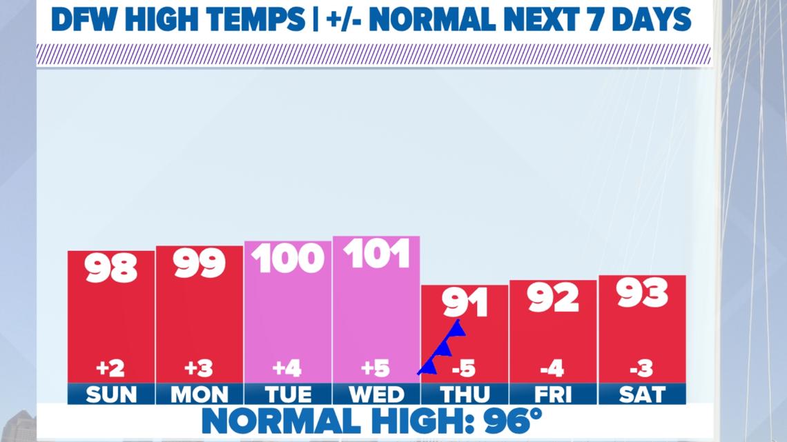
- Return of the 100s
- A cold front not far behind
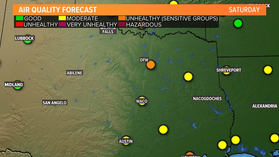
Air Quality
The air quality in DFW has improved. We're sitting at the moderate level on this Sunday, which still isn't good, but it's the best condition we've seen in days.

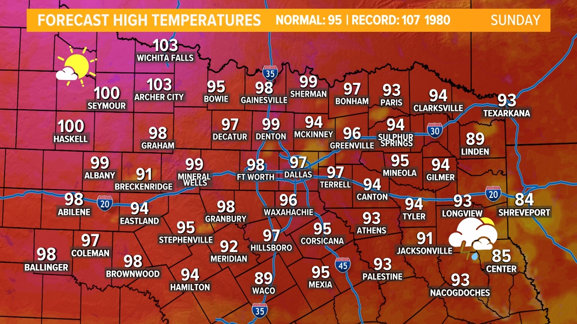
Heating up
The forecast doesn't change much day to day. High temperatures will be trending just a few degrees warmer than the normal for mid-July. Humidity will climb a bit over the weekend. This brings the heat index up to 107 for some on Sunday.


Any rain?
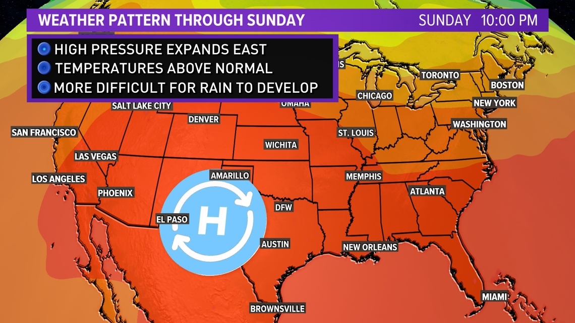
A strong ridge of high pressure will be over the western side of the country and that is bringing record high temperatures for many in the west. The strong ridge keeps North Texas in a northwest flow making it possible for storms to develop. As of now, if any storms develop, it'll be under the hottest part of the day. Generally, the activity will be very isolated with low coverage and low chances for severe weather. It is not impossible to see isolated storms, but most stay dry. This is a pretty typical summer time pattern. Over the weekend, the ridge of high pressure expands east into North Texas. This will make it difficult for storms to develop.

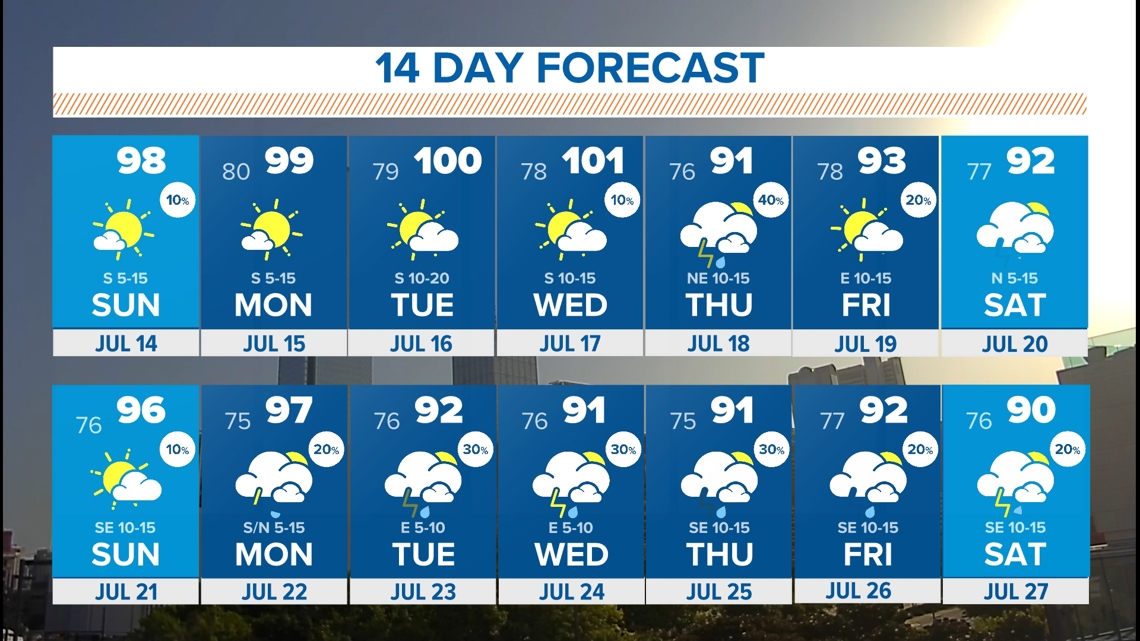
14 day forecast
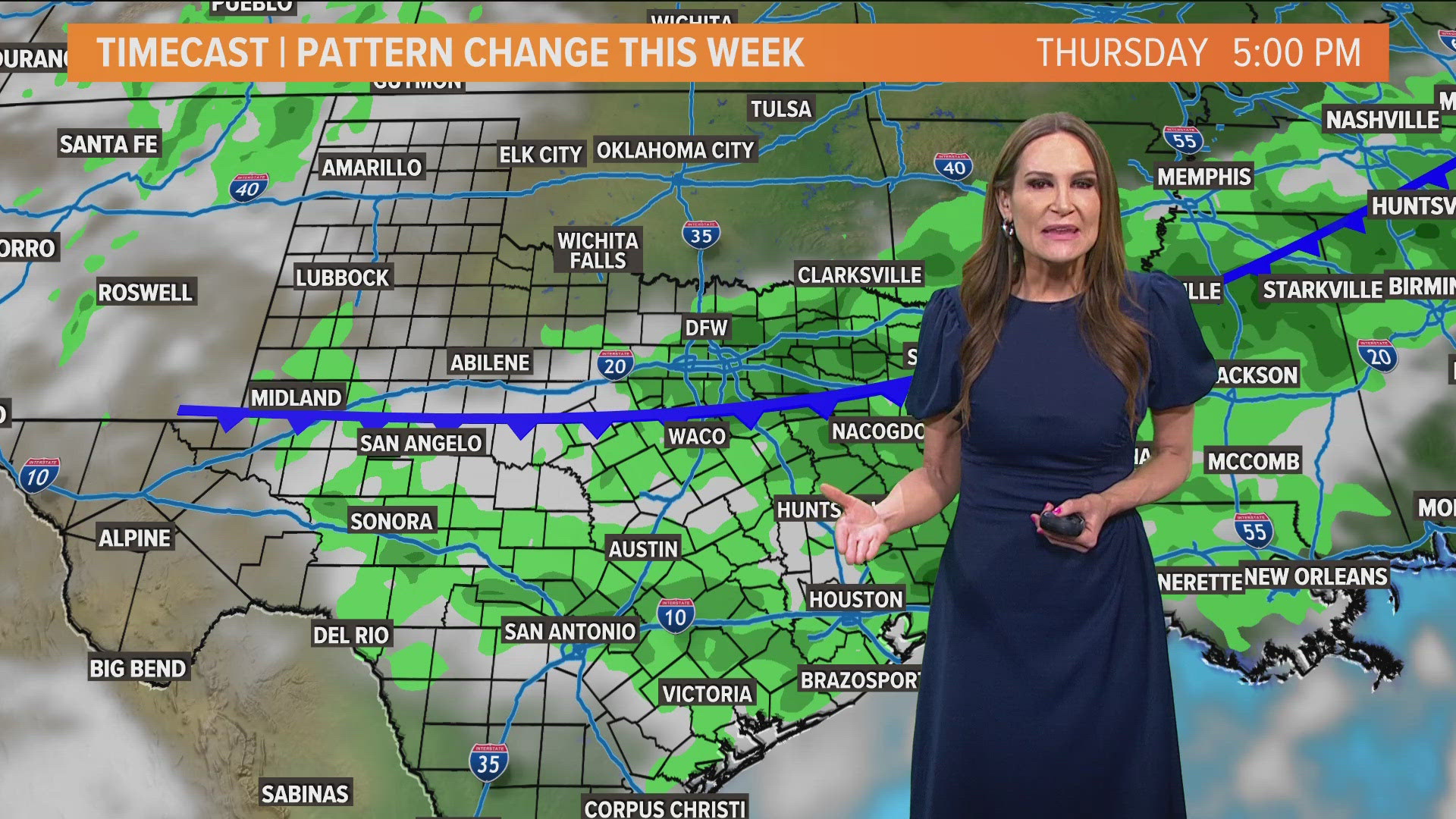
The pattern generally looks quiet over North Texas the next couple of weeks. Any tropical activity looks quiet. The ridge of high pressure over the western part of the United States may shift over to the east a bit late this weekend into early next week. The could bring high temperatures closer to reaching the triple digits. Tuesday and Wednesday will probably be the hottest temperatures we see this week. THEN... A cold front and daily rain chance? It's possible! Stay tuned on the latest numbers as we get closer.

