DALLAS — Be sure to download the WFAA app to track the latest forecast and get alerts from our team.
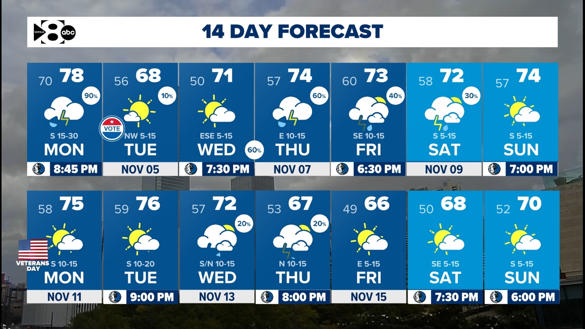
After a mostly inactive weather pattern throughout October, the forecast is picking up with activity here in the early goings of November.
Let's dive into that with a look at what's to come weather-wise as we head into the first week of this new month.
Quick look ahead:
- Rain chances continue through Monday
- Severe risk possible Monday
- More rain possible next week
Monday
The WFAA weather team has declared Monday a Weather Alert day.
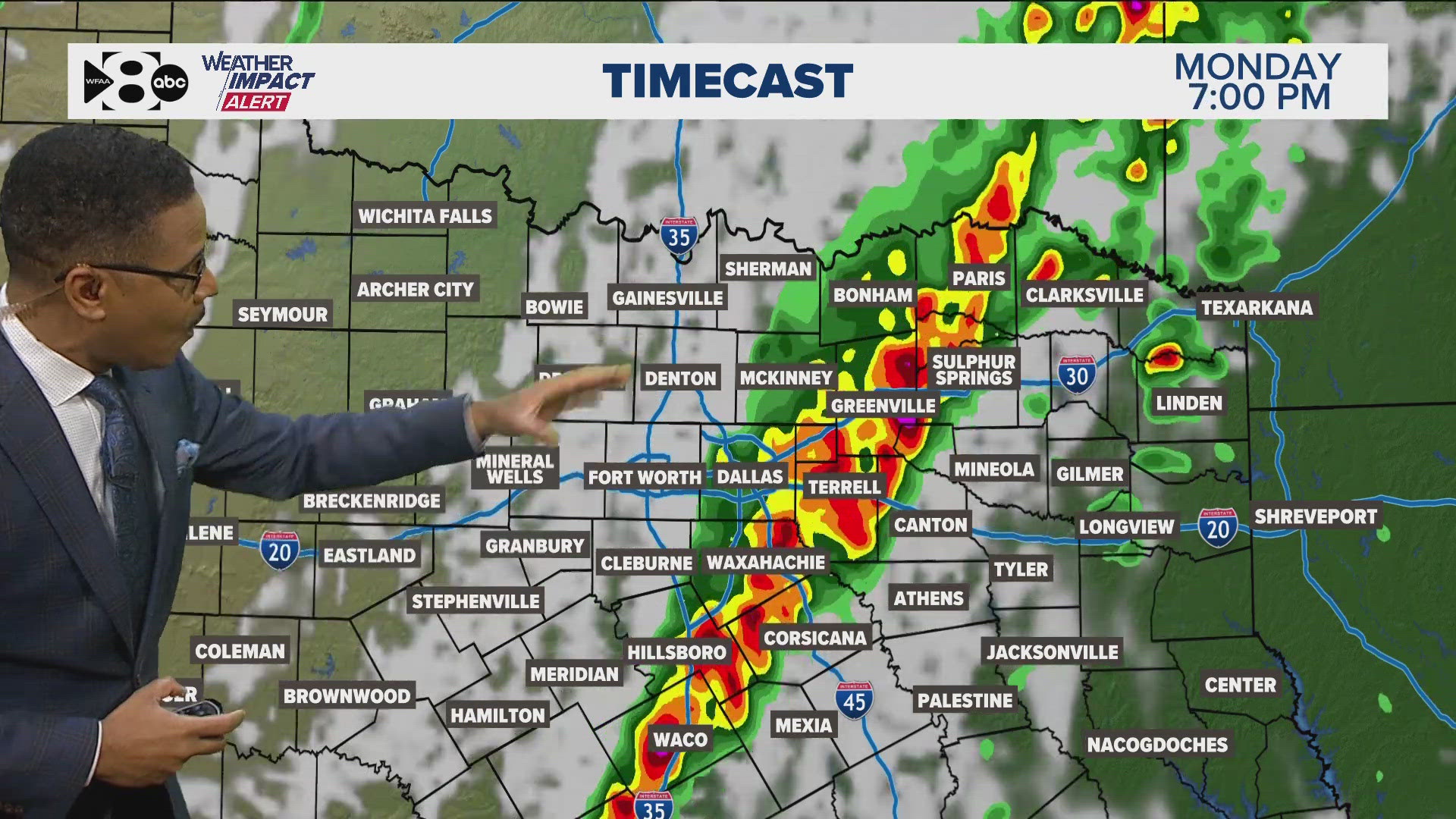
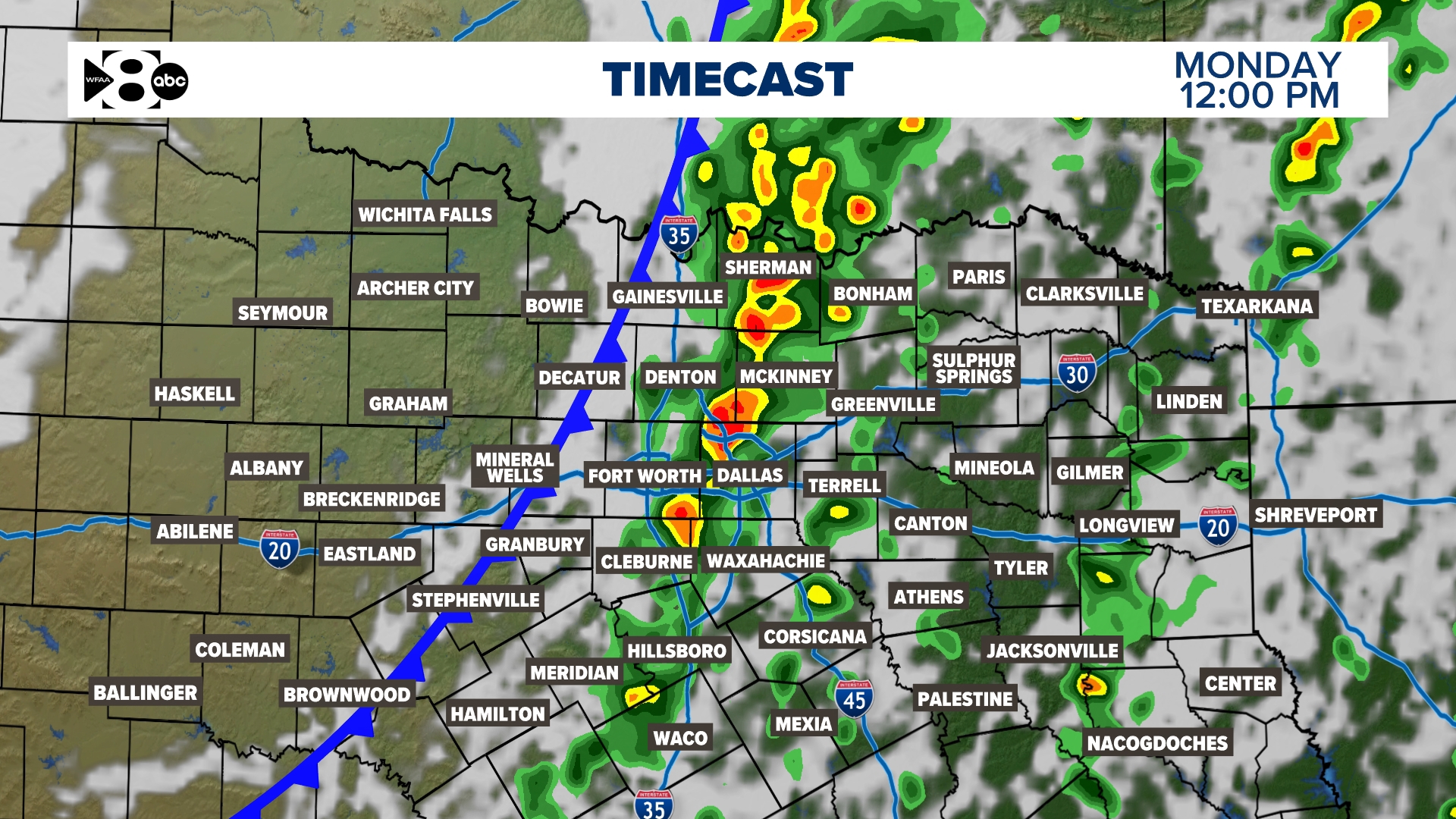
A line or broken line of storms will move across North Texas from west to east during the day. As of now timing looks like it will hit west of DFW through mid-morning, the main DFW metro region late morning into early afternoon, and east of DFW during the afternoon into evening.
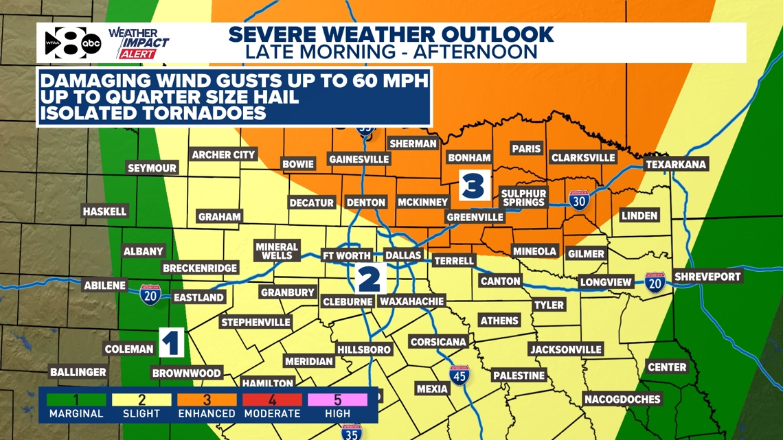
The severe threat with this round will be highest for areas that see storms during the afternoon into evening. Right now, that most favored area looks to be north and northeast of DFW in the "enhanced" risk.
Main threats will be damaging winds (60mph or higher) and large hail (up to quarter size). However, there will be a threat of tornadoes with any isolated storms during the afternoon or evening and with possible spin-ups within the line of storms.
For DFW, the severe threat will be highest for those that do not see storms until the afternoon, so make sure to stay extra aware.

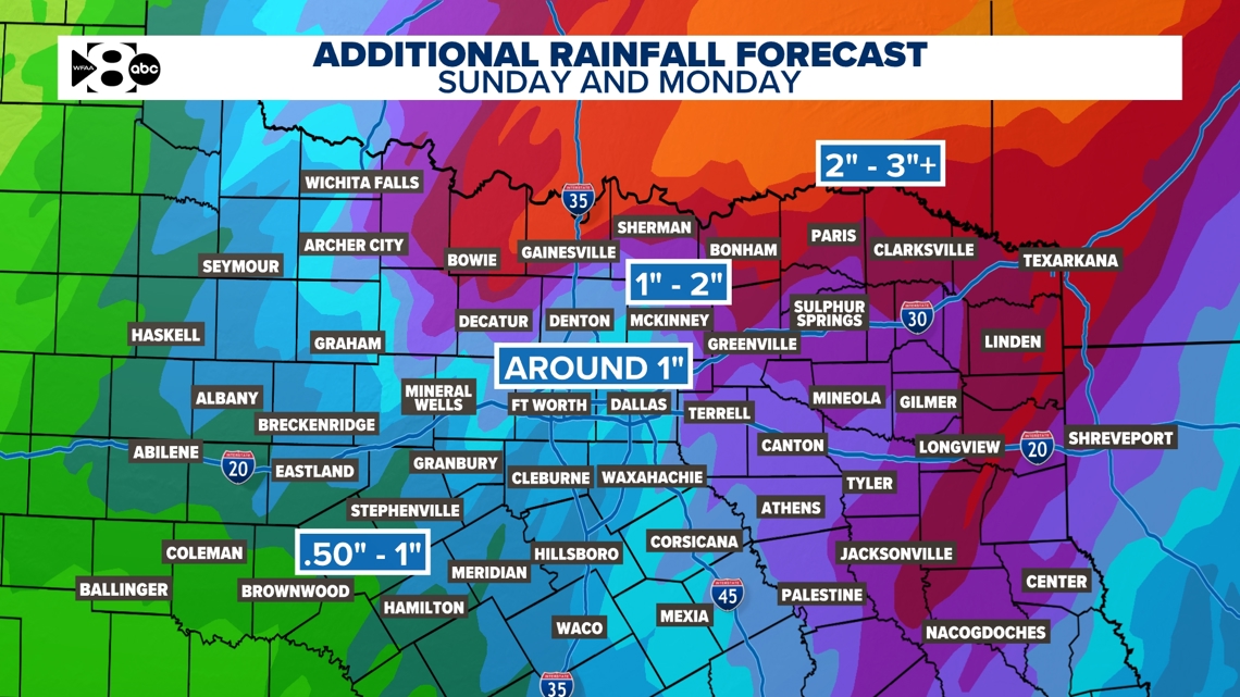
What about rain totals?
Totals look to be highest for those along the Red River and parts of East Texas through Monday with lowest totals for areas to the south and southwest.
For most of North Texas, totals around 1in give or take look most likely.

14-day forecast

