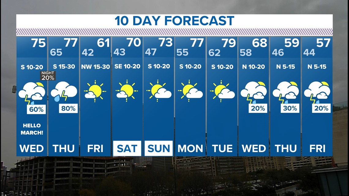
DALLAS — Meteorological spring kicks off on today, March 1. The forecast certainly reflects the start of spring with warm weather and storms.
Quick look:
- Clouds return with scattered showers and storms on Wednesday
- Strong to severe storms are likely Thursday late day into the evening
- Dry and cooler Friday into the weekend
Storm chances and severe weather threat
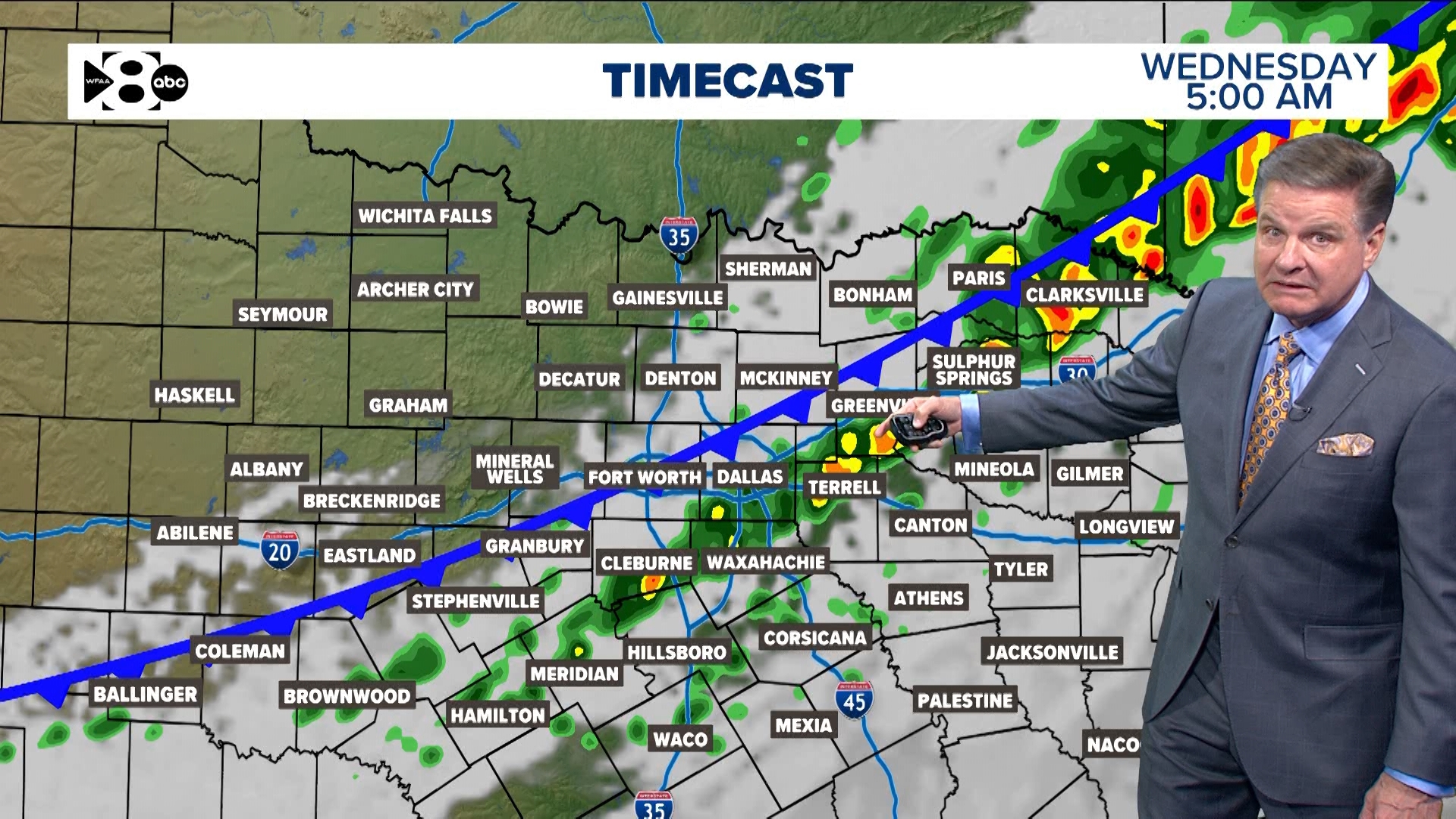
Wednesday
Hope you enjoyed the sunshine because storms have rolled through North Texas early on Wednesday producing large hail. It'll be a cloudy and muggier day for most with hardly any sunshine except for some peeks during the afternoon.
LIVE RADAR:
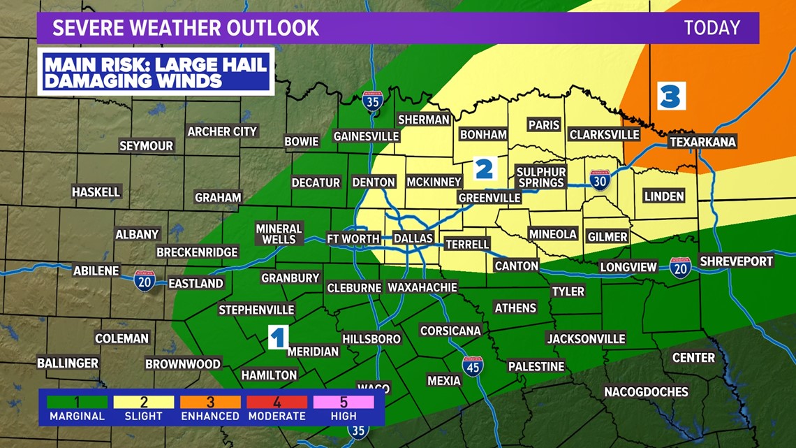
The afternoon and evening will feature some scattered rain, but definitely not for everyone. The severe threat during the afternoon looks very low for North Texas with any chances for strong to severe storms across the Ark-la-tex and east of there.

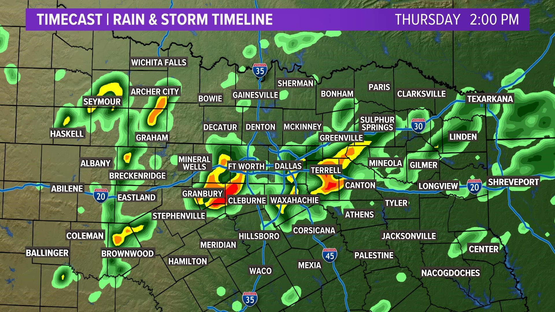
Thursday
The day will start out cloudy and muggy with some scattered showers or storms possible. The severe threat will be low Thursday morning, but it is not impossible to see some rain here or there.
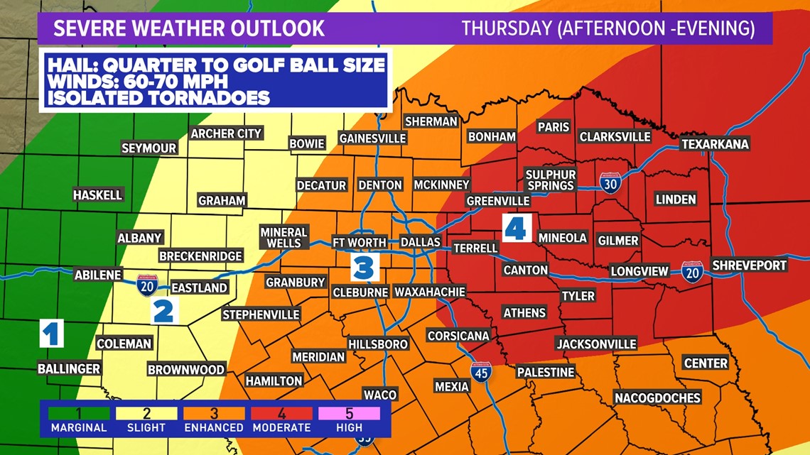
Better storm chances will be during the afternoon into evening as a cold front enters North Texas.
Storms will develop along that cold front likely somewhere west of the D-FW area. Exactly where is still not completely certain, but likely between Abilene and Fort Worth.
Those storms will then form into a line and sweep across North Texas arriving in D-FW anywhere from 4 p.m. to 7 p.m.


Primary concern with that line of storms will be strong wind gusts (60-70mph) and large hail (quarter to golf ball size). With a line of storms, the tornado threat is certainly not zero, but it is lower than with individual supercell type storms. Within that line there could be a few brief spin-up tornadoes.
Storms will move east and out of North Texas through the late night hours with the area looking storm-free by midnight.

Timing:
This weekend
Sunshine returns on Friday! But it will come with windy and cooler weather. Highs on Friday will be in the upper 50s to low 60s.
The weekend looks really nice with mostly sunny skies, chilly mornings, and pleasant afternoons.