DALLAS — Be sure to download the WFAA app to track the latest forecast and get alerts from our team.
After a mostly inactive weather pattern throughout October, the forecast is picking up with activity here in the early goings of November.
Let's dive into that with a look at what's to come weather-wise as we head into the first week of this new month.
Quick look ahead:
- Cooler day on Tuesday
- More rain possible this week
- Severe threat late week looks very low
Live Radar
The WFAA weather team has declared Monday a Weather Alert day.
Tornado Watch Cancelled
The Tornado Watch that was in effect for parts of North Texas has been CANCELLED.
Lingering showers and storms will continue into Monday night from DFW to the east, but the severe threat is very low. Main threats will be heavy rain and lightning. That heavy rain could cause some localized flooding issues mainly for areas east of DFW.
Some spotty rain is possible even into Tuesday morning.
Tuesday and the rest of the week
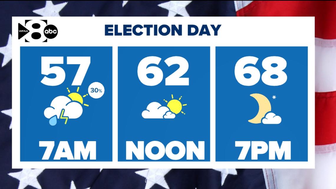
Tuesday will mostly shape up to be nice day. The morning will start off with some clouds and spotty showers, but those will quickly move east or end during the morning hours. Any showers that are out there should be light and won't be a major inconvenience. Skies will clear through the day and the afternoon will feature sunshine and cooler temps.
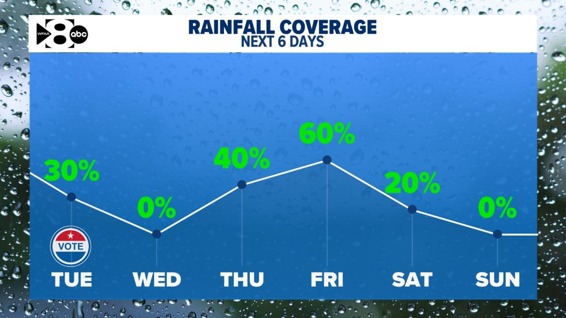
Wednesday will be another nice day, but rain chances return later in the week. Showers and some storms are possible Thursday, Friday, and into Saturday. Right now, the severe weather threat looks minimal but will continue to be monitored.


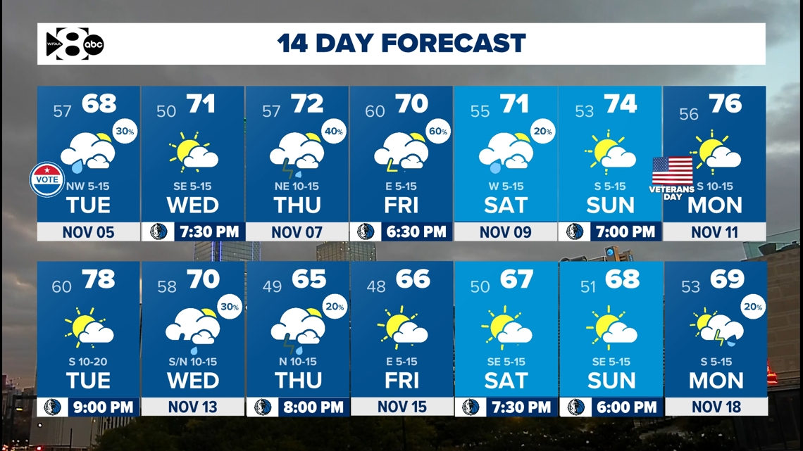
14-day forecast


