
DALLAS — A very early look at snowfall totals across North Texas has the highest amounts in and around DFW.
Especially south of local lakes where lake-effect snowfall contributed to totals over 1 inch.
Most places picked up less than 1 inch, with just a nice coating of snow across the area.
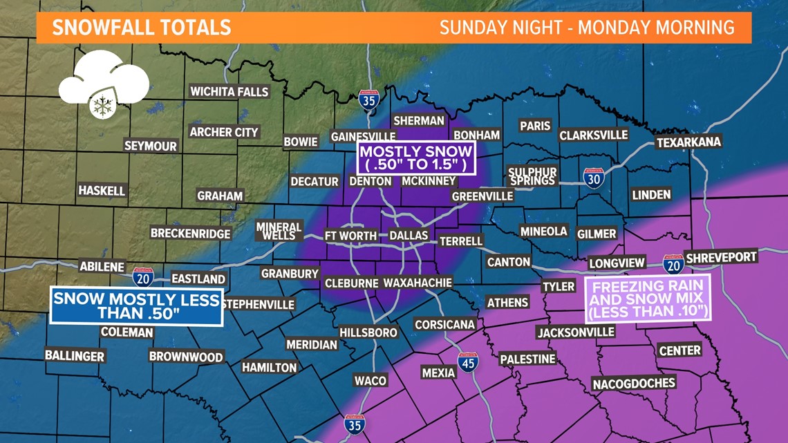
Areas east and southeast of DFW into East Texas and Central Texas mainly saw freezing rain and sleet mixed with some snow. Totals were low in those areas, but icy conditions remain.
To the west/northwest of DFW, that area of North Texas missed out on snowfall almost entirely. There could be a dusting here or there but most did not have any snowfall.
The lake-effect snow off of Lake Lewisville likely contributed to DFW Airport seeing more than 1 inch.
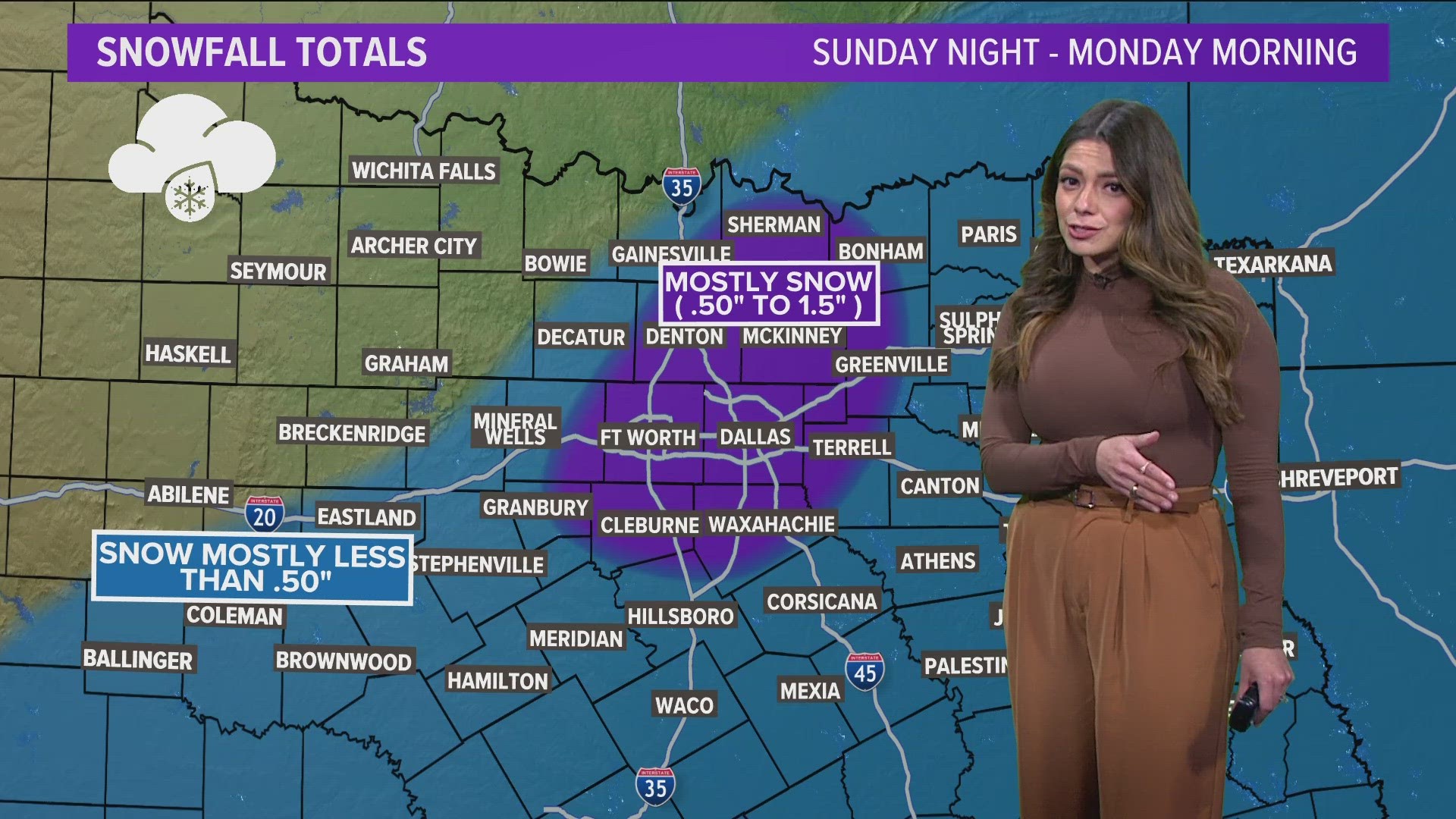
Here's a look at what areas of North Texas saw what - and how much, based off estimated totals late Monday morning.

How does lake effect snow form?
The key ingredient is a temperature contrast. When a frigid air mass (like the one we have in place) sweeps across the relatively warm waters of our lakes, the lower atmosphere undergoes a transformation. The cold air picks up moisture from the lake's surface and brings it upward. This motion, fueled by instability, is a crucial step in the formation of snow.
As the moist air ascends, it cools. This cooling condenses the water vapor into tiny droplets, which then freeze into ice crystals, forming the seeds of future snowflakes that blow with the winds sweeping across the lakes.
In North Texas, we had a decent breeze almost straight from the north. Lakes that are oriented mostly north to south were the most efficient lake-effect snow producers (Ray Hubbard, Eagle Mountain, Lavon, Lewisville, Joe Pool, etc.) since the wind traveled over those bodies of water for a longer amount of time.