DALLAS — An arctic blast has arrived and you need to be ready for it.
Be sure to download the WFAA app to track the latest forecast and get alerts from our team.
Versión en Español: ¿Qué tan frío se pondrá DFW y cuándo? ¿Veremos nieve o hielo? Último pronóstico aquí.
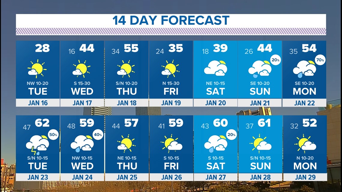
Here's a look at the forecast this weekend into early next week:
Quick Facts:
- Below-freezing through midday Wednesday
- Brief warm-up before more cold air arrives late week
- Rain, not snow, returns next week
Snowy Monday!
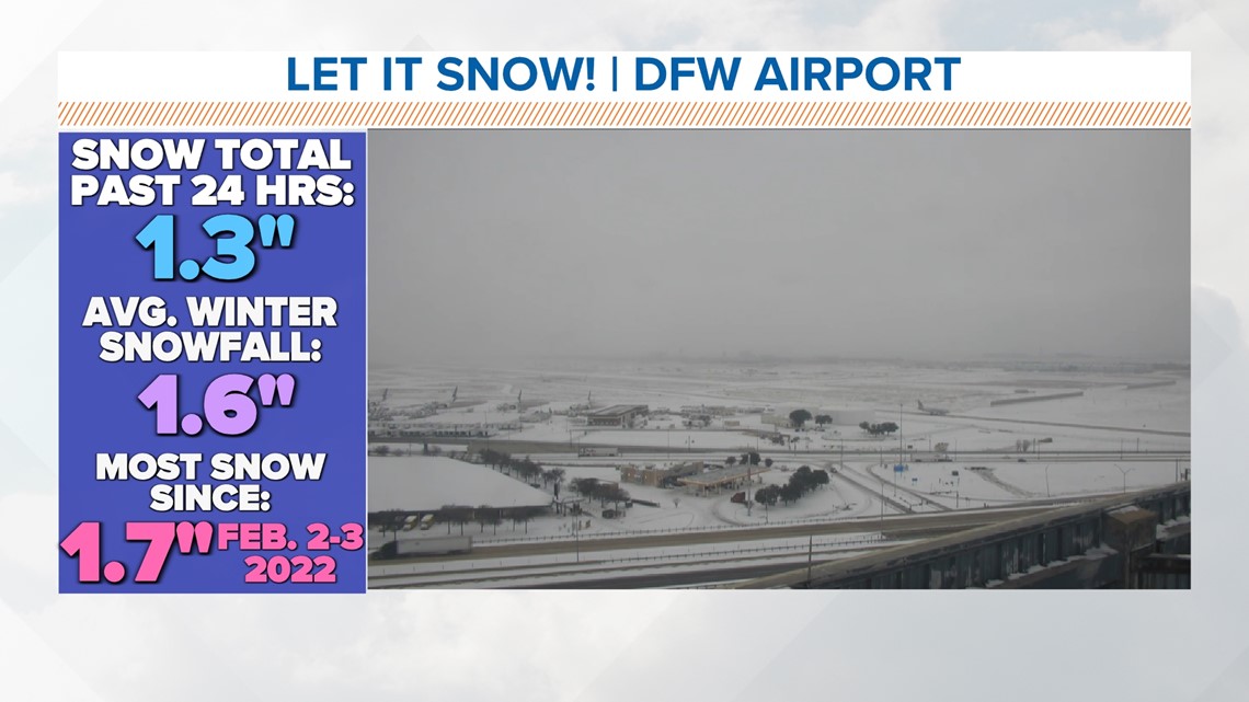
DFW and other parts of North Texas woke up to a coating of snow. The snow was just the kind that we like. Light and fluffy. This means it cleared easily off of cars and roads.
Totals for most areas were less than 1in, but some parts of DFW have seen more than 1in. Such as DFW Airport and areas that are south of our area lakes. In these locations, lake effect snowfall helped enhanced snowfall totals. The lake-effect snow off of Lake Lewisville likely contributed to DFW Airport seeing more than 1in.

Finally above freezing!
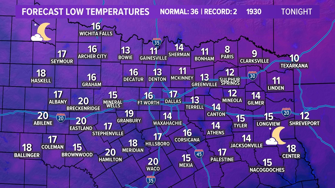
But you'll have to contend with another really cold night and morning Tuesday night into Wednesday.
Lows on Wednesday will be in the low to mid to upper teens depending on your location, but wind chills will be in the single digits. Bundle up again!
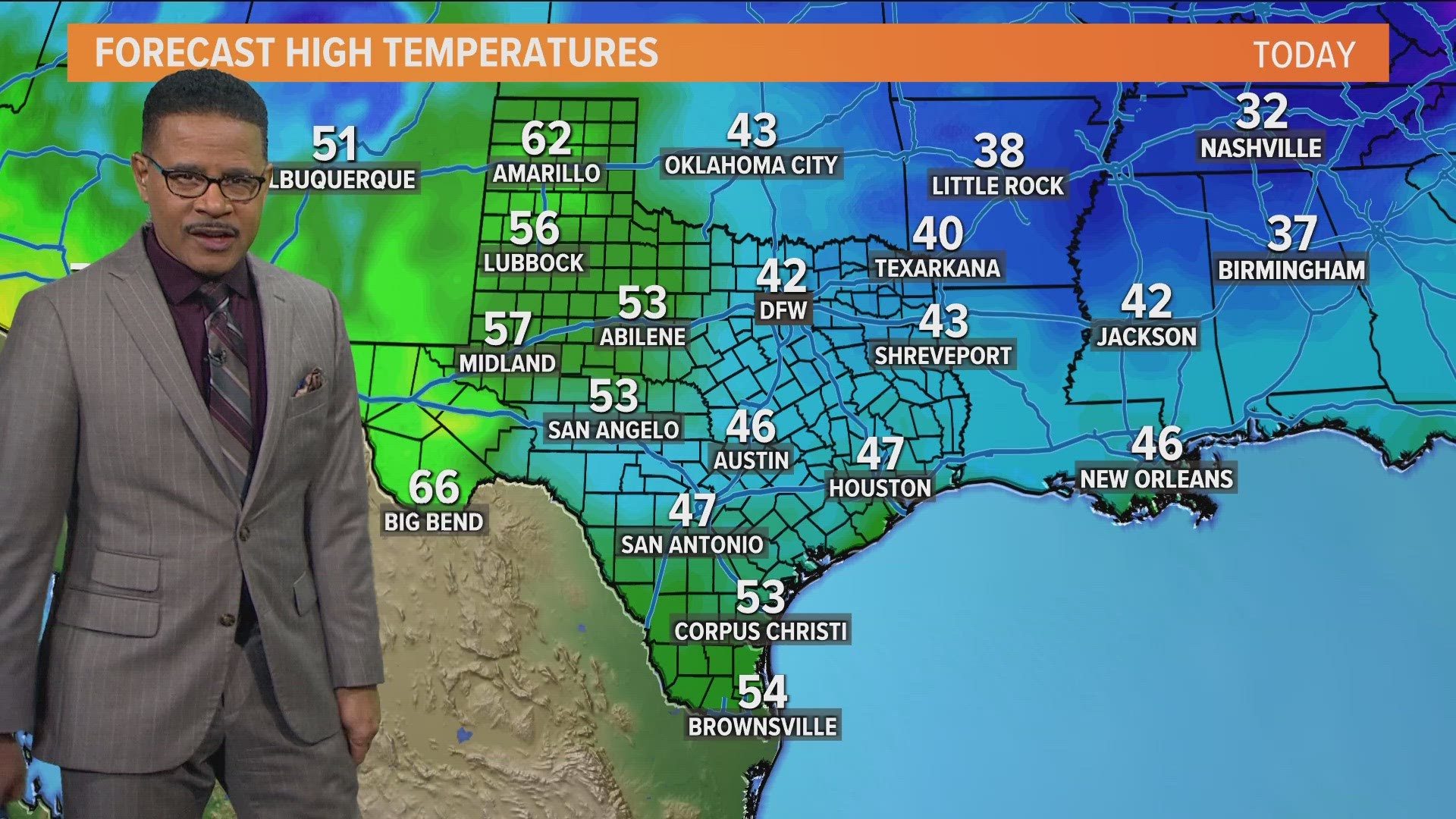
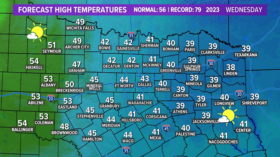
Thankfully, a southerly wind will pick up on Wednesday helping drive afternoon temps into the 40s.
DFW should finally be above freezing sometime late Wednesday morning after being below freezing since 6 p.m. on Saturday. That'll make the streak of consecutive hours at or below freezing around 89 hours straight.


Beyond
Temps "warm" this week with afternoons above freezing by Wednesday. Thursday will be pleasant, but another strong cold front arrives knocking temps back to cold for Friday into this weekend. Mornings will be well below freezing with afternoons staying chilly. No wintry weather with that front, but it will be cold again.
The following week does not look wintry but does look rainy the first half of the week.

