DALLAS — Meteorological fall has arrived, but it doesn't feel like it in North Texas!
Quick facts
- Record heat today
- A few strong storms possible tonight
- Fire danger stays elevated west
- Rain chances and "cooler" temps this weekend
Versión en español: Posibilidades de récord de calor y lluvia, pero ¿qué viene primero?
This Week
Summer continues for the first full week of September!
Record Heat Again Today
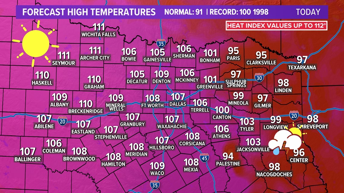
Heat and humidity will be around the rest of the week with highs at or above 100° for most of the area. A higher humidity means that it'll feel warmer than the actual temperature.
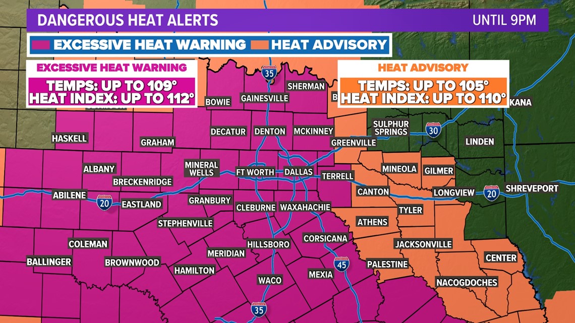
The Heat Advisory has been upgraded to an Excessive Heat Warning for all of D-FW and most of North Texas through Friday. Highs at or above 105° are likely in this area. A Heat Advisory remains for the rest of North Texas with heat index values up to 106°.

Record heat is likely again on Friday with highs well above 100°.

Friday Night - Saturday Morning Storms
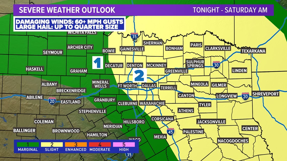
Record high temperatures are expected on Friday, but there will also be a chance for storms. A stalled boundary in east Texas will be the focus point for some storms to form. Large hail and damaging winds will be the main threat with isolated storms. Areas west of DFW are unlikely to see rain. The severe threat is highest late Friday into very early Saturday morning.

Fire danger and burn bans continue
Elevated fire danger will continue for all of North Texas for the foreseeable future. Because of ongoing drought, hot temps, low humidity, and breezy conditions, any fires that get started could spread quickly.

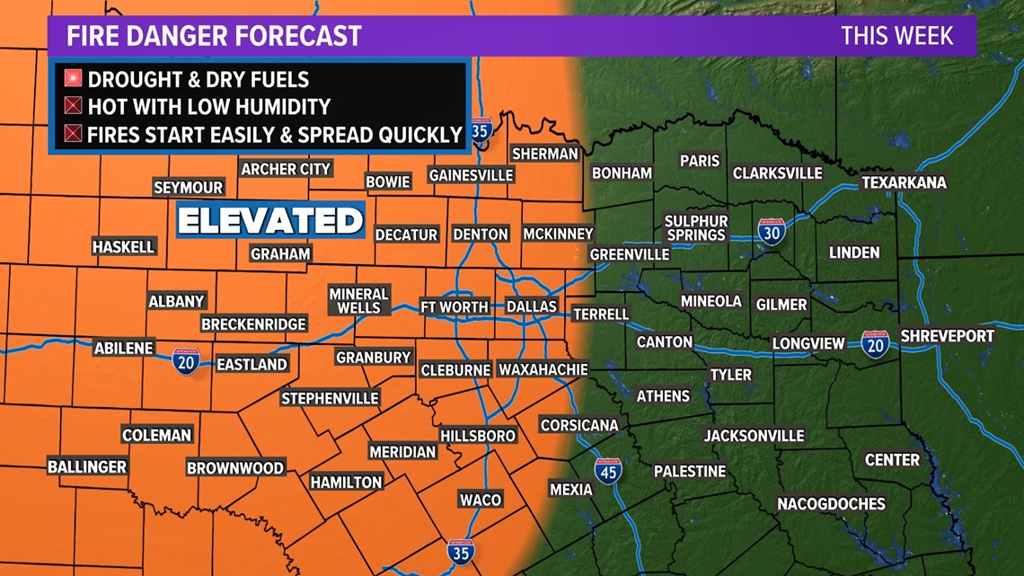
Please continue to practice fire safety!

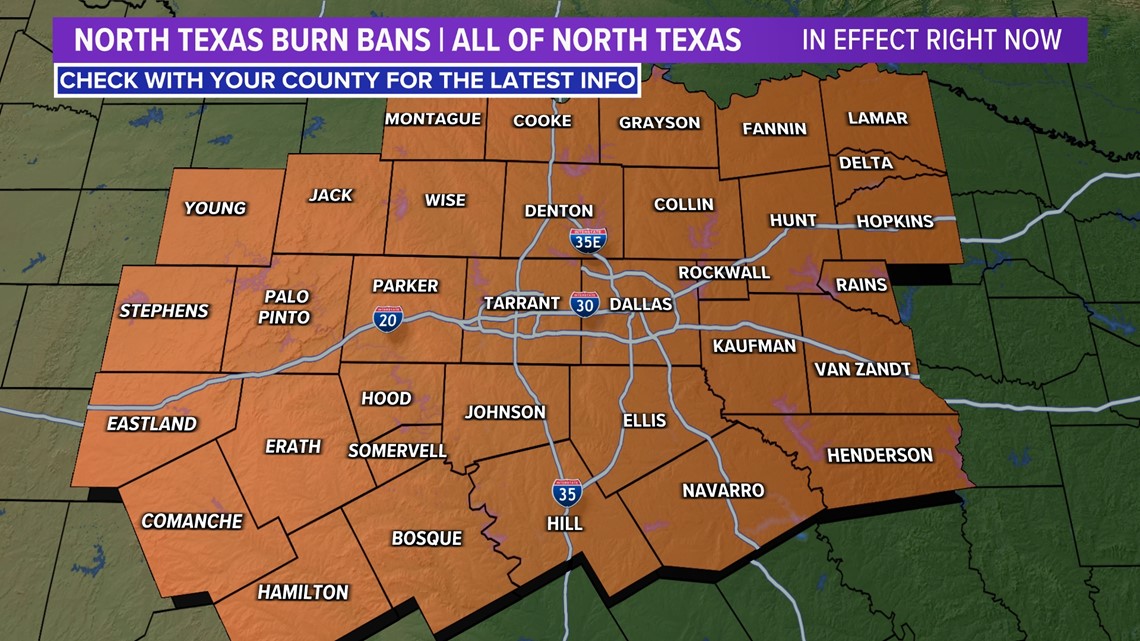
All North Texas counties are under burn bans, so please respect those. Also, use extreme caution with anything that causes sparks or open flames.
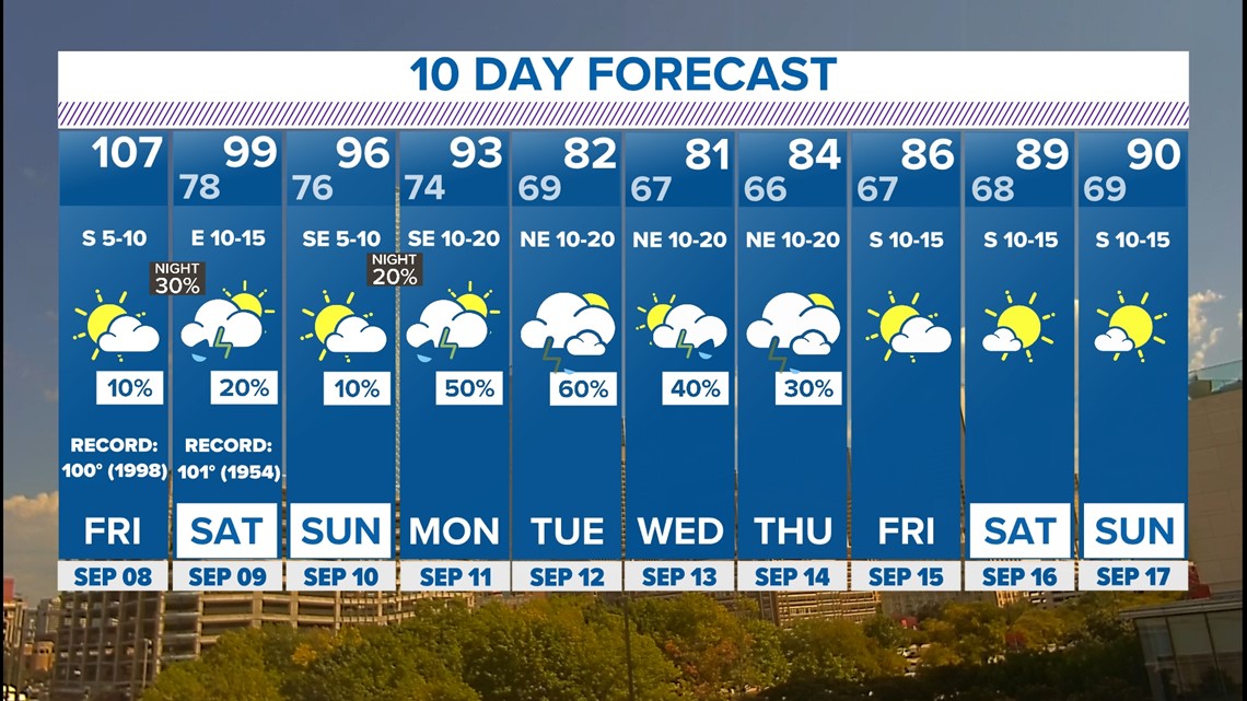
10-day forecast
After triple digits and dry weather this week, changes look possible this weekend and especially next week! A pattern shift may occur that looks like it will bring back rain chances and temps closer to normal for this time of year.

