DALLAS —
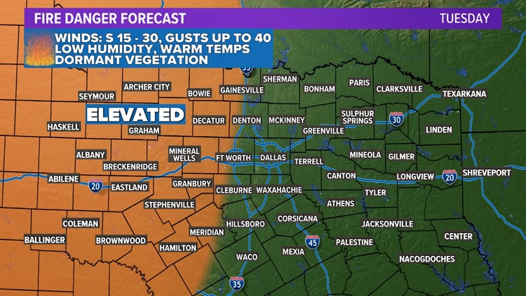
Fire danger Tuesday
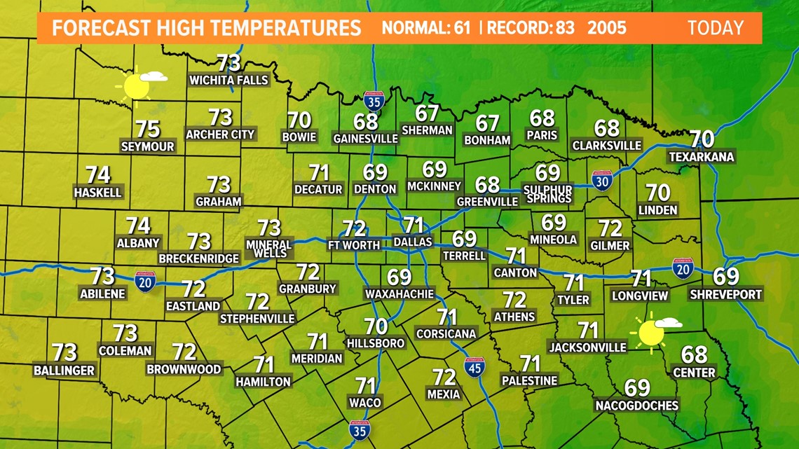
Temps will warm into the 70s again on Tuesday with gusty winds from the south and low humidity.

Those factors will contribute to elevated fire danger especially across western North Texas during the day Tuesday.

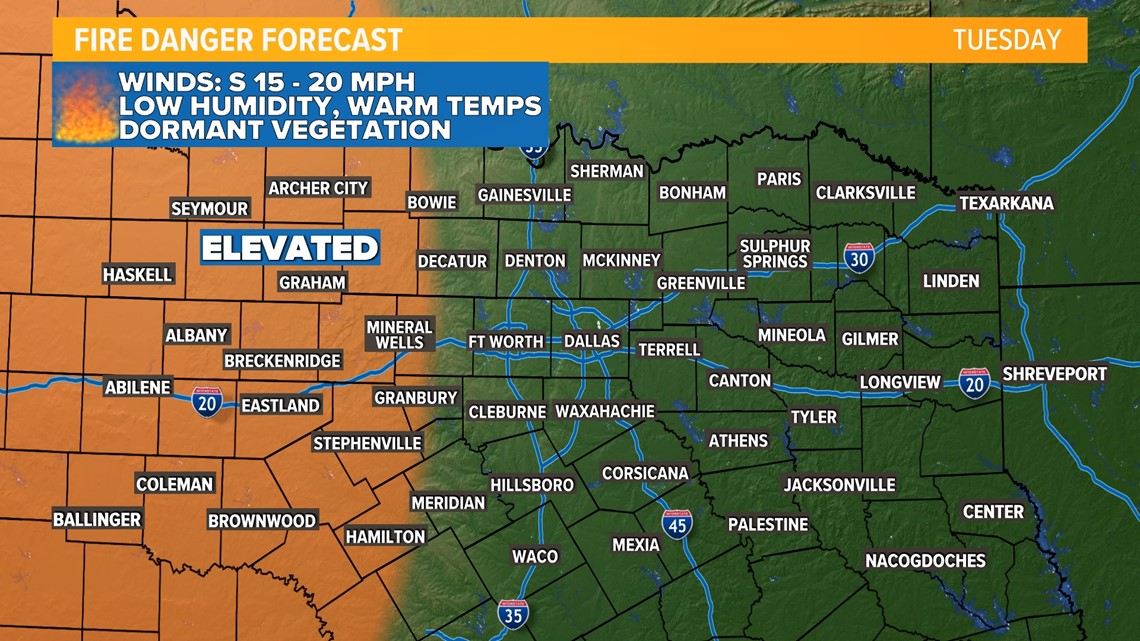
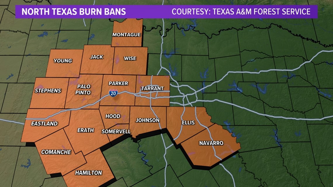
All of those areas are already under burn bans.

Storms on Wednesday
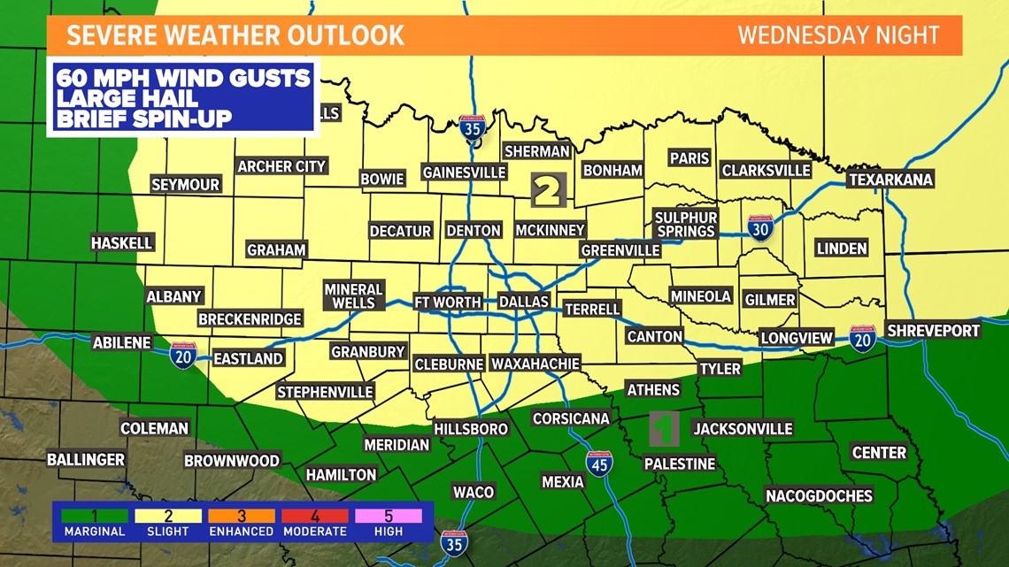
The way it looks now, the best chance for rain and storms will be late Wednesday night into early Thursday morning.
A round of storms will move from west to east across the area during that time. The severe weather risk does not look high, but it is not impossible to have some strong to severe storms during that time.
The main severe threat looks to be damaging wind gusts. However, if we get a line of storms, can't rule out a brief spin-up tornado within that line of storms.

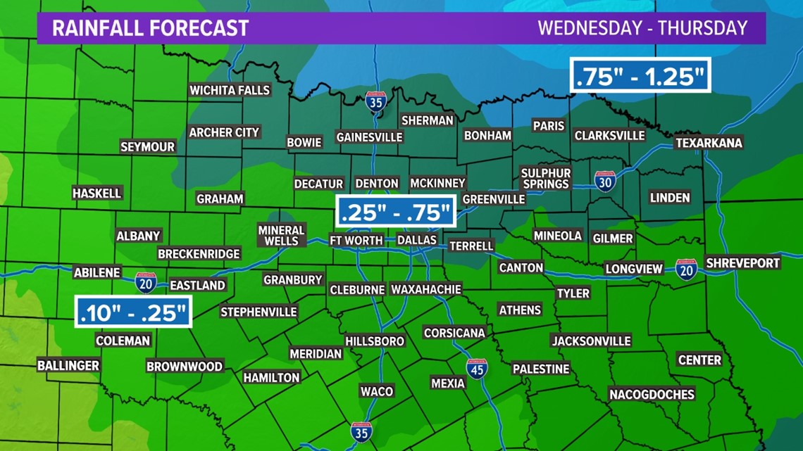
Rainfall totals with this storm system do not look to drought-busting, but we'll take whatever we can get. North Texas could see a quarter to three-quarters of an inch of rain, with more to the northeast.

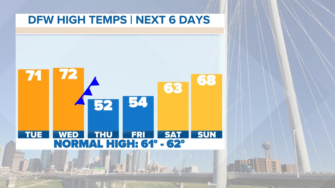
After the cold front moves through, temps will be much cooler for the end of the workweek. Highs on Thursday and Friday will only be in the 50s.

