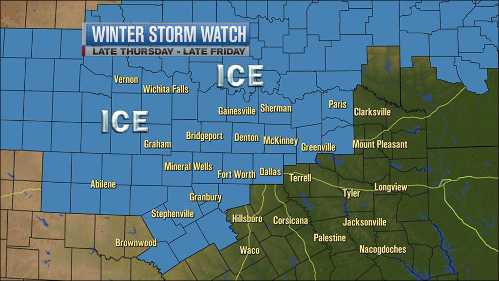
DALLAS After enjoying balmy December highs in the mid-70s on Tuesday, Dallas and Tarrant counties are included in a Winter Storm Watch issued late Tuesday night by the National Weather Service.
We'll enjoy another unseasonably warm day on Wednesday. Arctic air behind a powerful cold front will arrive on Thursday.
The Winter Storm Watch begins Thursday afternoon northwest of Fort Worth; on Thursday evening in Tarrant and Dallas counties.
A cold rain is likely during the day on Thursday before the precipitation changes into freezing rain early Friday.
What is unclear at this time is when exactly the temperature will drop below freezing in the Dallas-Fort Worth area, triggering the transition to freezing rain.
The most significant precipitation on Friday should occur prior to 6 a.m. If we don't drop below freezing until just prior to that time, then any ice accumulation for the Dallas-Fort Worth area should be minor, and the impact on travel will be minimal.
But if we drop below freezing well before the precipitation starts to taper off, we could be looking at a major impact for the Friday morning commute.
Areas northwest of Dallas and Fort Worth have the greatest chance for significant ice accumulation, while cities to the southeast have the lowest. Travelers should expect delays at area airports, but it's too early to say whether cancellations will be necessary.
After all, this could end up being like the arctic front that approached as November ended we missed freezing rain and ice accumulation by mere degrees. And that one came with a 24-hour Winter Storm Warning issued by the National Weather Service.


