DALLAS — Storms were clearing out of North Texas early Monday.
Here's what we're seeing -- and expecting -- to start the week:
Monday storm chances
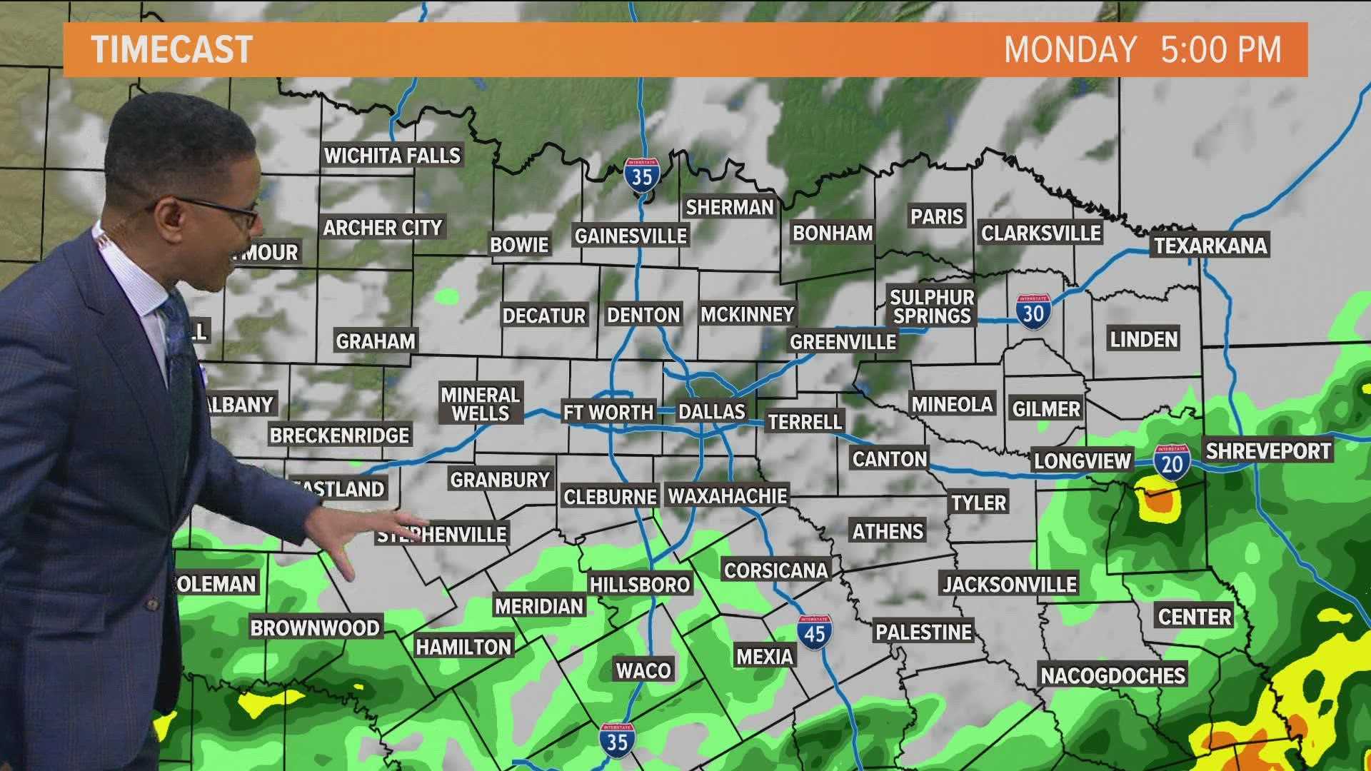
Lingering showers and storms were still in the area first thing Monday from DFW to the east and the south. That means the Monday morning commute was featuring rain, especially areas on the southern half of the Metroplex.
We still do not have severe weather in the forecast Monday morning, but the rain may cause some traffic delays as you head back to work and school.
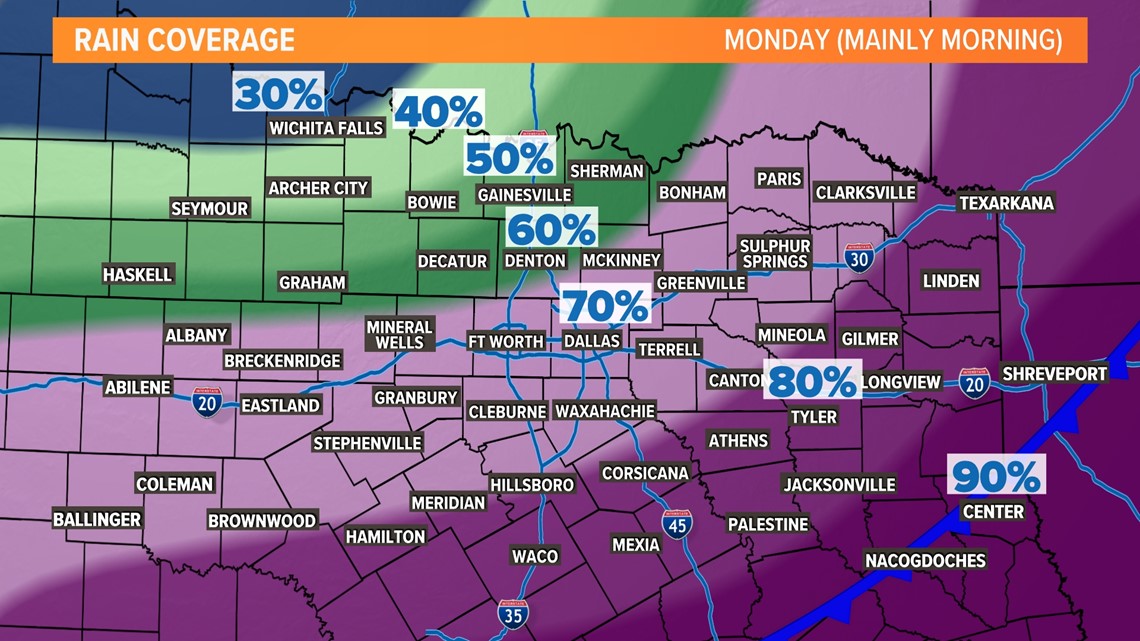
We will see the rain chances gradually come to an end Monday afternoon and evening from northwest to southeast.

How much rain? Flooding threat?
Rain is something we desperately need here in North Texas, and a lot of you will get a decent amount.
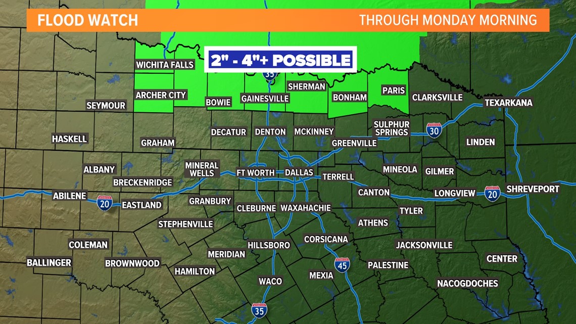
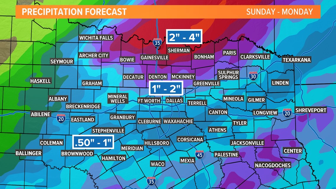
Right now, the highest rain totals look to be in locations closest to the Red River. That's where 2"-4" of rainfall is possible. A Flood Watch has been issued for these areas as well. Some flooding of creeks, streams, and low-lying areas is possible.

In D-FW, totals of 1-2 inches look possible with lower totals for southern and eastern North Texas.
Flooding threat in D-FW is low, but not zero. Heavy rain caused ponding or standing water on roadways late Sunday night into Monday morning.

Another Look:
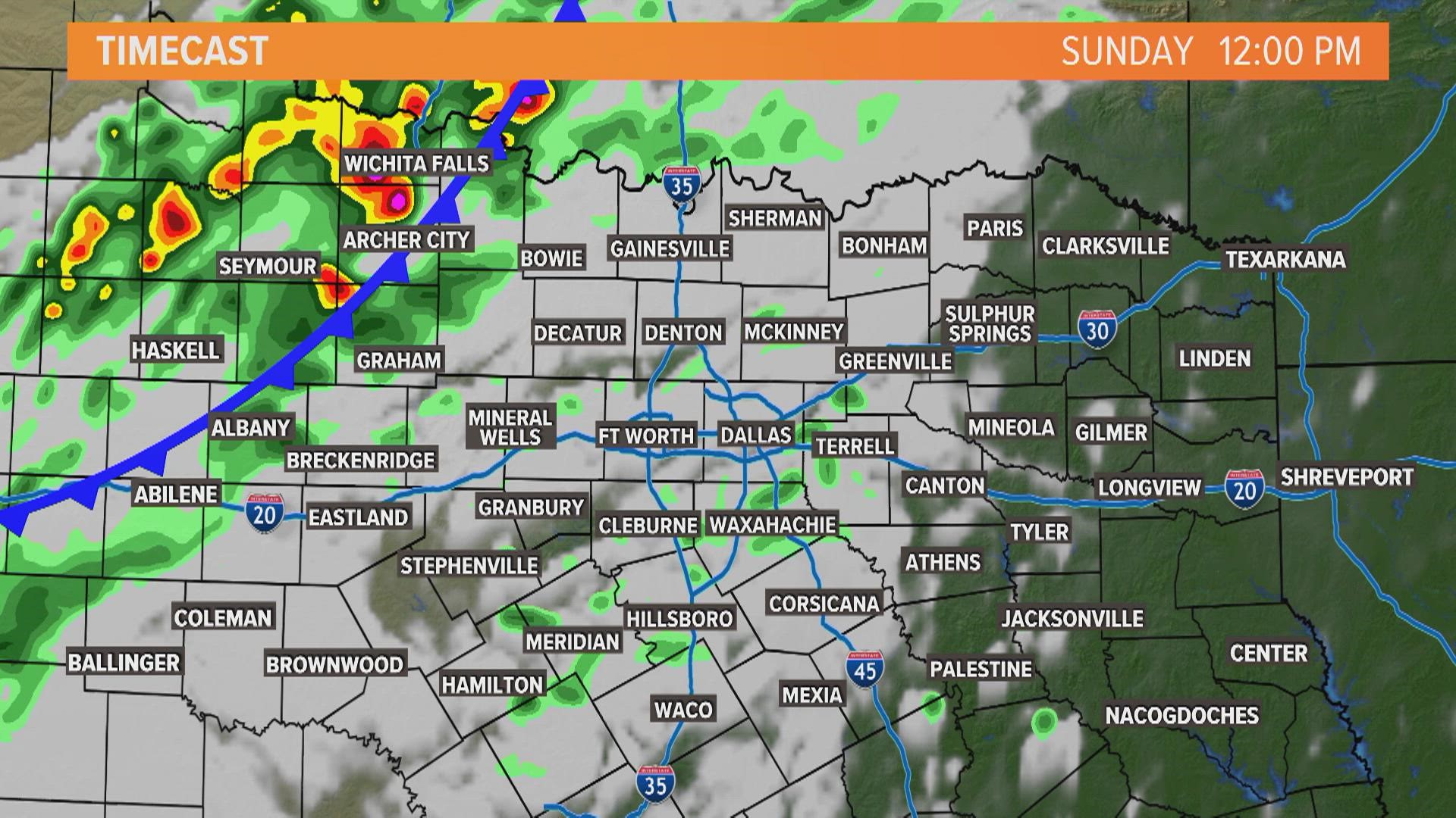
Here's another look at the timeline of rain through Monday.
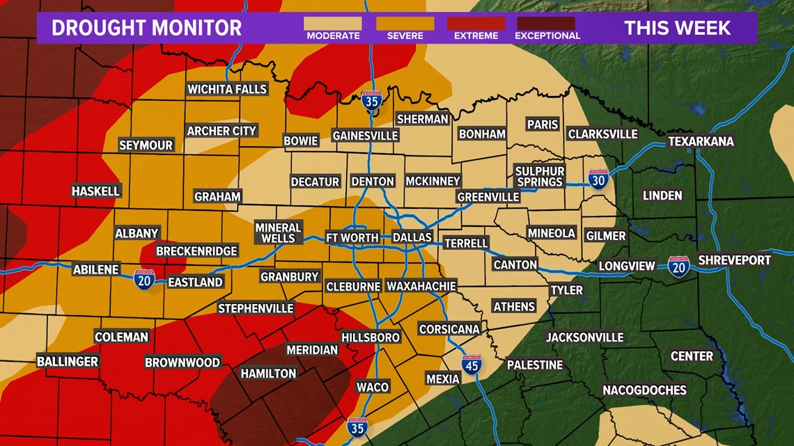
This won’t be a “drought buster,” but it will be a “drought denter.” Here’s the latest look at the drought monitor across our area.

