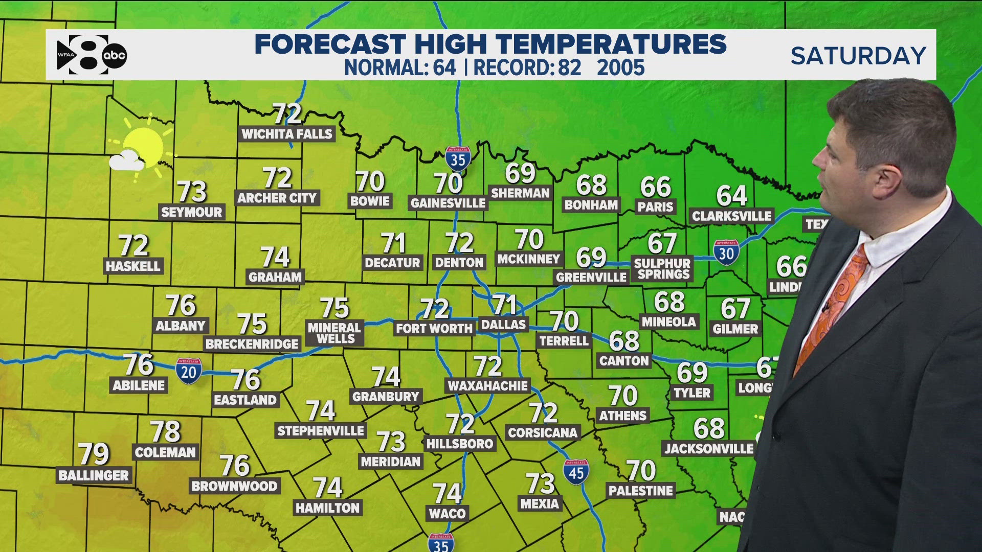
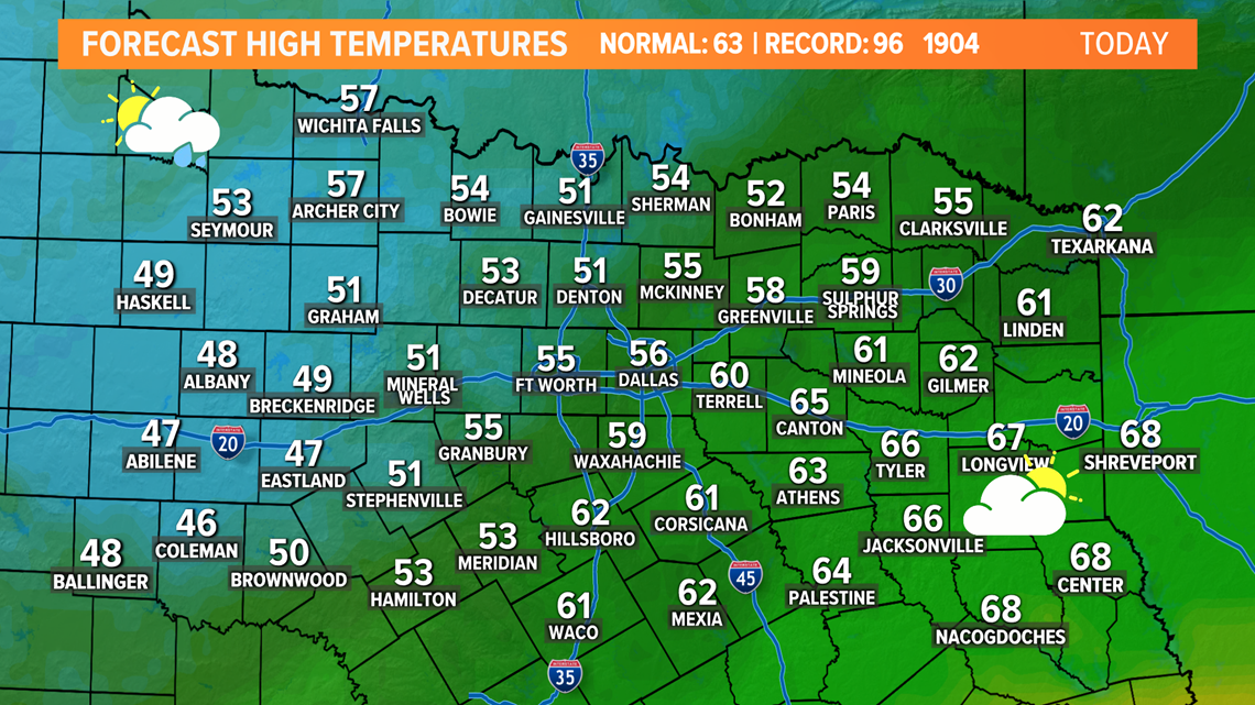
DALLAS — A frontal boundary made its way through North Texas yesterday and cooler air has filtered in behind the front. Much cooler temps are expected this afternoon.

Rain Chances Through the Weekend
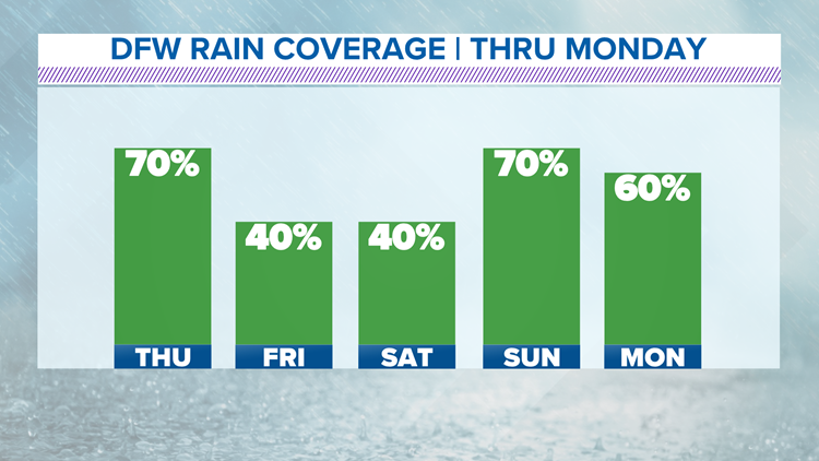
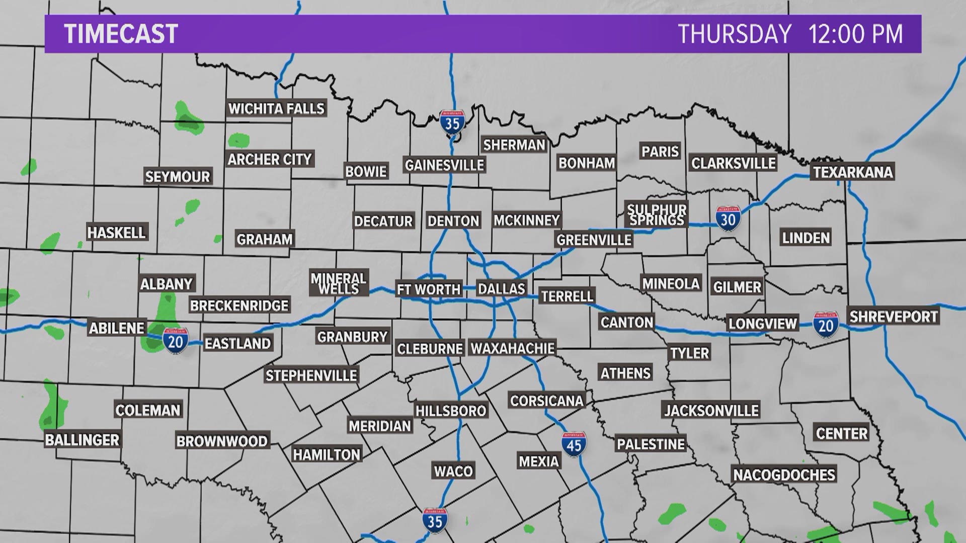
The cold front that moved through North Texas yesterday will stall just to the south of us in Central Texas. This will keep daily chances of rain through the weekend. It will stay dry tonight and into Thursday morning, but rain will move up from Central Texas on Thursday afternoon. So, you will have several hours in the morning to get work done outside before the rain arrives after lunch.
Click the video below for an hour by hour look at the rain chances into the weekend
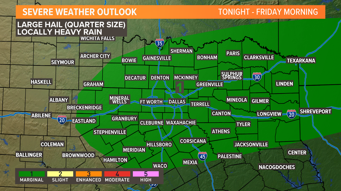
Showers and storms are likely Thursday night into early Friday. There is a low end risk for some hail along with locally heavy rain. This round of rain will move out early Friday morning, but the morning commute will still be wet for many.

Friday afternoon and into Saturday will be dry before showers increase Saturday night and into Sunday. The best chance for widespread rainfall will be in northeast Texas and you can't rule out a few thunderstorms as well.


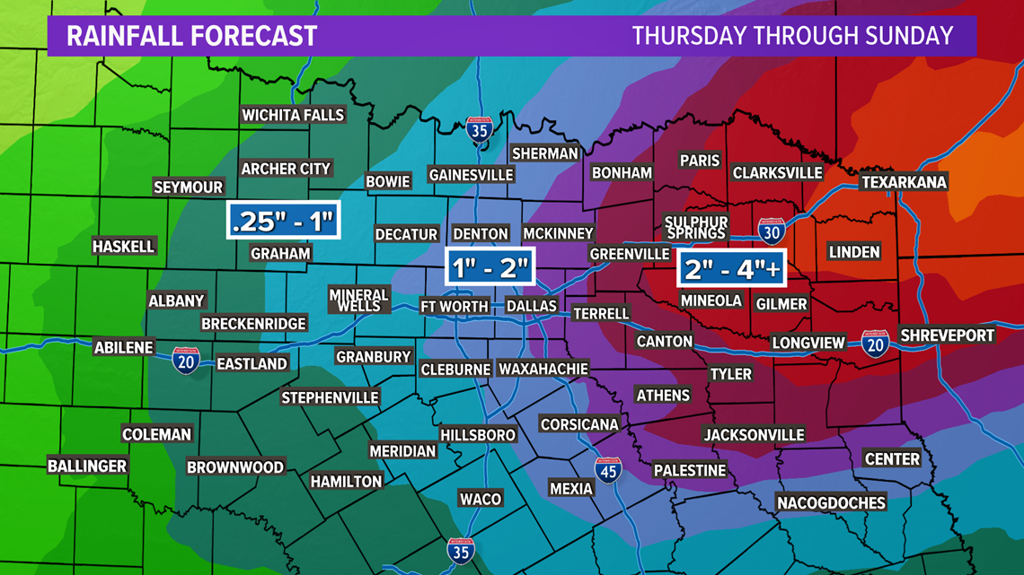
The month of March begins on Monday and the active weather pattern continues with daily rain chances through the end of next week. Rainfall totals could range from 1 to 2 inches for DFW and higher totals up in northeast Texas. Stay tuned for more fine-tuned details as we get closer.

