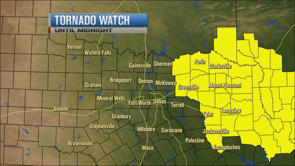
11:05p Storms are struggling to survive in Denton County as they move quickly to the east. - Meteorologist Steve McCauley
10:14p The National Weather Service has canceled the Tornado Watch for Dallas-Fort Worth, but it remains in effect for counties to the east. - WFAAWeather
9:46p A severe thunderstorm warning is issued for Fannin and Lamar counties until 10:30 p.m. Quarter-size hail and damaging winds are possible. - WFAAWeather
9:16p Storms continue to remain north of Dallas-Fort Worth and are now moving due east at 35 mph. - WFAAWeather
9:13p Storms are weakening, but the Tornado Watch for all of North Central Texas continues for three more hours; the National Weather Service isn't yet sounding an 'all clear.' - Chief Meteorologist Pete Delkus
9:08p A bit of good news: storms are weakening due to cool outflow boundaries ahead of the oncoming weather system. - WFAAWeather
9:01p Strong winds are on the way for Denton and Grayson counties as outflow boundaries arrive. A spotter in Sanger reported a 40 mph gust. - WFAA Weather
8:42p Storms are sending out strong outflow boundaries; strong winds are expected in eastern Wise and northern Denton County by 9 p.m. - Chief Meteorologist Pete Delkus
8:28p Heads up, Grayson County! Possible golf ball-size hail and high winds are on the way. Northern Collin county will be in the bull's-eye in another hour. - WFAAWeather
5:30p WFAA Chief Meteorologist Pete Delkus said late afternoon sunshine was actually helping to destabilize the atmosphere, making it more likely that storms can expand in coverage before midnight.
Thunderstorms are likely to move into Denton, Tarrant and Johnson counties around 7 p.m., Delkus said. The next hour, the wet weather will arrive in Colin and Dallas counties as it moves to the east.
Earlier in the day, a forecast of high wind forced cancellation of the final day of the Main St. Fort Worth Arts Festival. Organizers provided online instructions for patrons to redeem unused coupons.


