Updated at 9 a.m. Tuesday with the latest forecast.
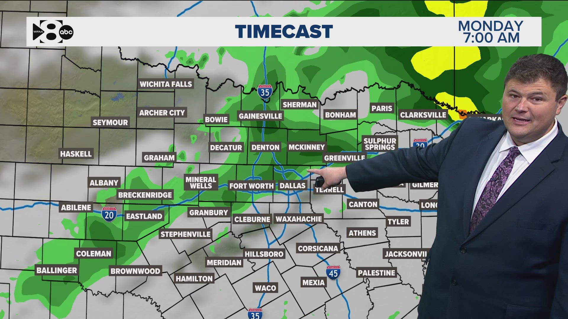
Another day and another round of storms for North Texas. A cold front is inching south through the area and along that front is another complex bringing heavy rain, lightning and even gusty winds.
A severe thunderstorm watch has ended for the Dallas-Fort Worth area after the bulk of the precipitation fell Tuesday morning during the commute.
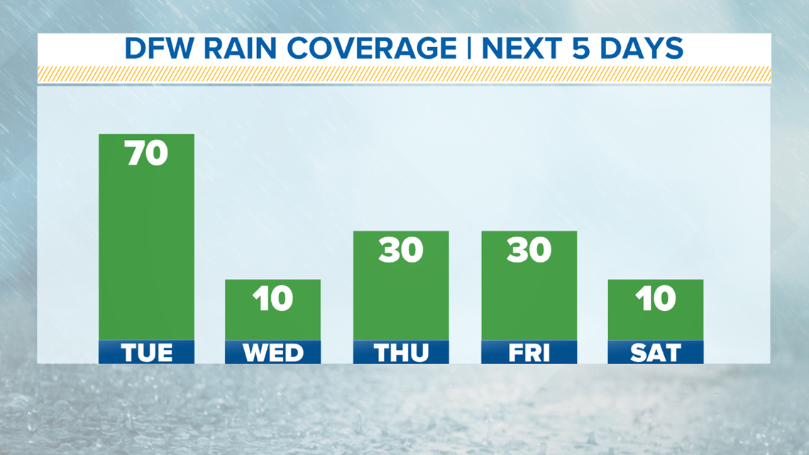
Scattered storms will be possible during the afternoon, but the coverage drops off quite a bit. Coverage by Tuesday afternoon drops to 20 percent across North Texas.

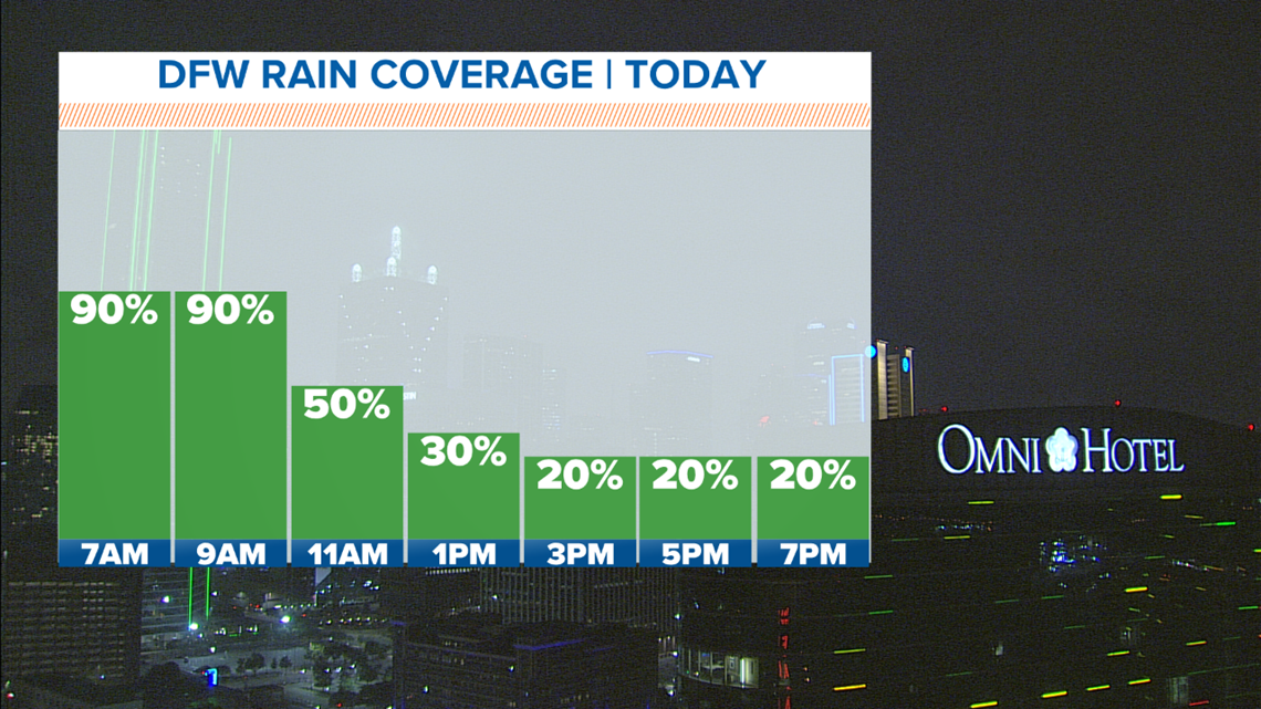
Tuesday morning's rain could bring an additional 1-3 inches across North Texas with isolated amounts topping 4 inches of rain.
Flash flooding was a major concern for the morning commute, and multiple cities reported high waters on roadways.
Irving police said there were multiple parts of the city with high water, particularly near Highway 183 and Carl Road. Crews were working to close down the affected roads.
The Southlake Department of Public Safety said it had multiple road closures Tuesday morning, with White Chapel Road shut down at the bridge on the 3800 block of the road. The 600 block of West Continental had been closed, but has since reopened.
Fort Worth police said by about 9:30 a.m., they had responded to 17 water-related emergency calls since 6 a.m.
Remember to never drive over flooded roads. Turn around, don't drown!
RELATED: Download the WFAA app

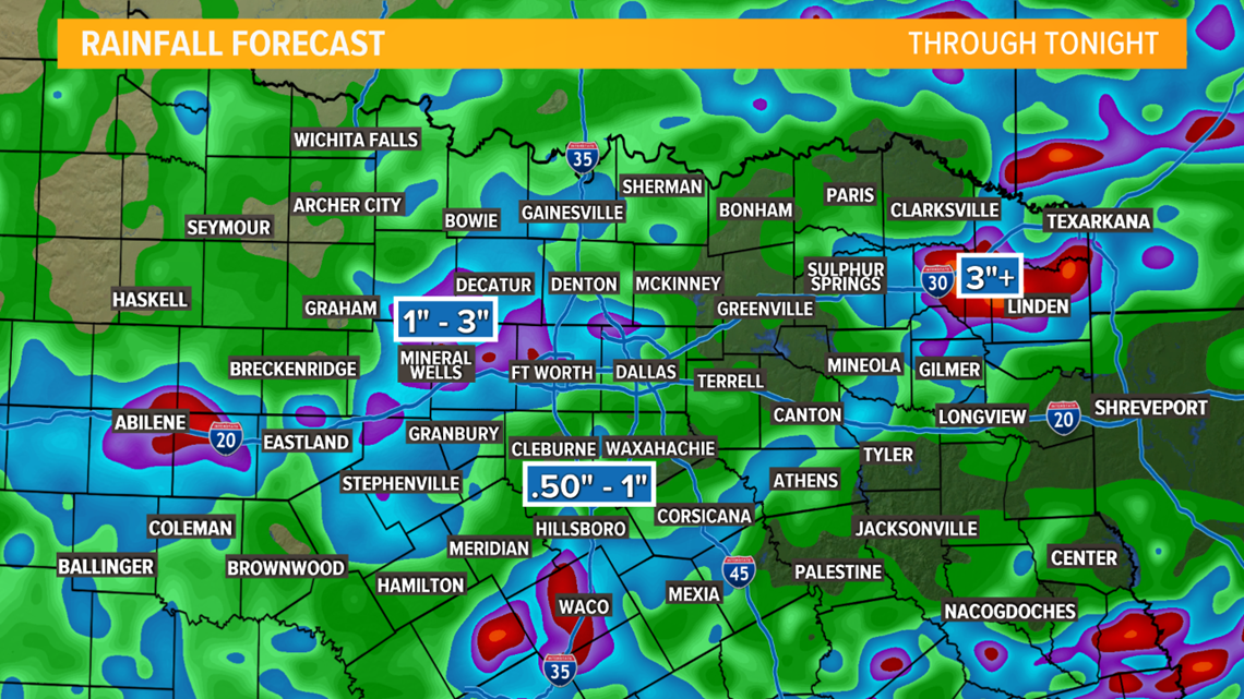
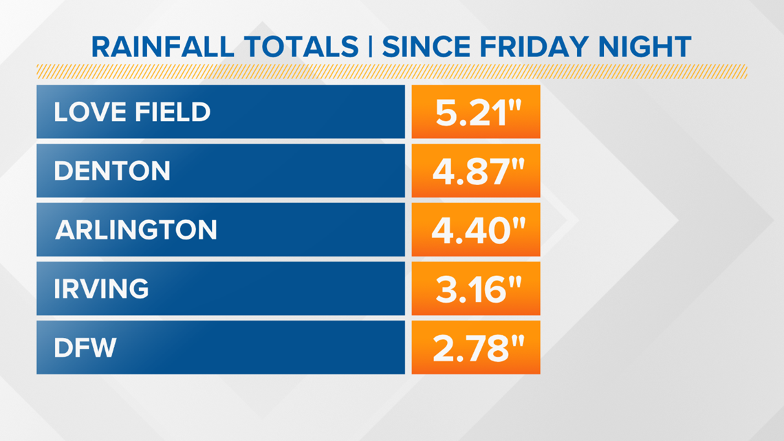
We went three weeks without a drop of rain, and since Friday night, many locations across North Texas have received three to five inches of rain.
Here are some of the higher totals recorded:

RELATED: Check the radar
WHAT TO EXPECT TUESDAY
Another complex of showers and thunderstorms will move through Monday night as a front inches into North Texas. The chance of showers and thunderstorms will continue throughout the day Tuesday.
It won't be a washout, but scattered storms will stick around through the evening. This time-frame will be the highest rain coverage of the next 5 days.

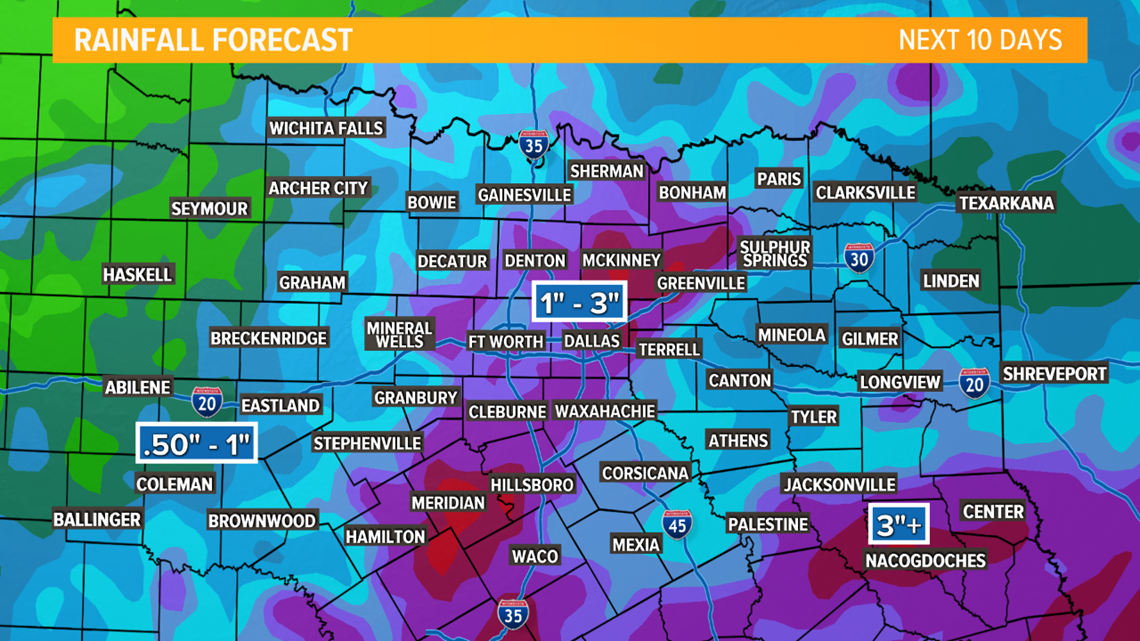
The rain will continue to pile up with an additional 1-3" possible on top of the 2-5" we have already seen across North Texas since the weekend started.
Flooding will be a concern, especially in locations along the Red River that have seen quite a bit of rainfall since Friday night.

Stay with WFAA for weather updates throughout the week and have a way to receive warnings. Download the WFAA app to check one of our dozens of local radars near you, as well as the latest forecast, cameras and current conditions.


