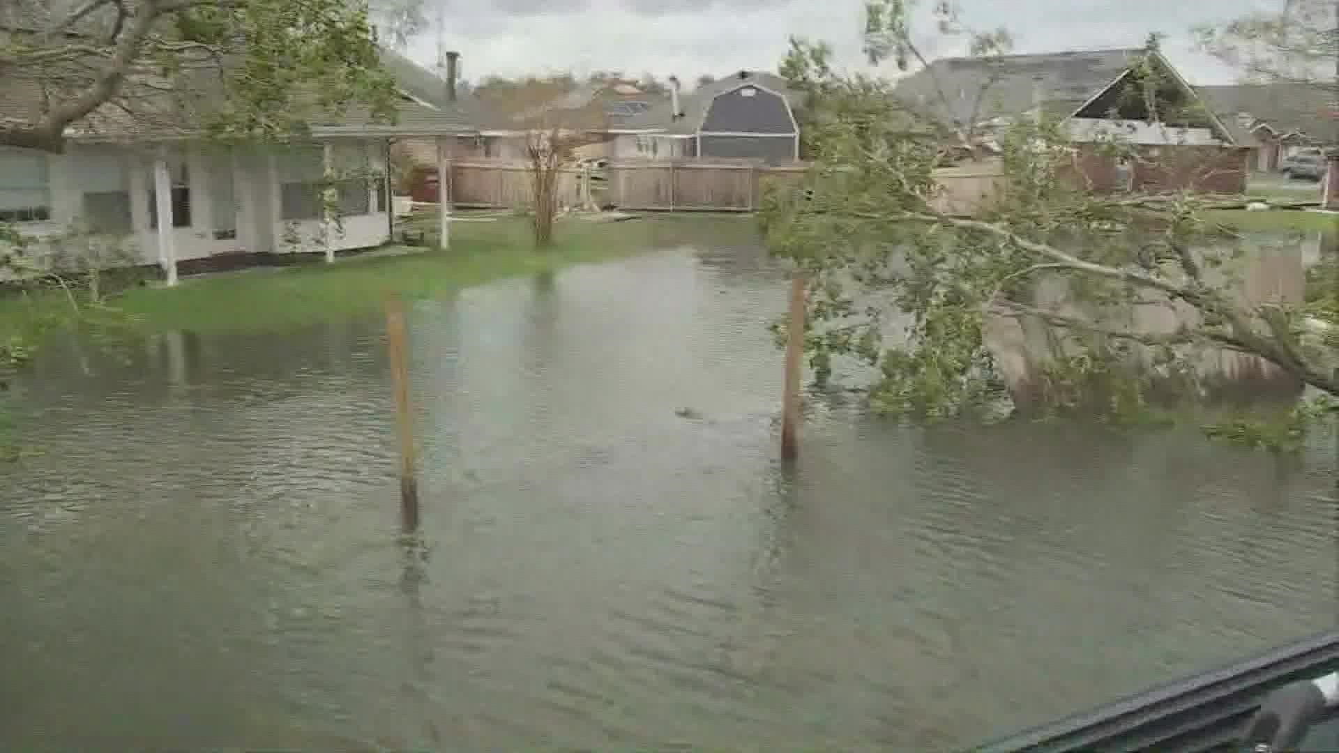
TEXAS, USA — Updated at 6:30 a.m. Tuesday with the latest advisory.
Ida continues to weaken, and is now a Tropical Depression with peak wind speeds of 30 mph. The center of the storm has moved into northern Mississippi and Alabama.
Ida officially made landfall at 11:55 a.m. CDT Sunday near Port Fourchon, La., according to the National Hurricane Center.
It was a Category 4 storm with max sustained winds around 150 mph, with gusts up to 160 mph.
Official landfall occurs when the center of the eye passes over land. This ties Laura (2020) and Last Island (1856) for the strongest hurricane by wind speed to hit Louisiana. It is also the second strongest hurricane by pressure at 930 mb. Hurricane Katrina was at No. 1 with 920 mb.
Here are some of the top wind gusts as Hurricane Ida made landfall over the southeastern Louisiana coast.

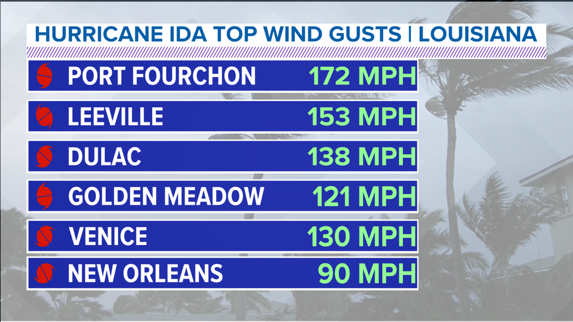
There have only been 4 hurricanes on record in the U.S. since 1851 that have made landfall with 155 mph max winds before: Labor Day (1935), Camille (1969), Andrew (1992), and Michael (2019). All of those were Category 5 storms.
Tropical Depression Ida
Ida has been downgraded to a tropical depression. As of 4 a.m. Tuesday, the storm was moving through northern Mississippi and Alabama with 30 mph winds.

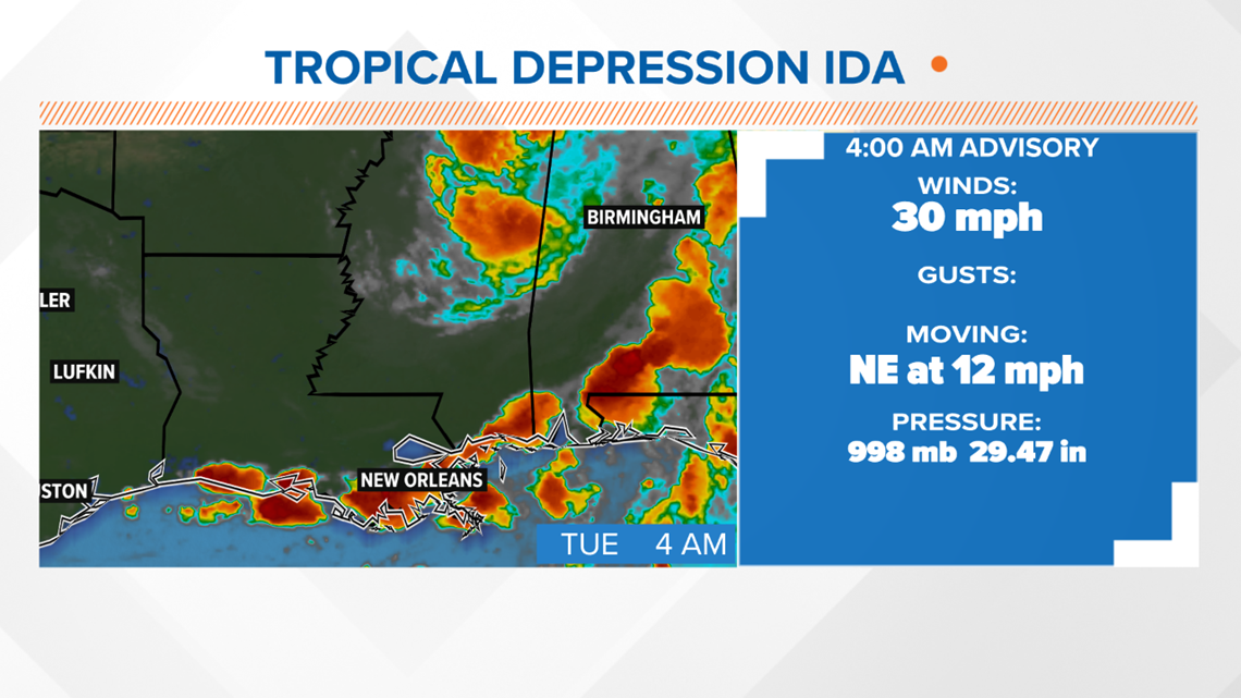
In less than 24 hours, the storm went from a Category 4 with winds of 150 mph at landfall to a tropical depression with winds of 35 mph.
The storm will continue to weaken, in terms of wind speeds, but will continue to cause a significant flooding threat over the next several days.
However, threats from the storm are not done. Heavy rain, flooding, and tropical tornadoes are all possible for parts of the southern and eastern U.S.
Watch a 6 a.m. Monday update below about the tropics:
What is Ida's path?
Ida will continue moving north through Mississippi Monday into Tuesday.

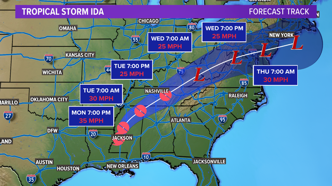
The path will curve to the north and east, moving through parts of Alabama, Tennessee, the Virginias, and then the East Coast before moving back out into the Atlantic by late this week.
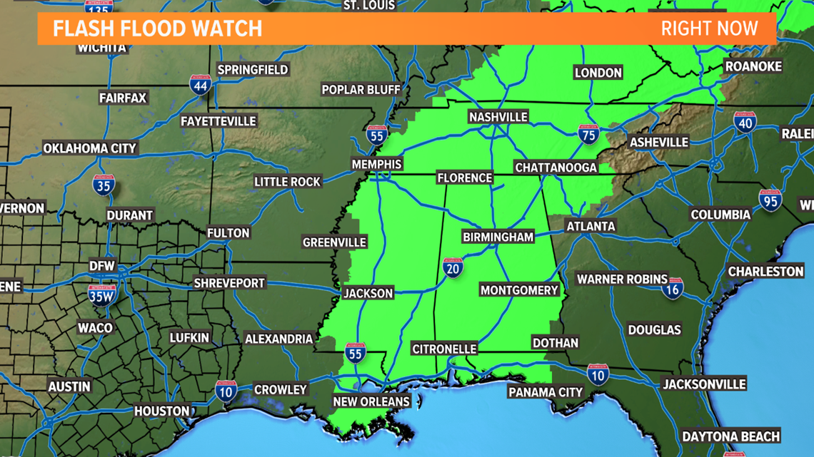
Threats the rest of the week from the storm will be heavy rain and flooding. In fact, Flash Flood Watches have been issued for most areas along the path of the storm.

What does Ida mean for North Texas?
Not much.
Since North Texas will be well west of the storm, the wind and rain will stay away from our area.
Some spotty to scattered showers and storms are possible this week, but nothing more than that.
We'll continue to keep an eye on the storm and keep you informed!

