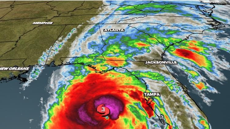
DALLAS — Hurricane Helene strengthened into a Category 4 hurricane on Thursday before making landfall, marking significant risk for the southeastern United States.
The storm is making landfall on Florida's Gulf Coast Thursday night. The coast is expected to be hit with strong winds and storm surges that cause major flooding. Helene produced winds upwards of 90 mph.
As the storm develops, WFAA will have a livestream with radar and video from the affected areas. Hurricane Helene is forecasted to strengthen as it moves through the warm water in the Gulf of Mexico, becoming a major hurricane.
Models show Helene is likely to move through the panhandle, into the western portion of Georgia on the path to Atlanta by Friday morning. The storm system is likely to pass through Chattanooga, Tennessee, and curve into Middle Tennessee and the Nashville area Friday evening.