Well, we asked for it.
After a brutal run of 100-degree days this summer-- close to a record-setting pace, even! -- we got the break we asked for in the form of a rain system that brought record setting rainfall. We went from a significant rain deficit to the 10th wettest summer on record.
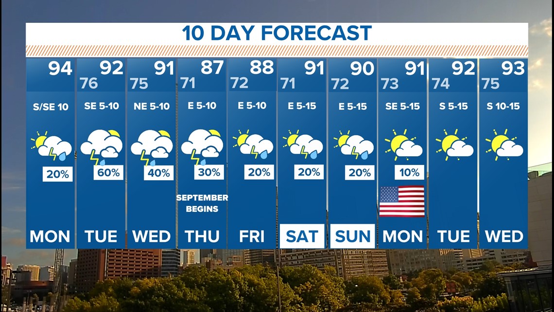
So, does this mean the end of triple-digit heat, officially? Not necessarily, but no such high temps are showing up on our 10-day forecast.
Meanwhile, what does the weekend look like in terms of additional rain?
Let's get into it.
Remember: NEVER DRIVE INTO OR THROUGH FLOODED ROADWAYS.
This Week
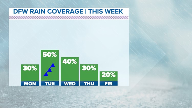
An unsettled weather pattern will be around this week which will feature daily chances for showers and storms along with cooler temps by the middle to end of the week.

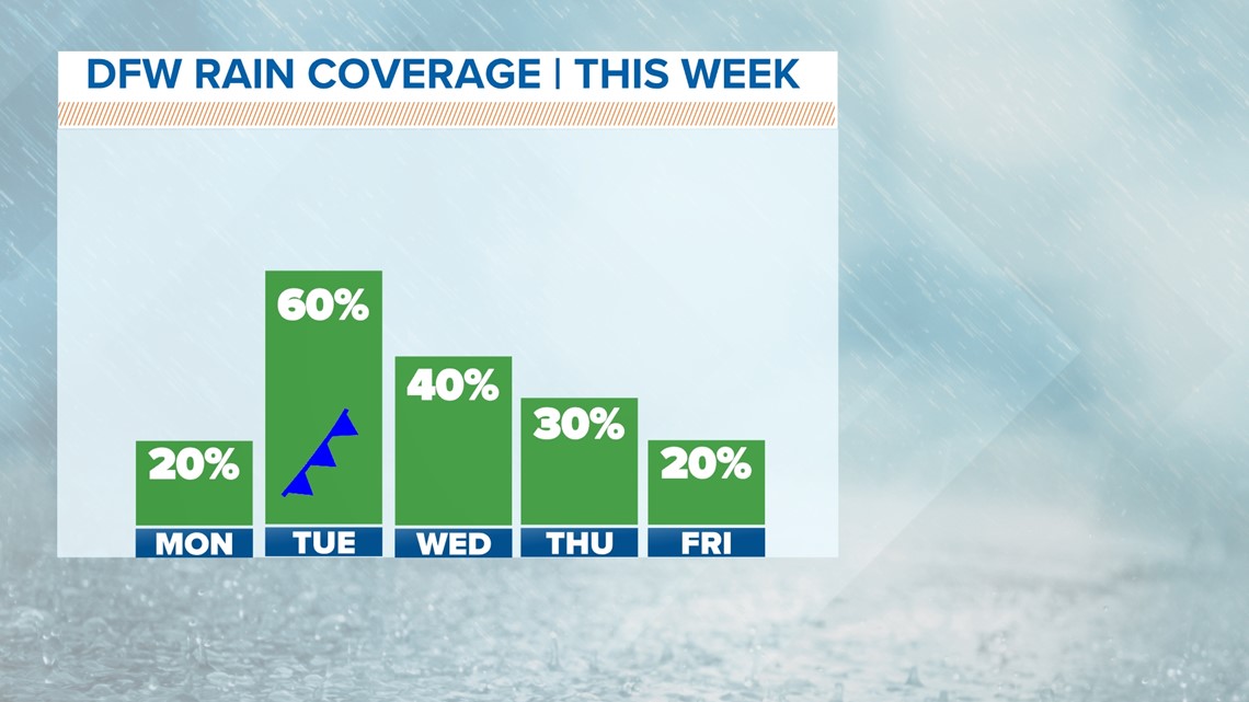
However, it's important to keep expectations in check this week. Even though chances are higher, this rain looks NOTHING like what we had earlier this week. And it doesn't mean everyone will see rain every day.
The chances are for passing showers and storms. Somewhere in North Texas (remember it's a big area) will likely see rain each day, but not everyone.

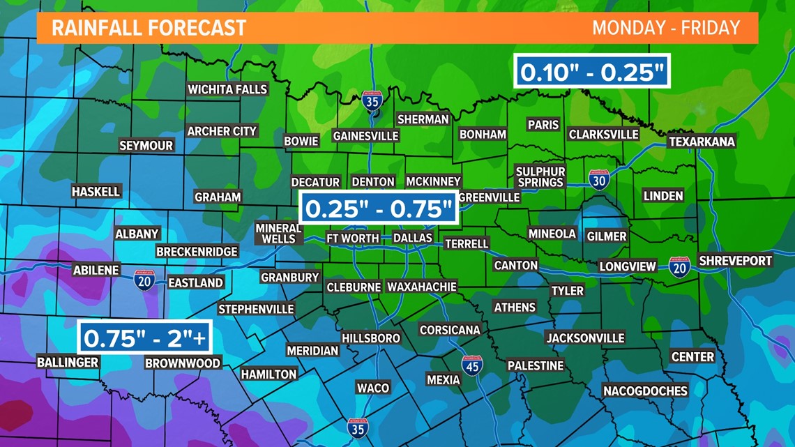
Some could be heavy, but rain amounts do not look high enough to warrant major flooding concerns.

