DALLAS —
Monday High Fire Danger
Even with recent rain, drought conditions remain across all of North Texas.
North Texas now needs around 6 to 9 inches of rain to get out of the drought.

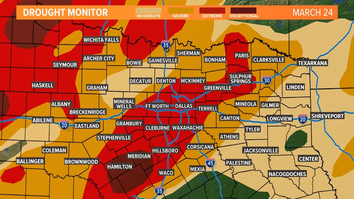
On Monday, fire danger INCREASES across the western half of North Texas. The rest of North Texas will see elevated fire weather conditions. Any fires that get started could spread very quickly and out of control.

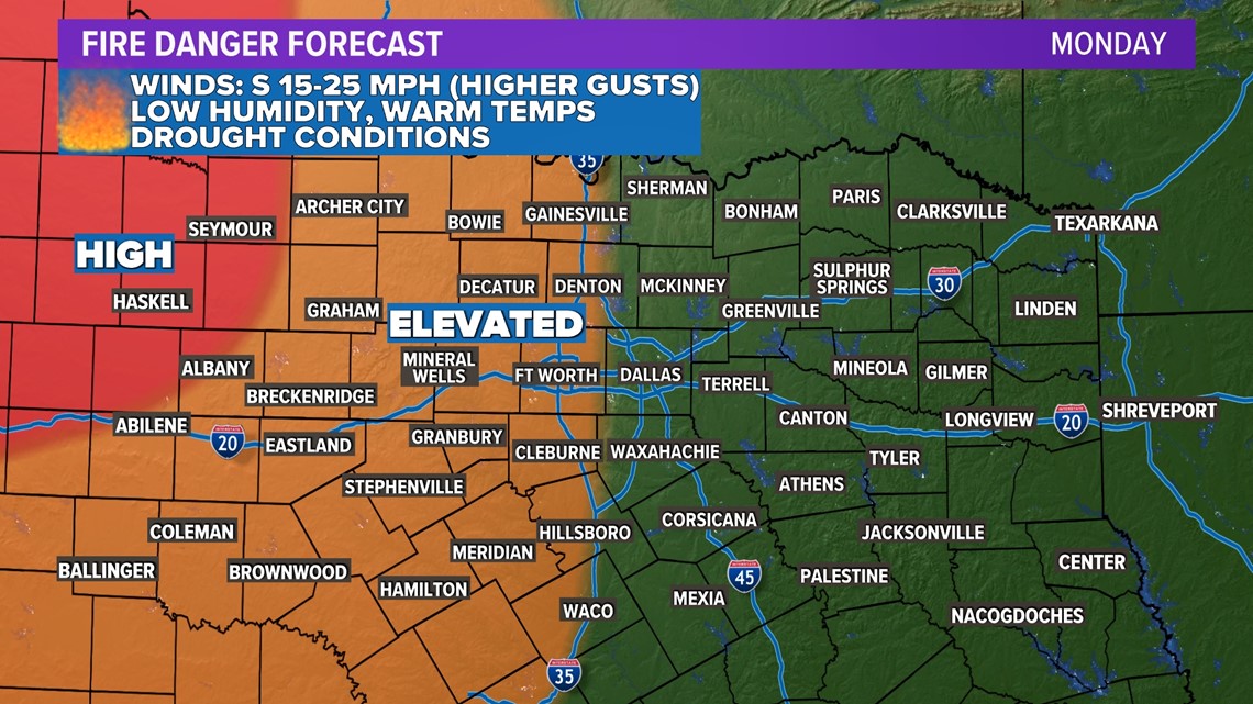
Fire danger will continue on Monday especially for areas west of D-FW.
Higher humidity returns by Tuesday to help limit fire danger. Our next best chance for rain comes late Tuesday and Wednesday.
Take a look below to see how you can avoid fires!
Best practices
We've already seen our fair share of grassfires this year, please help out and prevent any more.


Warmest Day Of The Season
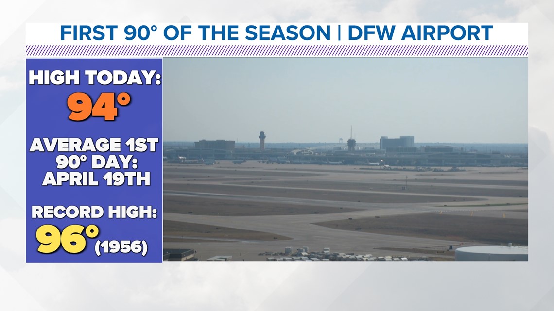
DFW hit 94° Sunday afternoon. That's just 4° shy of the record high set back in 1956. It's also early to see 90° temps! The average 1st 90° day is April 19th.

Next Storm Chance
We need the rain.
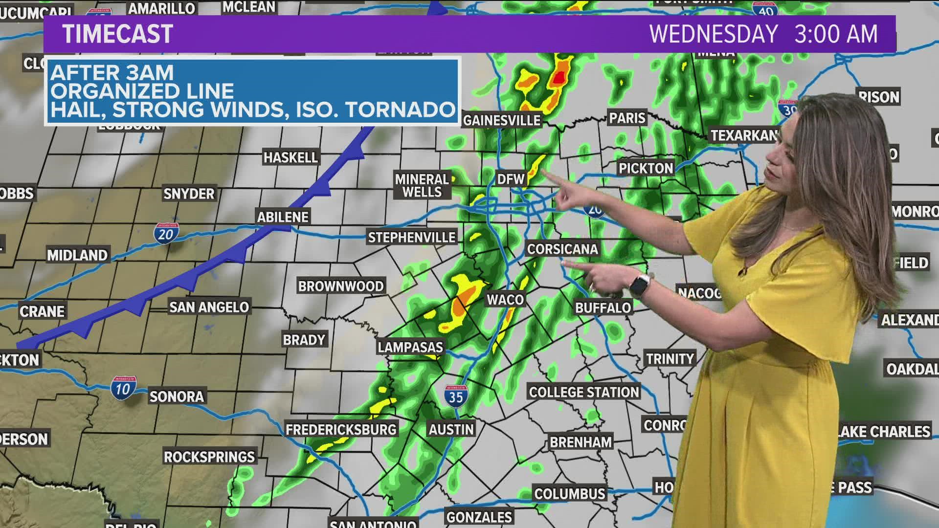
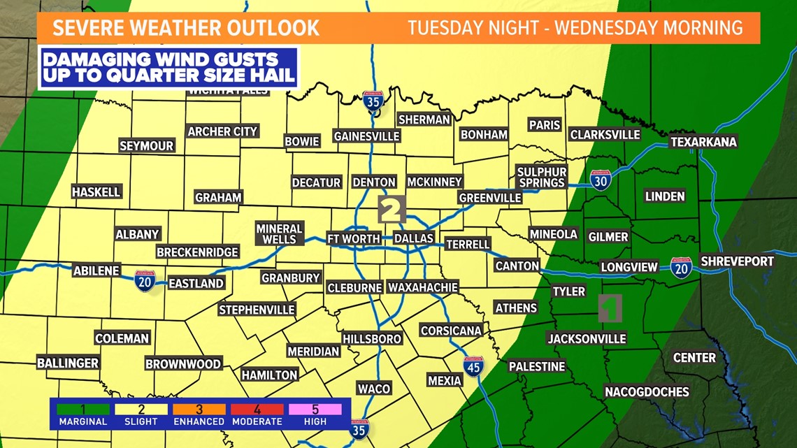
And it looks like pretty much everyone will see a round of showers and storms mainly late Tuesday night into early Wednesday morning.
A line or broken line of storms will move from west to east across North Texas during that time.
With storms arriving during the nighttime hours, the severe threat is not zero, but it is lower. Main threats would be for damaging winds and pocket change size hail. Can't rule out a brief, weaker tornado, but that threat is much lower.
This is NOT the same severe threat we saw this past Monday.

By the time the storms leave us Wednesday morning, around 1/2in of rain to over 1in of rain is possible. While this won't end the drought, it will certainly help.


