DALLAS —
The Severe Threat is Over
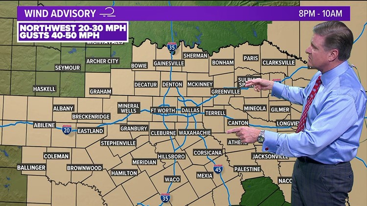
The severe weather threat across North Texas has ended. The cold front is well east of our area and windy conditions will take over.

More Storms Overnight... They Won't Be Severe
Another round of showers and storms are possible overnight as we see the backside of this potent storm system wrap around into North Texas. There will be no severe weather with this round, but pockets of heavy rain and thunder are expected.

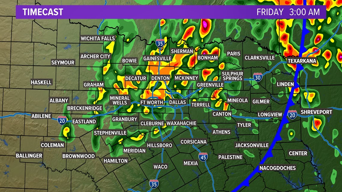

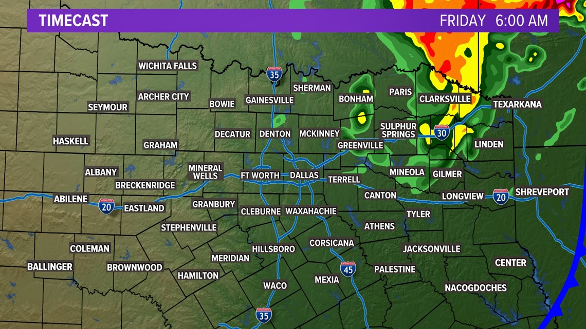
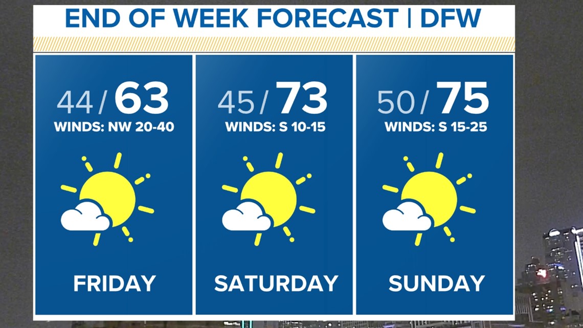
Any lingering overnight rain will be out of North Texas by daybreak. That's leading to some really nice weather as we head into the weekend! Enjoy it, we deserve.it.

*Previous warnings in North Texas
Tornado warning in Dallas
A tornado warning was issued for Dallas County just before 6:30 p.m. on Thursday. The storm had potential for winds up to 80 mph in the area.
It was able to expire at 7 p.m.
Here's a look at what happened:
A Tornado Watch was issued for the majority of North Texas, including D-FW, until 10 p.m.
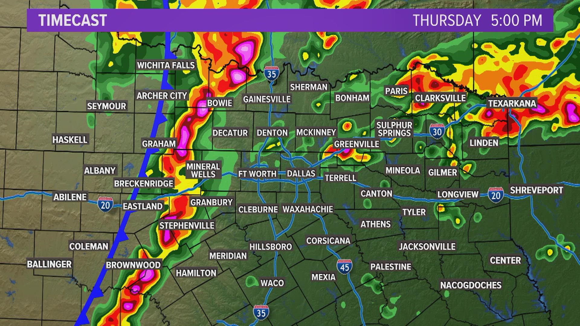
A line of storms moved across North Texas Thursday afternoon through Thursday evening.
Damaging winds, large hail, and a few tornadoes will be possible as the line of storms moves through.

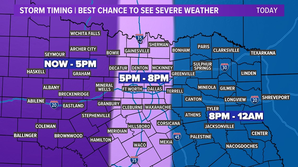
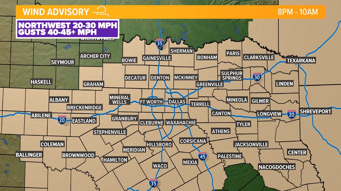
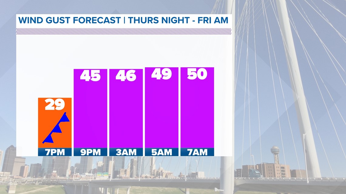
Once the line of storms moves through, the severe threat will be done in your location. It will be windy throughout the nighttime hours behind the cold front that sweeps through.
Then comes the winds
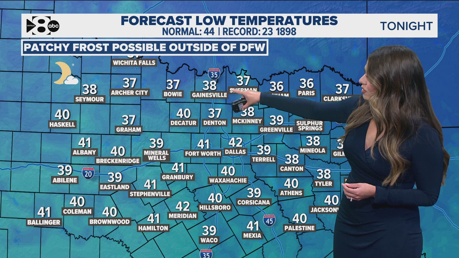
Non-thunderstorm wind gusts overnight Thursday into Friday morning could be as high as 50 MPH. Winds will get better by late Friday morning and by the afternoon. This will bring much cooler air into the area for Friday.

Please stay weather aware Thursday as our entire team tracks the storms from development to departure.


