DALLAS —
Tornado Watch
A tornado watch has been issued for most of North Texas until 2 am. All modes of severe weather are possible as a line of strong to severe storms moves east tonight.
Severe storm chances return to North Texas tonight.
A line of thunderstorms moving west to east across North Texas is likely this evening into the overnight hours.
Since storms are possible after dark for most, don't go to sleep Sunday night without a way to get weather warnings while you are sleeping! Download our free WFAA app to stay up-to-date on all news stories in the Dallas-Fort Worth area.
Timing
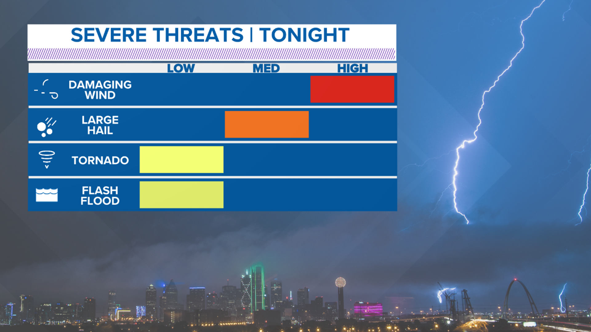
Storms will develop first across areas west/northwest of Dallas-Fort Worth in the 6 p.m. to 9 p.m. timeframe.
Those storms will then quickly move east arriving in D-FW from around 9 p.m. to midnight give or take. So closer to 9 p.m. for western D-FW and closer to midnight for eastern D-FW.
These storms have already impacted the State Fair of Texas. The fair announced Sunday that it will close early due to weather and asked everyone to leave the park by 8:30 p.m. Normally, the fair closes at 9 p.m. on Sundays.
Areas east of D-FW can expect storms to arrive after midnight.
Storms should be moving fairly quick, so by sunrise Monday morning all of North Texas will be dry.

Severe Threat
The line or broken line of storms will likely contain severe storms or segments of the line that are severe.


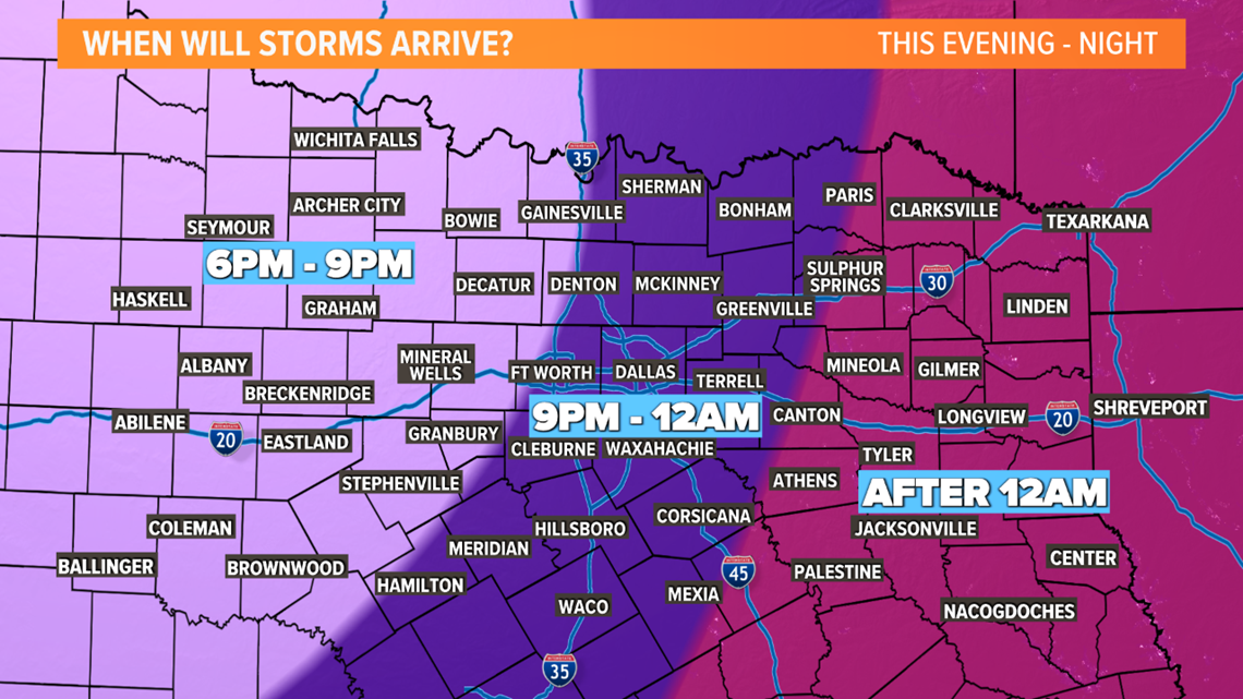
For D-FW, storms are likely with damaging winds being the primary concern. However, can't rule out some pockets of large hail or a tornado.
Main severe threat will be damaging straight-line winds of 60+ mph for all of North Texas.
Stronger parts of the line could contain hail up to the size of quarters or golf balls.
Within that line of storms, embedded tornadoes are possible as well. These type of tornadoes usually spin up very quickly and don't last very long. However, they are still tornadoes and can cause significant damage to anyone in the path
If any storms can stay isolated (not in a line or ahead of the line), they would carry a higher hail and tornado threat. IF this occurs, the chances are best for areas along and north of HWY 380 to the Red River.
Rest of the week
Monday will actually be a really nice day behind a "cold" front. Temps will be cooler than this weekend and the air will feature low humidity again.
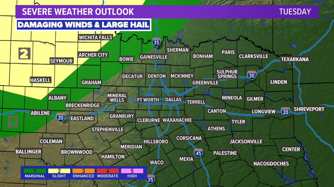
Tuesday will be a return to warm and humid with a chance at some scattered showers or storms. Severe threat looks low, but a few stronger storms with hail are possible. The highest threat for severe storms will be mainly to the northwest of Dallas/Fort-Worth.

Wednesday and Thursday look more unsettled with a rounds of showers and storms on those days. The severe threat does not look high, but can't rule out a few strong to severe storms with gusty winds and hail. Thursday looks to be more of a rain event with heavy rain possible.
Some lingering showers and storms are possible Friday before cooler and drier weather arrives by next weekend.

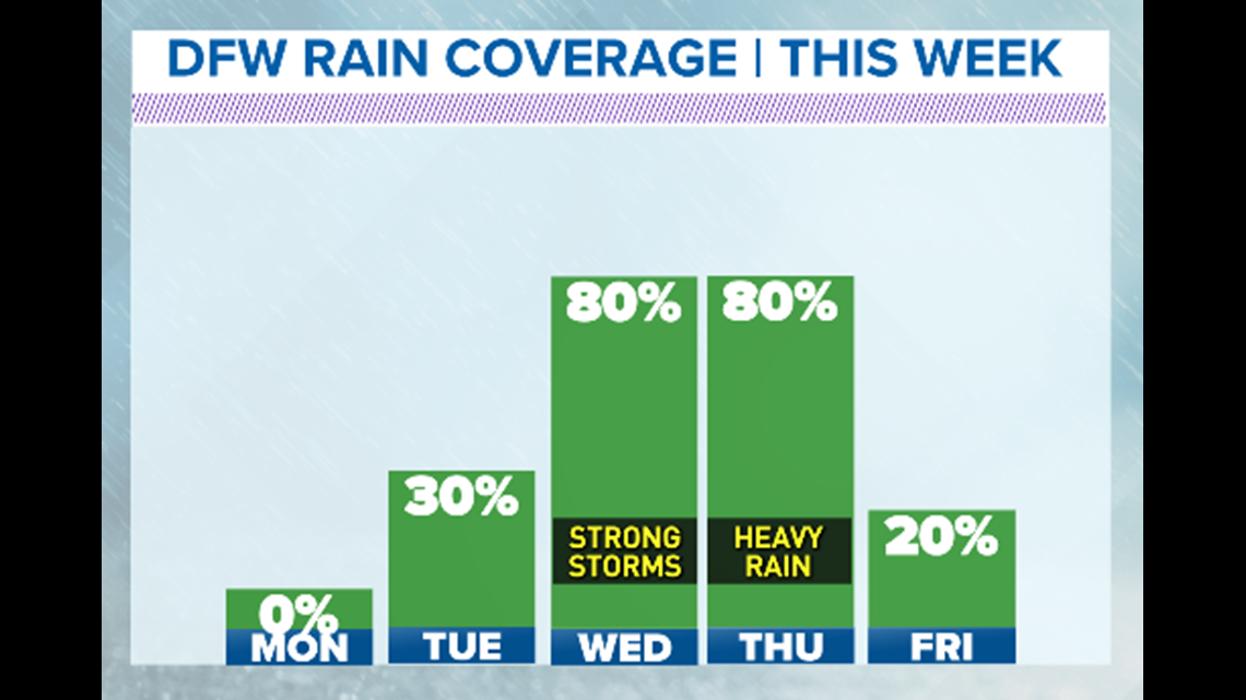
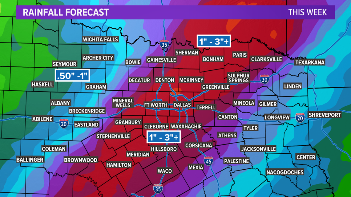
While the threat for severe storms appears low mid to late next week, the threat for heavy rain and localized flooding looks possible.
Any thunderstorms will have heavy rain, and repeated rounds of heavy rain could cause some localized flooding issues.
By the end of next week, 1in to 3in of rain looks possible for most of North Texas.

