DALLAS — Winter isn't done with us just yet!
Friday
Friday brings major changes again.
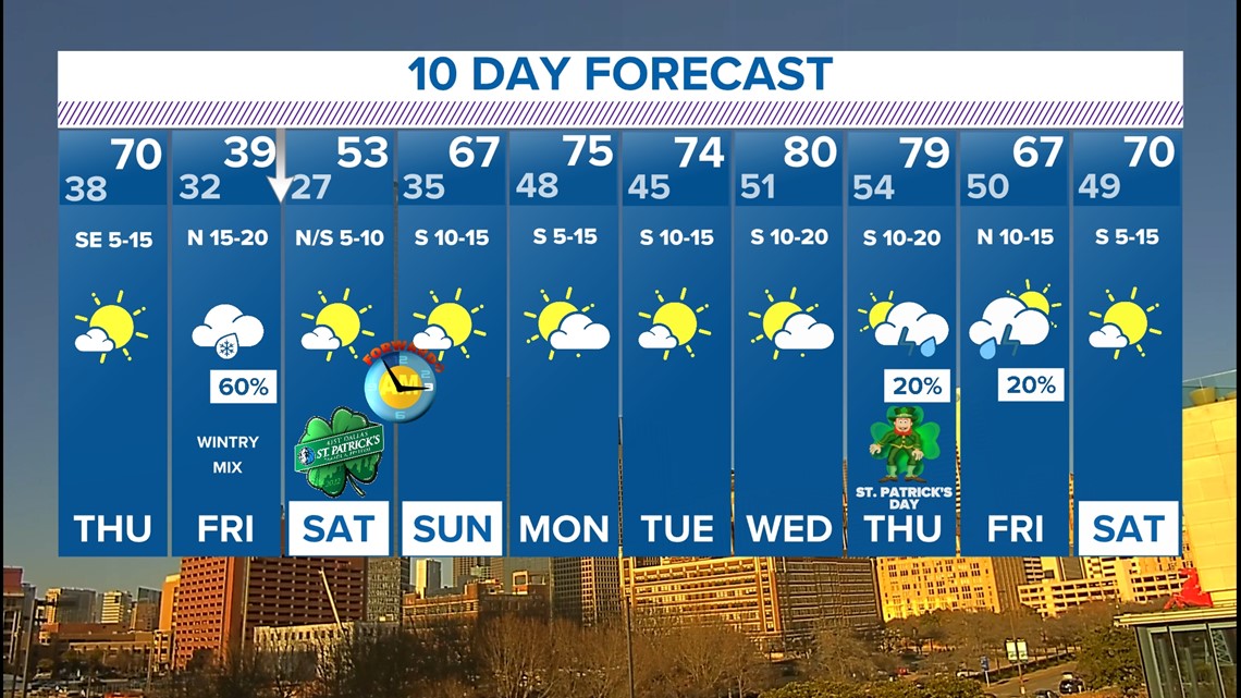
A strong cold front will move through Thursday night into Friday with temps not making it out of the 30s and 40s all day Friday.
There will also be some rain or a wintry mix possible on Friday, as well.

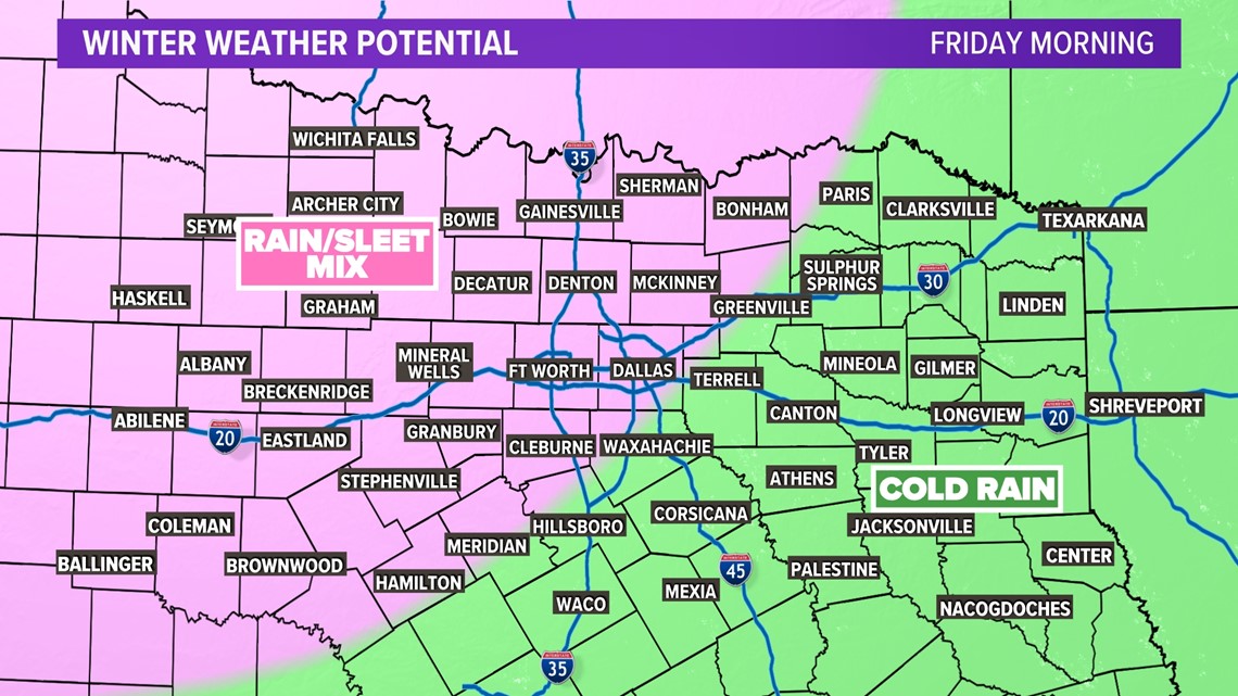
A rain and sleet mix will spread across North Texas Friday morning. Precip may start as rain and then transition to a sleet mix during the morning hours.
During the afternoon, that rain/sleet mix may transition to a more sleet and snow mix.

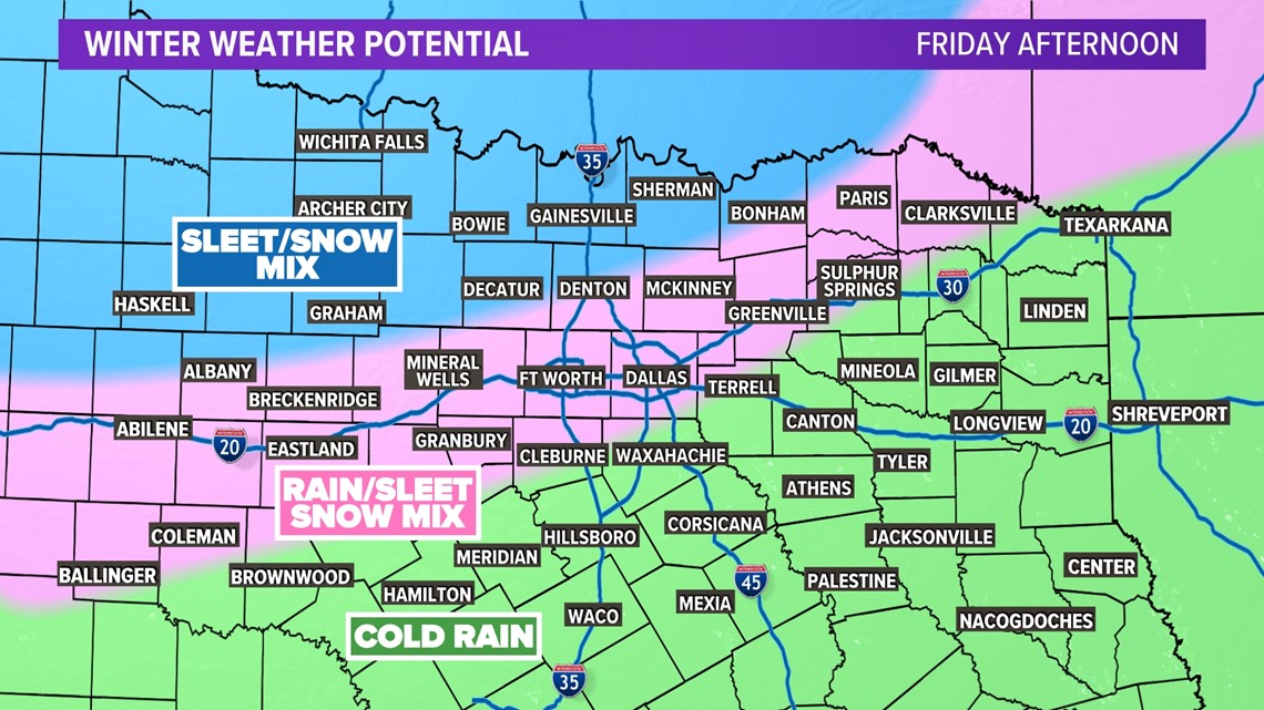
By the late afternoon into evening, any wintry mix will start to end from west to east across North Texas.
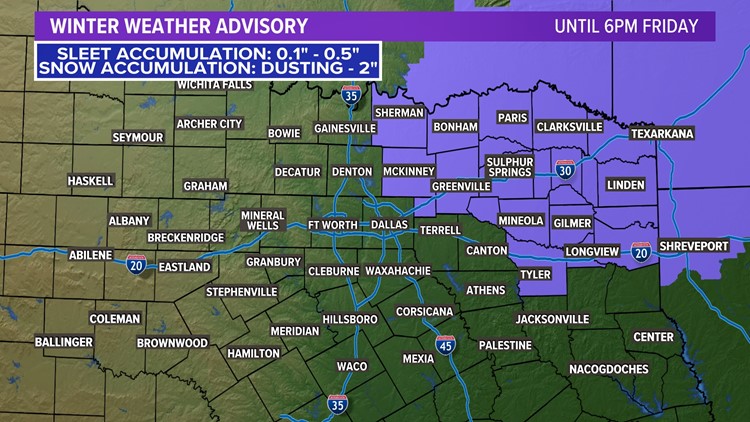
It is still too early to talk exact accumulation (if that even occurs). Widespread travel issues do not look likely at this point. But if we get any accumulation on grassy or elevated surfaces, that could cause some slick spots on some bridges or overpasses.

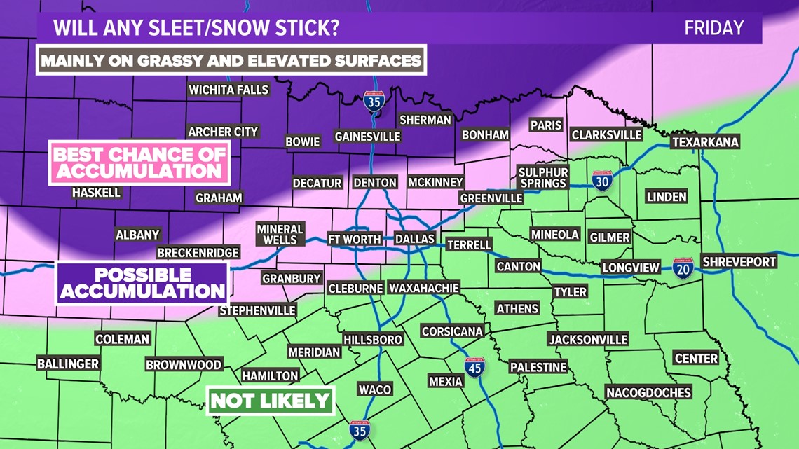
Best chances for that to occur will be across northern and western North Texas. In D-FW, it is not impossible to see some light amounts.
There are still a lot of details to be fine-tuned with this next system, so keep checking back for updates!
Weekend Freeze
Any precipitation will clear out Friday night, so things will be dry by Saturday.
However, temps will fall, with all of North Texas likely seeing a freeze by Saturday morning. On average, the last freeze for DFW is March 12th, but a freeze has been recorded as late April 13th!
Temps will warm quickly through the weekend with highs in the upper 60s by Sunday.

