
DALLAS — Be sure to download the WFAA app to track the latest forecast and get alerts from our team.
Hurricane Season began back on June 1 and right on cue the tropics are heating up with Tropical Storm Alberto brewing in the Gulf of Mexico.
Alberto?
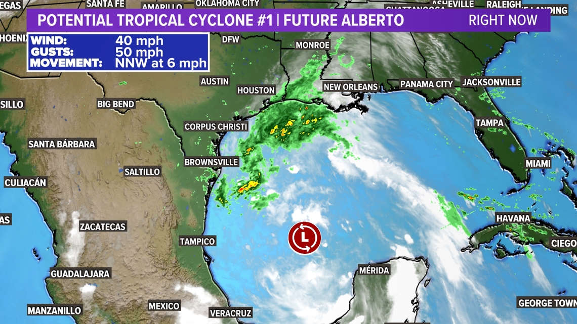
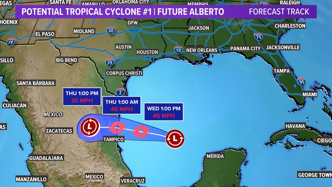
As of right now, Alberto has not formed in the Gulf of Mexico. There is a tropical disturbance in the Bay of Campeche that is likely to become a tropical depression or a tropical storm by sometime Wednesday. If the disturbance strengthens to a tropical storm, it will get the name "Alberto", which is the 1st named storm of the 2024 Hurricane Season.
Right now the disturbance is called a Potential Tropical Cyclone. This means it has a very good chance of becoming a tropical depression or storm soon. This also allows the National Hurricane Center to issue a forecast cone or track along with watches or warnings.

Where is it headed?
The center of the storm will track into Mexico between Tampico and Brownsville, Texas late Wednesday night into early Thursday morning.
However, areas well away from the center of the storm will see heavy rainfall and even storm surges.

Heavy rain and flooding
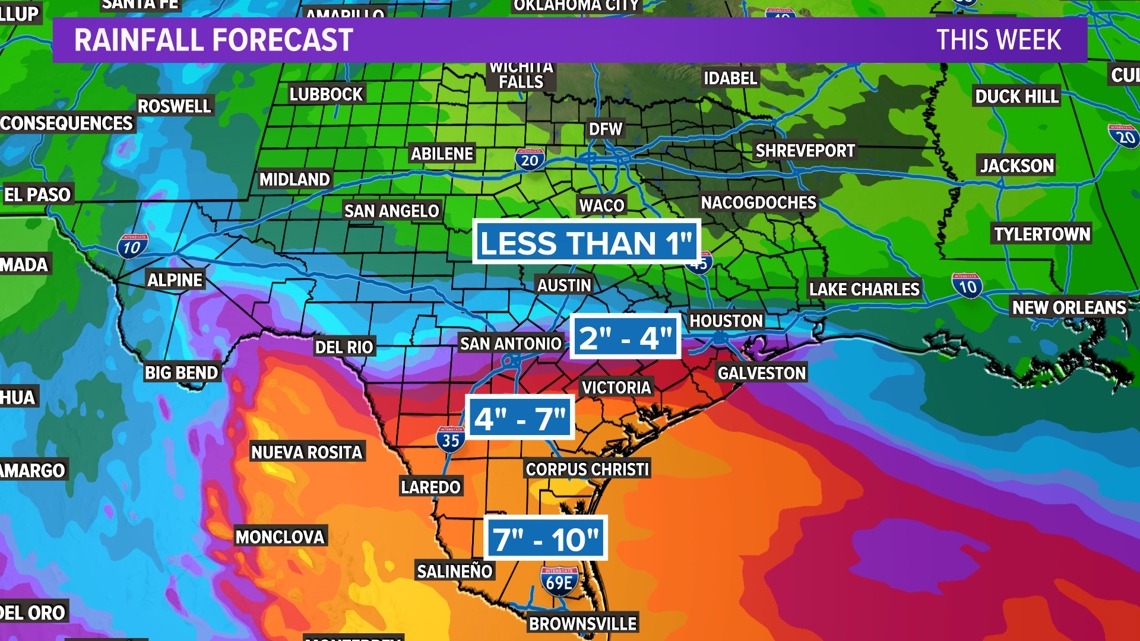
Heavy rain will be the main concern with this system. Even if it never forms into a tropical storm, heavy rain and possible flooding will be headed to parts of Texas and Mexico.
The highest rainfall totals Wednesday into Thursday will be in South Texas and northern Mexico where 7 to 10 inches of rainfall is possible. Totals taper off farther north, but areas between San Antonio and Corpus Christi can expect between 4 to 7 inches. Along and south of I-10 will see the highest of the rainfall totals.
Rounds of heavy rain and high rainfall totals could cause flooding issues in those areas.

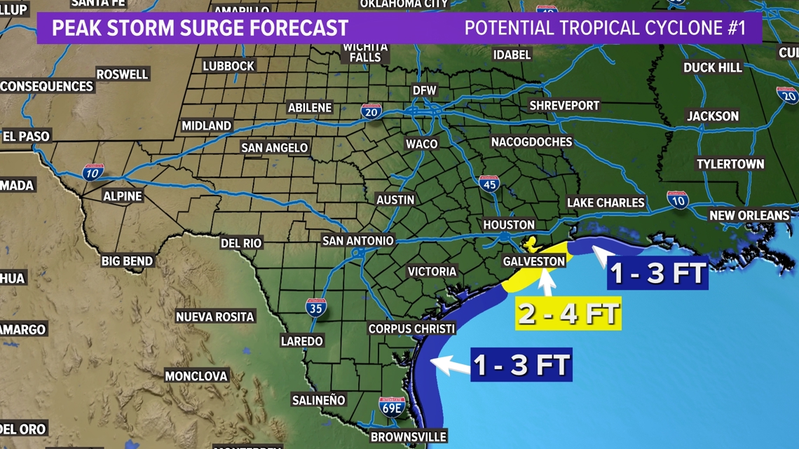
Storm surge
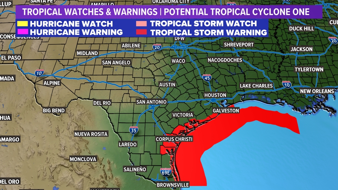
Even though the center of the storm will pass well south of most of the Texas Coast, storm surge is possible for areas along the coast. Mostly between 1 to 3 feet, but areas in and around Galveston could see a surge from around 2 to 4 feet.
For this reason along with the chance for gusty winds, a Tropical Storm Warning has been issued for most of the Texas coastline.


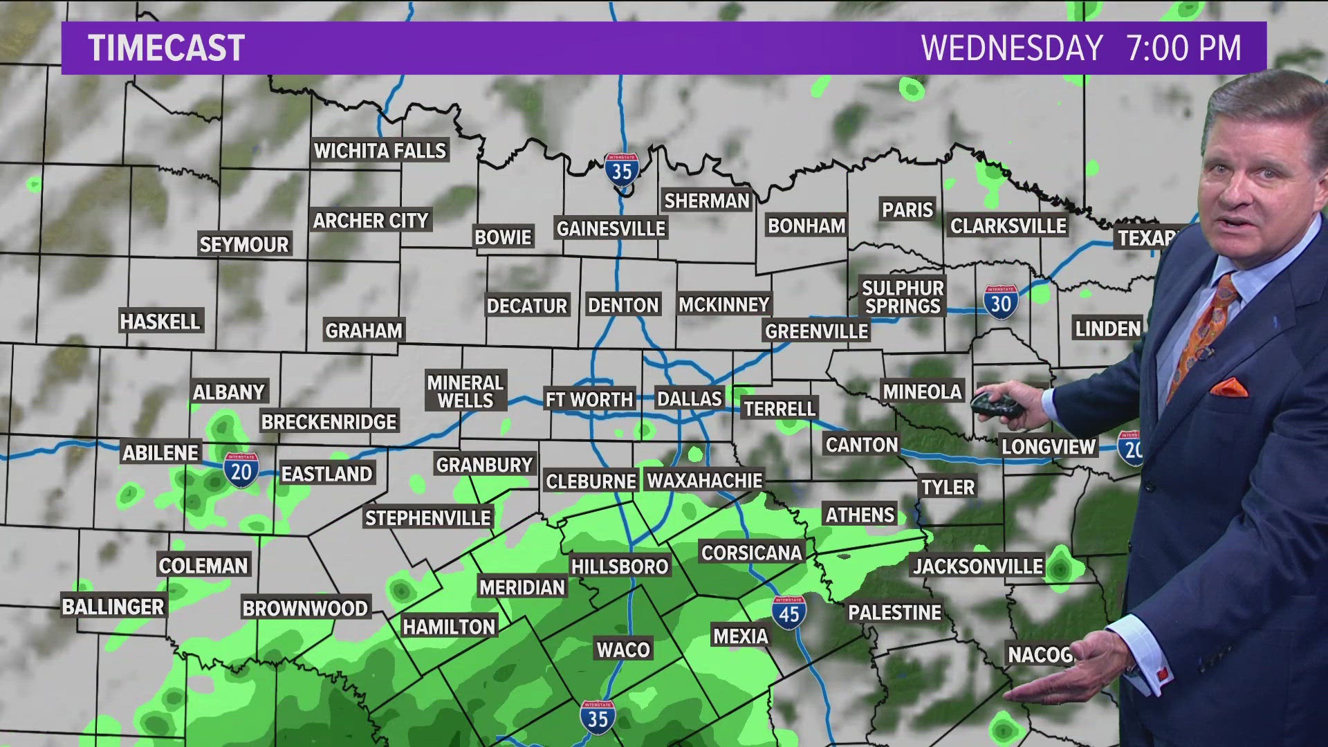
What about North Texas?
We won't see much from this storm. A few passing showers are possible Wednesday along with some increased cloud cover.
That cloud cover will actually be beneficial as it will help keep the afternoon summer heat in check.