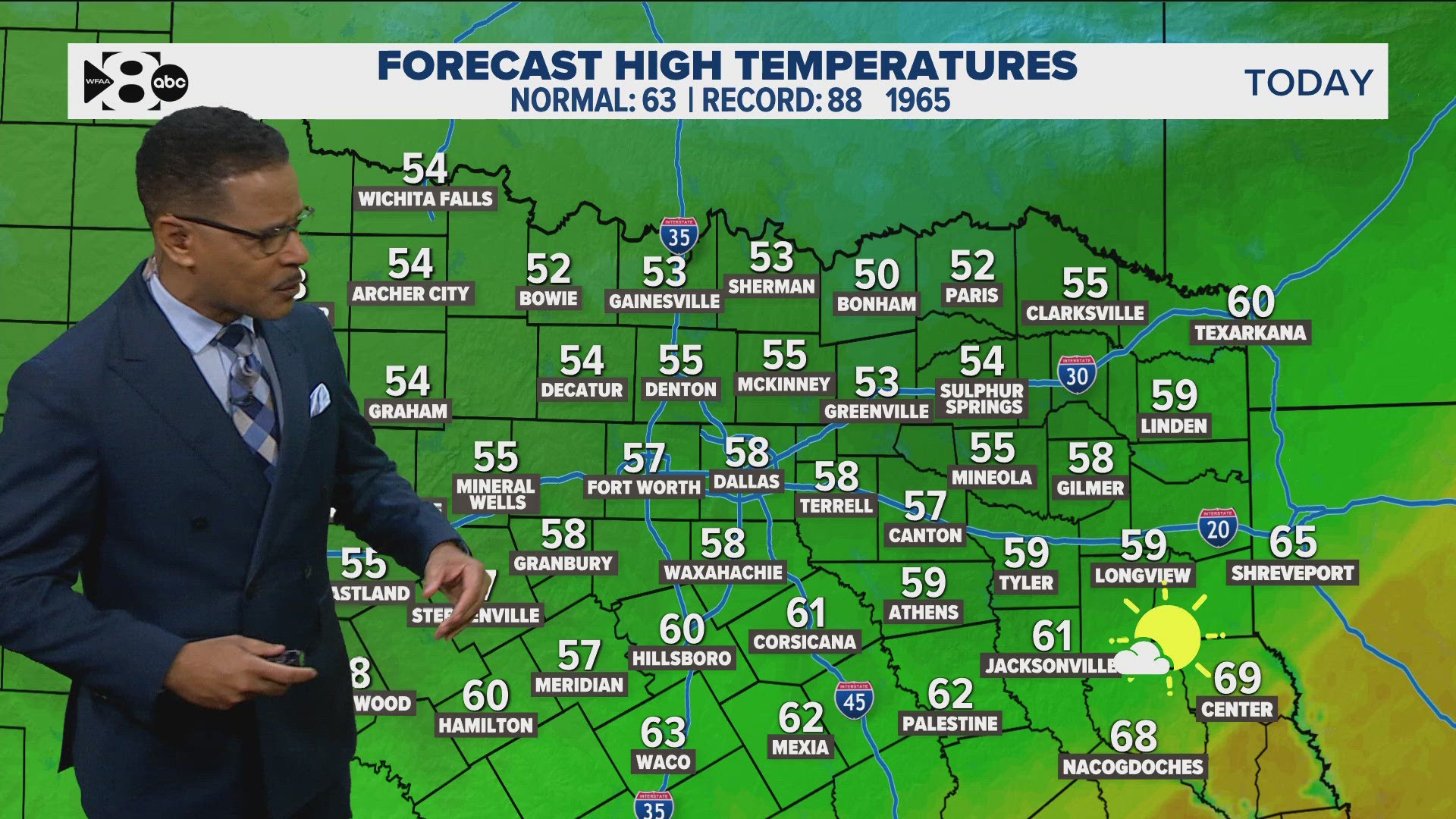
DALLAS — Many across North Texas reported the first freeze of the season this past week which is about three weeks ahead of schedule. The brief taste of winter has left, for now, as temps climb for the weekend.
Versión en Español: El aire más frío que el Norte de Texas ha visto en meses está aquí.
Here's what to expect:
Quick Facts:
- Warmer and breezy start to the workweek
- Rain stays away for now
- Another front and rain chances Thursday
Early this week
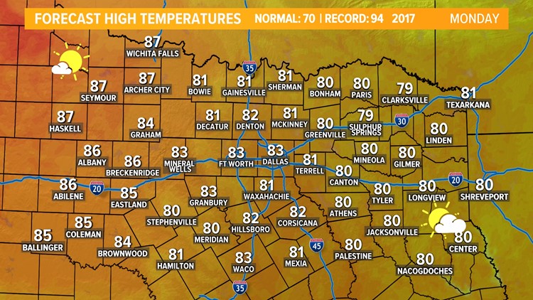
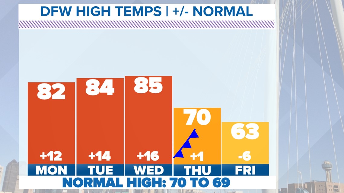
No more frosts and freezes for quite a while here in North Texas. The weekend was very warm with highs in the 70s and 80s. We will carry the warmth into the first half of the workweek. Highs on Monday will be in the low to mid 80s. It will be just as warm if not a little warmer on Tuesday and Wednesday before a cold front arrives on Thursday.


Thursday cold front and rain
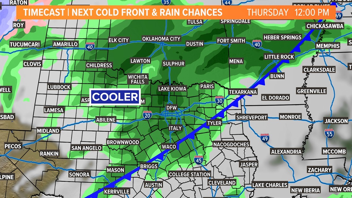
Our next front looks to arrive on Thursday bringing back cooler temps and rain chances. This front does not look to be as strong as the last one, but will drop temps back to normal or a little below normal late week and into next weekend.
Scattered showers and storms are possible on Thursday, but rain does not look heavy enough to cause any flooding issues and the severe weather threat looks very low.

November by the numbers
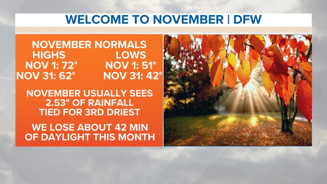
On average, November high temps drop by about ten degrees throughout the month while morning lows dip into the low 40s. November (normally) is not a month that records a lot of rain. Daylight continues to lower with DFW losing about 42 minutes of daylight between the first and last of the month.
November on average reports the first freeze of the season on November 22 for DFW.

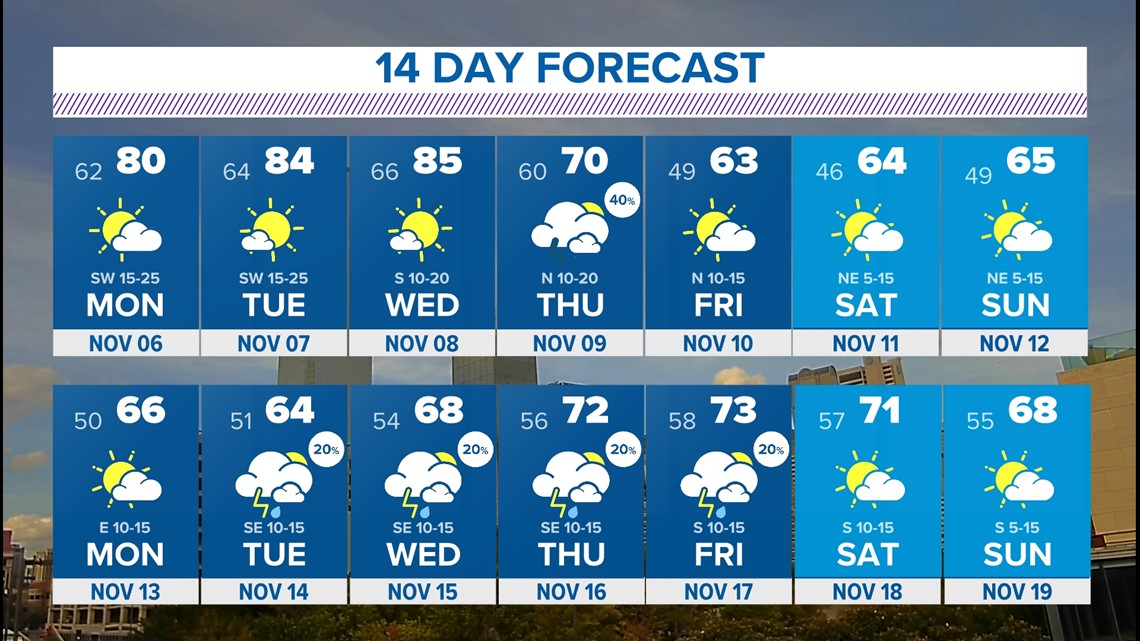
14-day forecast
The weather pattern for the following week looks a bit more unsettled with almost daily rain chances in the forecast. While it likely will not rain every day everywhere, the pattern is looking unsettled enough to keep daily rain chances in the forecast for now. We'll fine-tune as we get closer.

