Updated 8 pm Tuesday with the latest forecast
A long awaited pattern change arrives this week!
The pattern this week will favor disturbances moving across or near North Texas, bringing rounds of showers and storms.
In fact, between now and the rest of the week widespread 2" to 4" of rain is likely across North Texas. Northern areas of North Texas could see 5-6" or more.
This also means that localized flooding could be a problem in some areas. Quite the change from August!
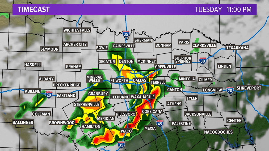
Tuesday Night into Wednesday Morning
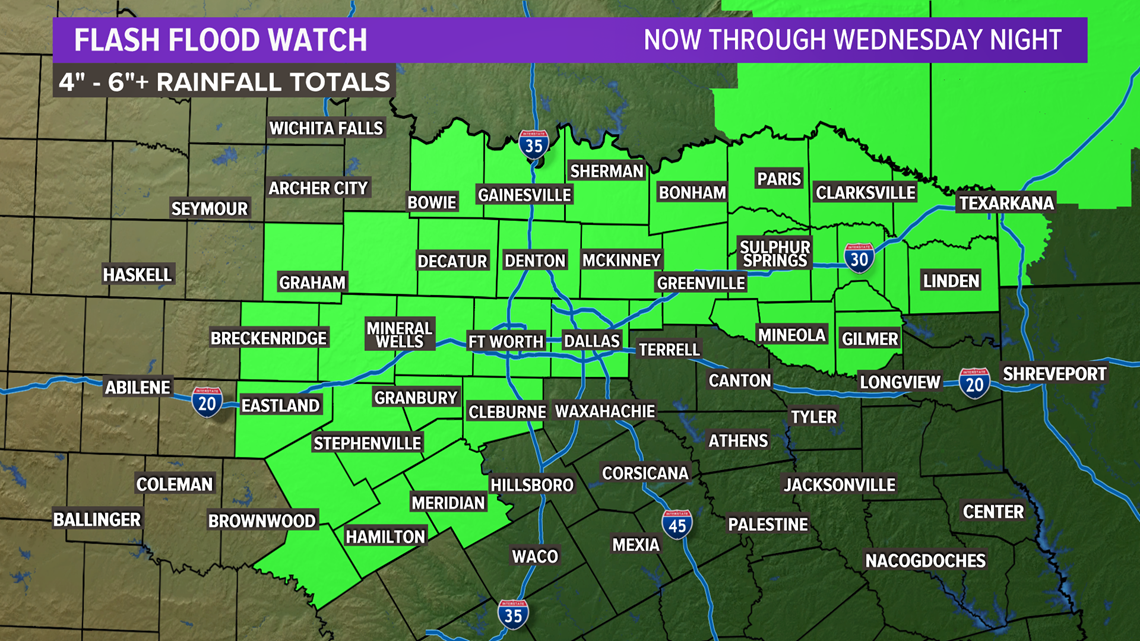
Rainfall totals as of Tuesday night range from a half of an inch to up to 6" of rain across North Texas. Scattered showers and thunderstorms will continue into the overnight hours. The overall severe threat will be low, but because of all the rain that has fallen in many of these locations already flooding will be the main concern.

A Flash Flood Watch remains in effect through tomorrow night for the counties in green.

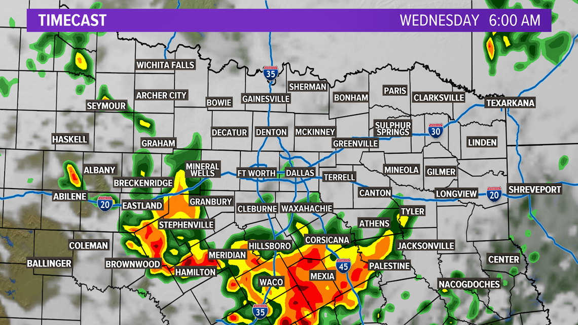
Wednesday through Friday
More rounds of showers and storms are possible. A round or two is Wednesday morning into the early afternoon.

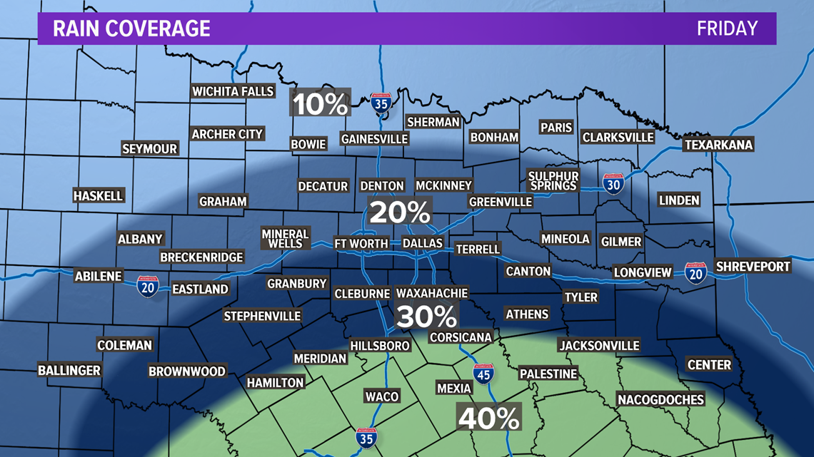
Scattered rain will continue to be possible Thursday into Friday. The overall coverage shifts into Central Texas on Friday with higher rain chances south of I-20.

While temps won't be "cool" by any means, they will be a lot cooler than recently! Highs will be in the middle 80s to low 90s for North Texas.
Thankfully it looks like near or below normal temps will continue into Labor Day Weekend with perhaps an even stronger cold front possible by early next week.

