DALLAS —
Cool for some, warm for others
Temperatures the rest of the week will continue to be tricky. It all depends on where you live in North Texas.
A stalled front will keep things cool and closer to normal for some and warm and above normal for others.
Warmest temps will be in southeastern North Texas with coolest temps in northern North Texas. D-FW will be somewhere in between with highs above normal in the 60s to low 70s.
Rain this week
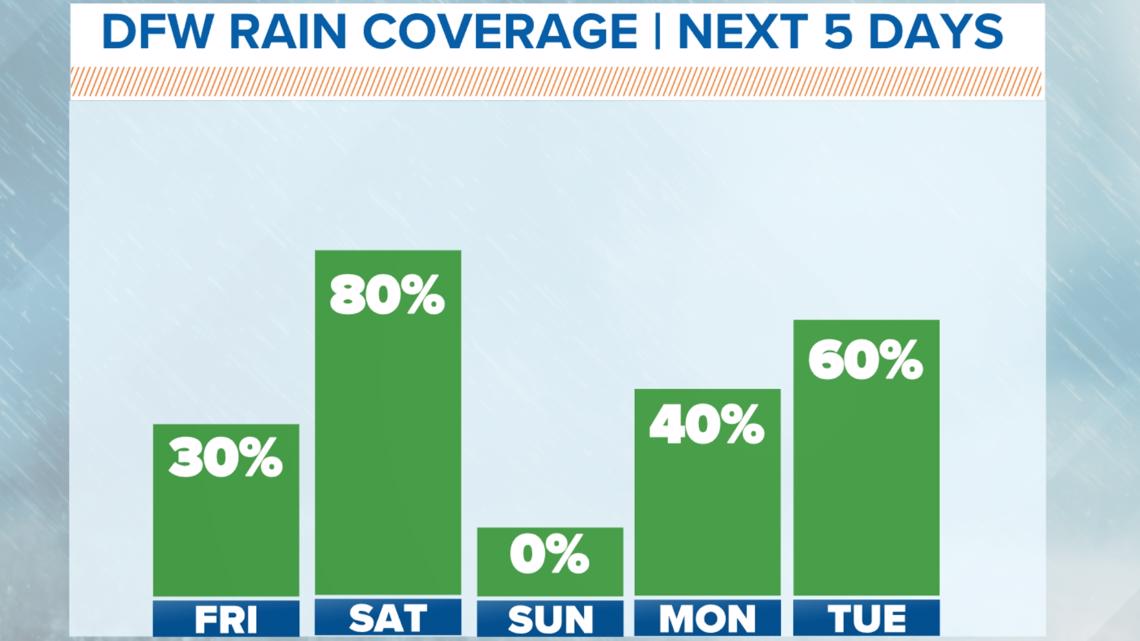
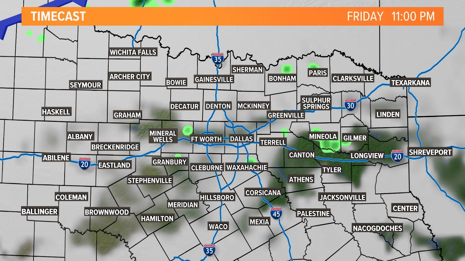
Scattered showers will continue to be around North Texas through the day on Friday. There might be a rumble of thunder here or there, but no severe weather. Most rain will be light.
Not everyone will see showers but they will be out there.
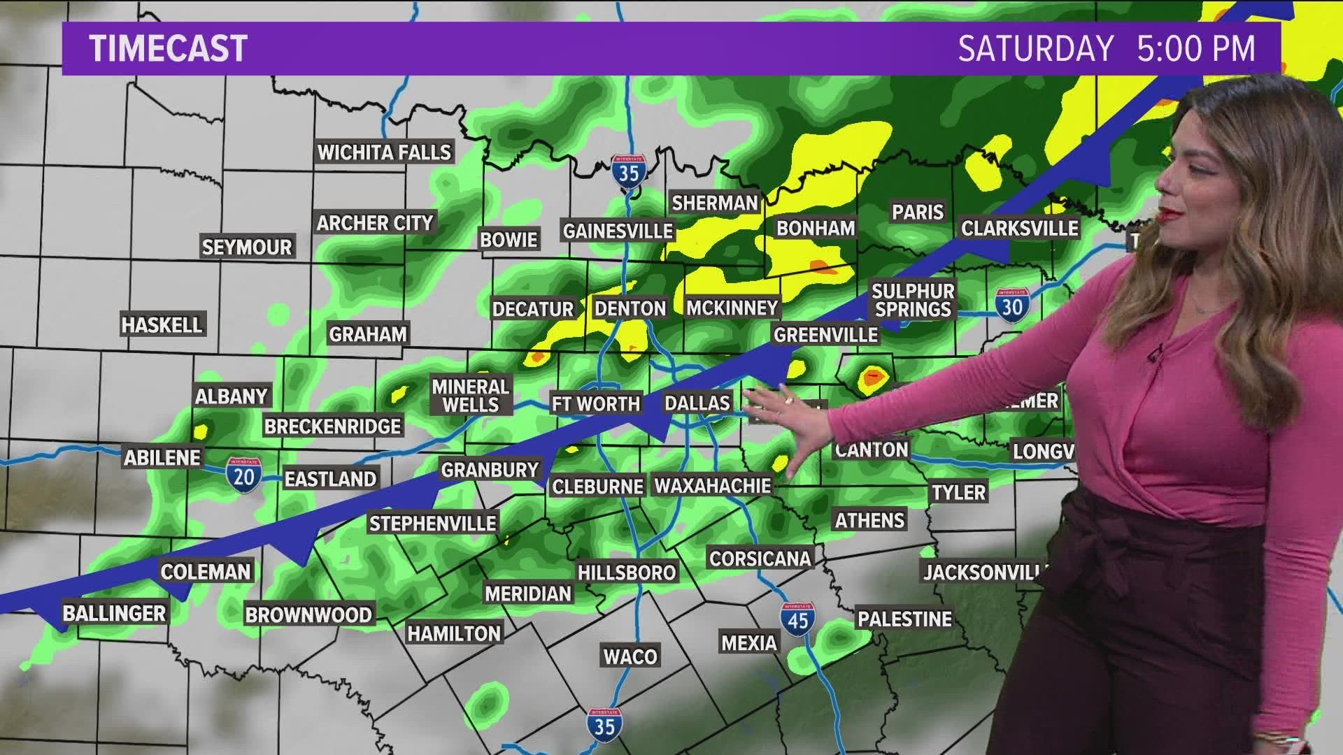
The next round of widespread rain looks likely on Saturday with rounds of showers possible during the day. Nothing looks severe, but it could be a rather wet Saturday.


Rain timing through Saturday:
10-day
After Saturday's rain, Sunday looks dry and pleasant.
Winds pick up out of the south on Monday and it will be back to warm and muggy. This sets up rain late Monday into Tuesday.
A stronger front looks to move through North Texas sometime Monday night or during the day on Tuesday. Thunderstorms look like they will accompany that front, and some storms could be severe. It is way too early for specifics, but something that we will be keeping our eyes on.
Much cooler and below normal temps look like they may return again for the second half of next week.


