Updated at 12:53 p.m. Monday.
Short Forecast
Rounds of showers and storms are likely on Monday. It will not rain all day long at any one location, but most places will see at least one round if not multiple rounds of rain during the day.
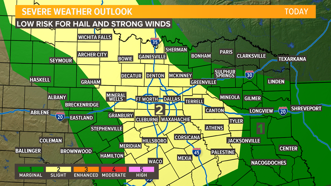
The overall severe threat is low, but can't rule out an isolated strong to severe storm mainly during the afternoon and evening. Threats from those storms would be strong winds and hail.
Widespread flooding is very unlikely, but any areas that see repeated rounds of heavy rain could see localized flooding of typical flood-prone locations.
RELATED: Check the radars
More Details
Timing
While most places will pick up rain at some point during the day, an all-day rain is not likely for most.
Scattered showers or storms will continue to increase in coverage throughout the afternoon.

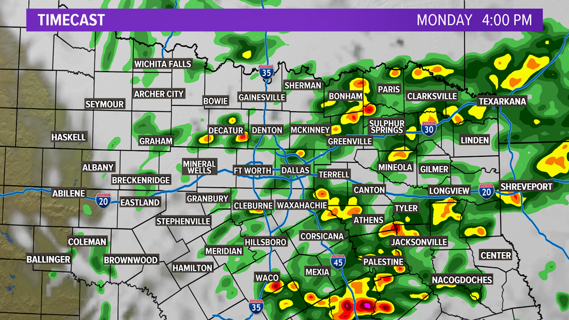

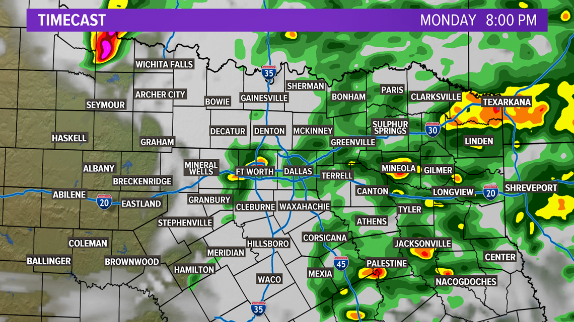
By late evening into the overnight hours, showers and storms will begin to move out of North Texas. Rain coverage overnight will be lower than during the day. All of North Texas will be dry by Tuesday morning.
Severe Threat
The overall severe threat is low in North Texas, but not zero.
A few storms this afternoon and evening could have strong winds (50-60+ mph) and hail (up to quarter size).
Widespread severe weather is not likely.

Rainfall Amounts
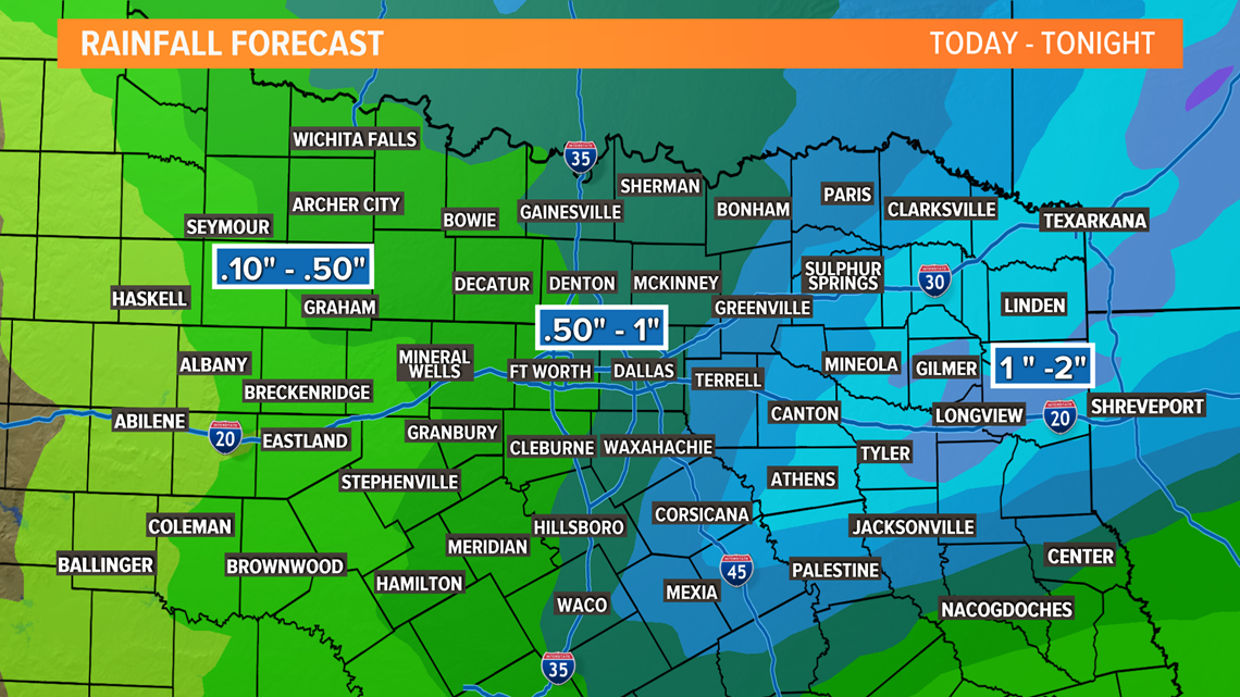
Around half an inch to 1 inch of rain is a safe bet for most of North Texas.
Higher amounts look possible for eastern parts of North Texas into East Texas with lower amount across western North Texas.
Any areas that see repeated rounds of heavy rain or 1 to 2 inches of rain in a short amount of time could see localized flooding given how wet things have been recently.
Flooding of typical flood-prone or low-lying areas would be possible in those locations along with ponding on the roads.

