DALLAS — Be sure to download the WFAA app to track the latest forecast and get alerts from our team.
Quick facts:
- Rain and storms return Thursday
- Severe threat and flooding threat
- Heating back up this weekend
LIVE RADAR
Thursday
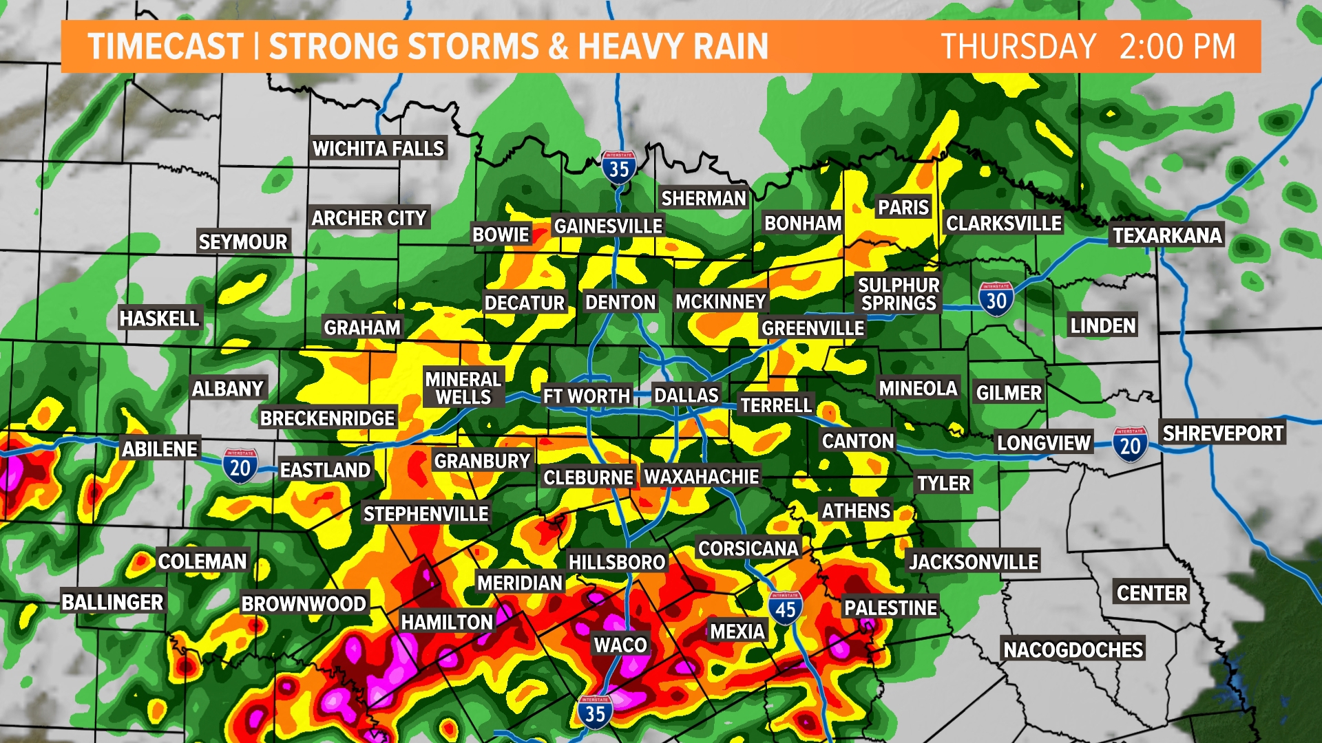
Storms will continue now through Friday with the highest of the coverage happening late morning Thursday through Thursday evening.
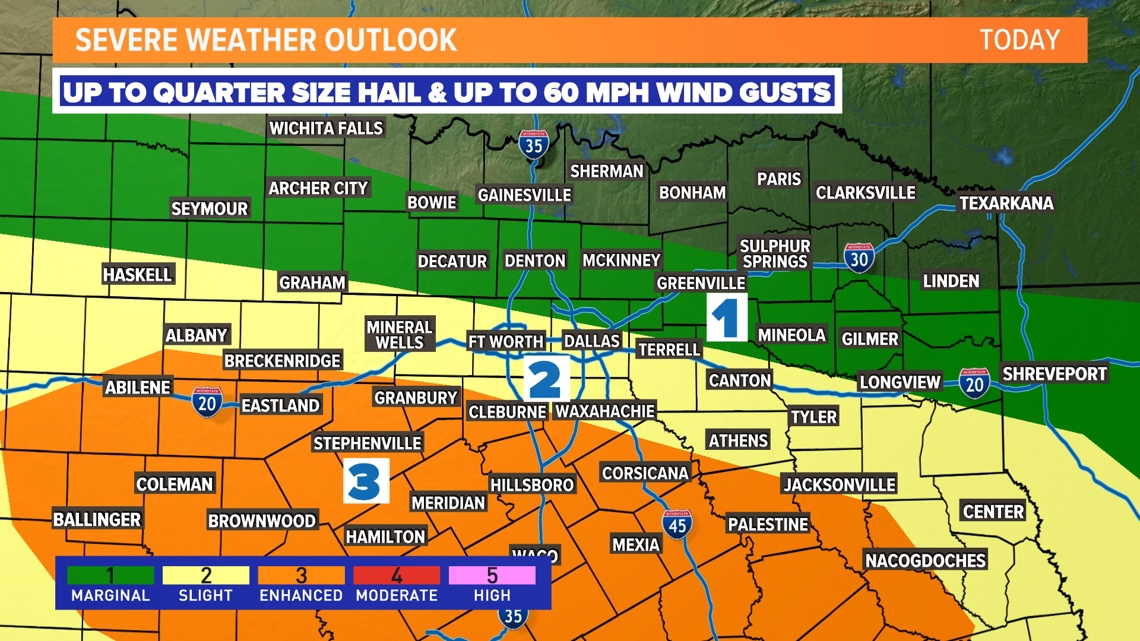
Some storms could be severe with mainly a threat of large hail and damaging winds. The tornado threat on Thursday looks low and not overly concerning.
Not everyone will see severe storms, but they are possible for parts of the area. We'll fine-tune coverage and timing over the next couple of days.

Rainfall Forecast and Flooding Potential
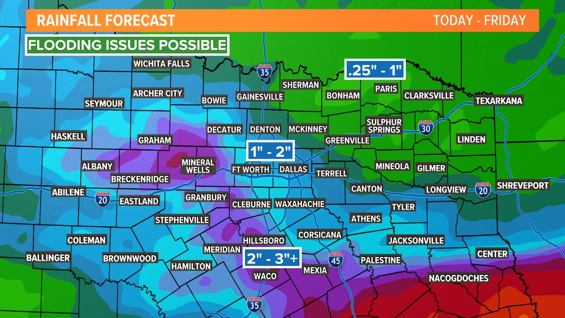
Rounds of showers and storms could cause additional flooding issues for parts of North Texas Thursday into Friday, especially in areas that have seen the most rain recently.

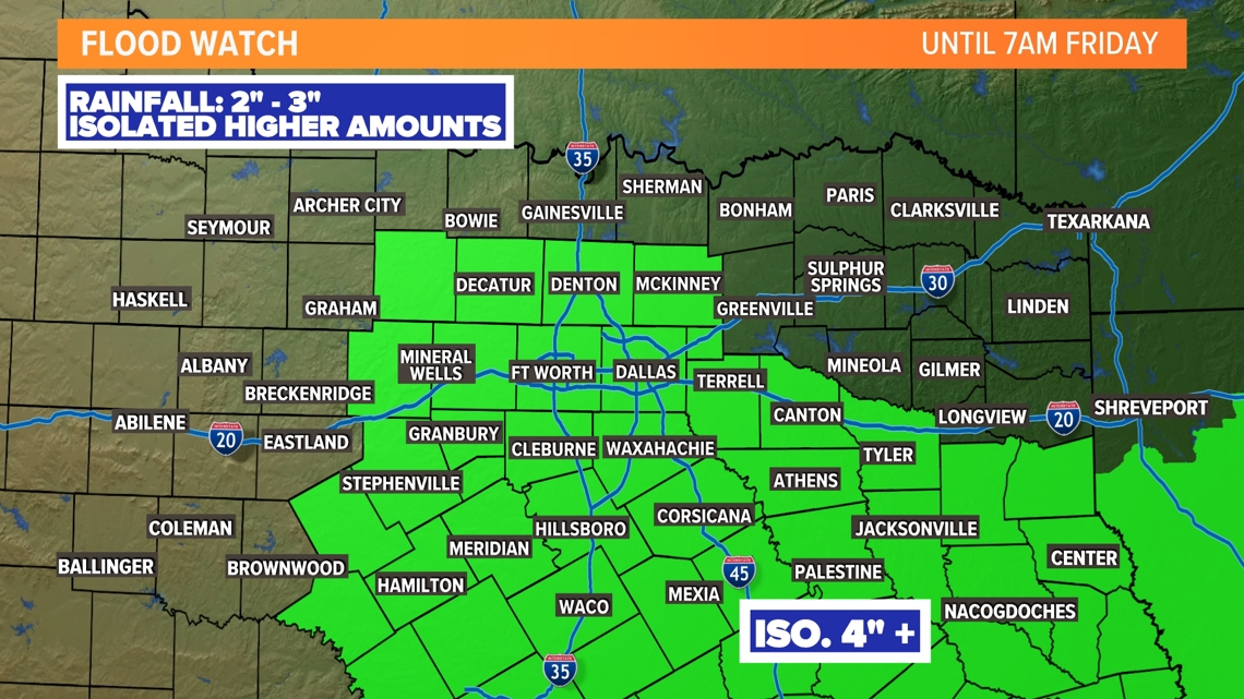
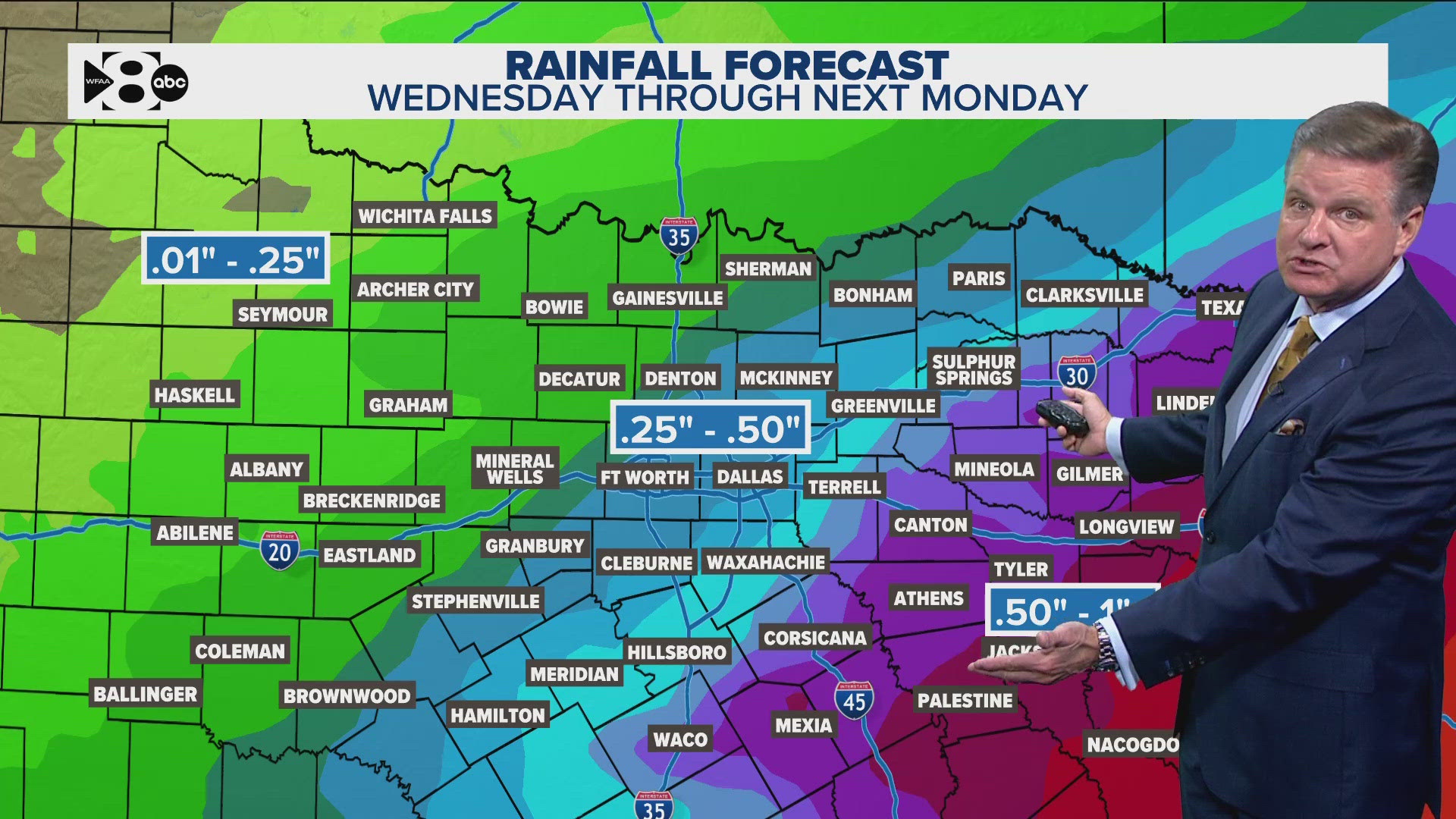
The highest rainfall totals and potential for flooding look to be in southern North Texas with totals of around 2-3 inches. For DFW, rainfall totals of around 1-2 inches are possible.

