Updated at 11:20 a.m. Thursday with the latest forecast information.
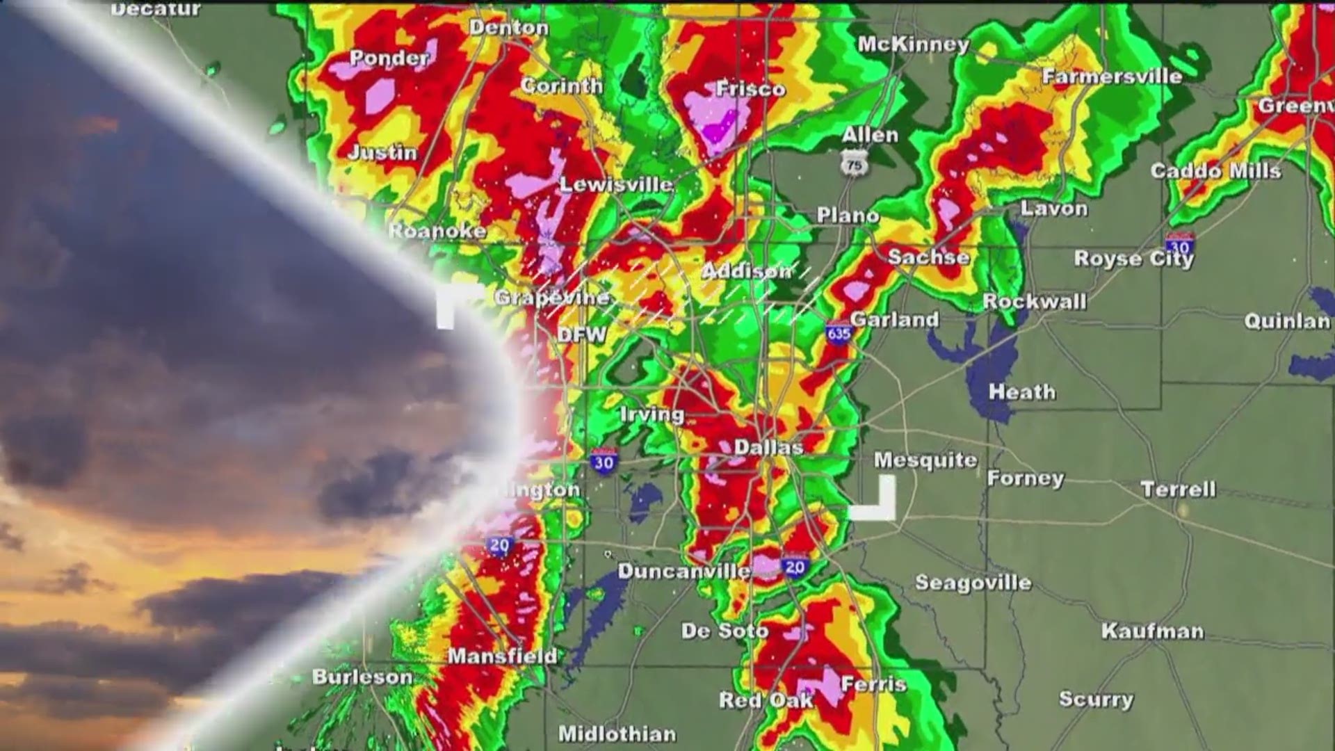
North Texans are in for a wild ride in the next three to four days. The Dallas-Fort Worth area will basically experience all four seasons, including winter.
Yes, winter. It will begin as rain, with the potential for severe thunderstorms, and then wrap up with winter weather, possibly including some snowflakes with the rain.
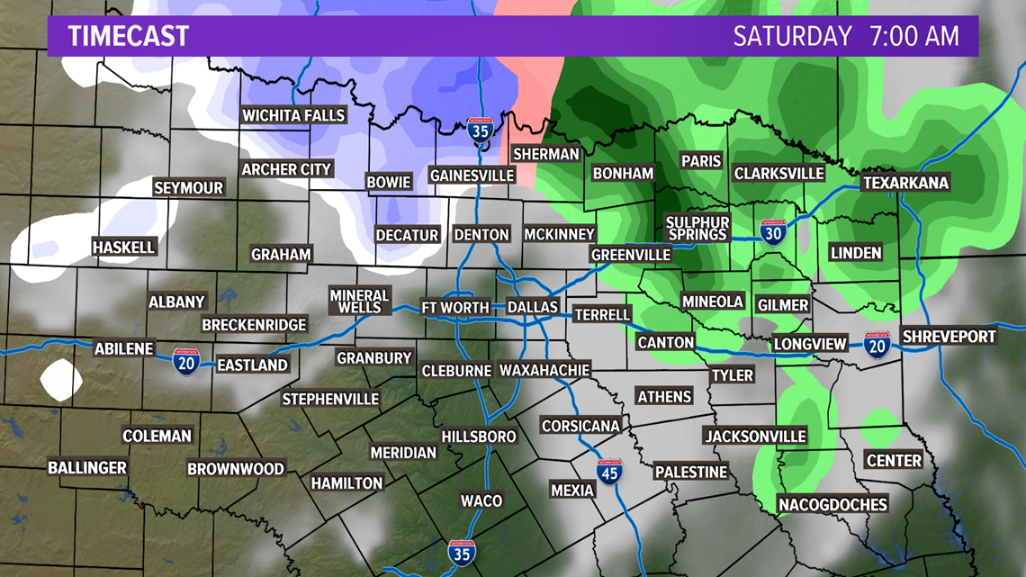
The winter weather potential will mainly be confined to along the Red River on Saturday morning.
Once the main area of low pressure moves to the northeast, there will be an area of wrap-around moisture that will sink south into North Texas.
The question is how far south does the moisture go and how fast does the cold air arrive? One model has the potential for flakes dipping as far south as Interstate 20.
The good news is temperatures are expected to stay above freezing and ground temps are warm as well.

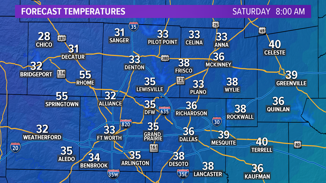
This will limit any accumulation and impacts from the winter weather.
The winter precipitation will start to move into the area around 3 a.m. Saturday.

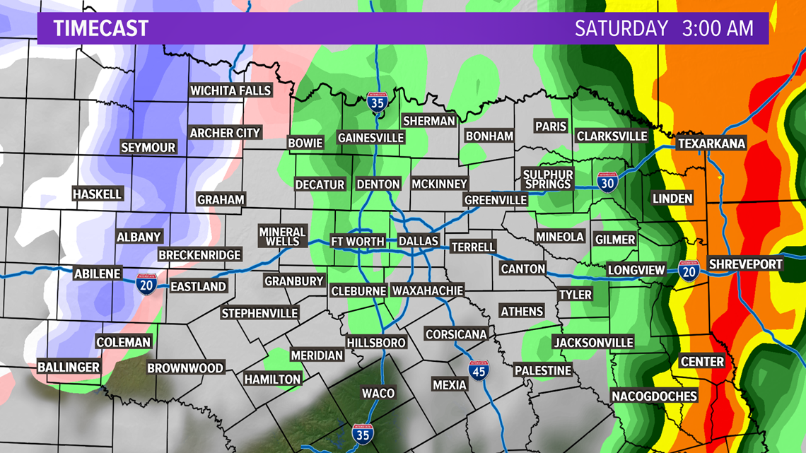
By 6 a.m., the potential for snow arrives near Mineral Wells.

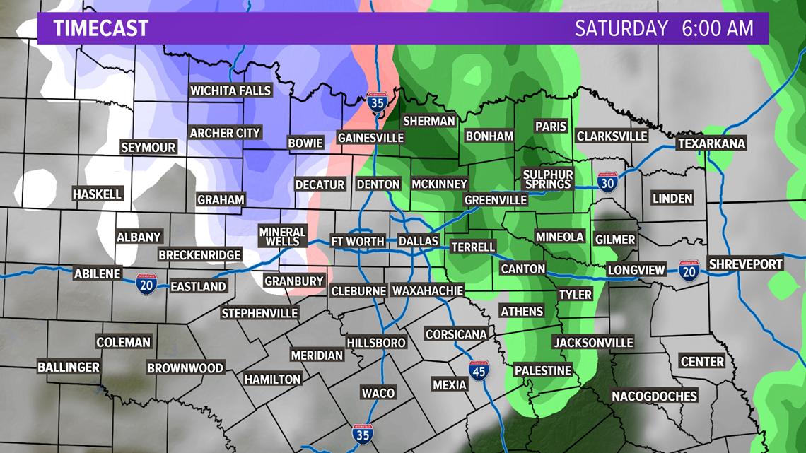
At 7 a.m., the winter weather will be in the along the Red River near Wichita Falls.

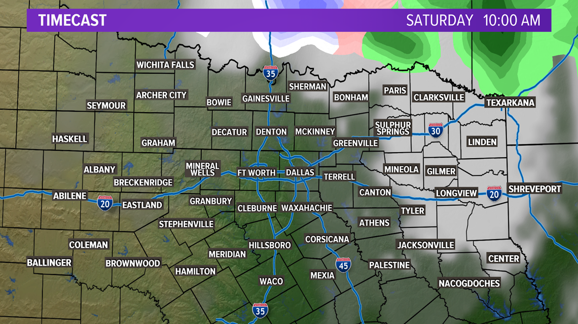
Around 10 a.m., the winter precipitation moves out of the area.

This is a developing story. WFAA's weather team will be keeping an eye on any changes to the forecast. To stay up-to-date, download the all-new WFAA app.

