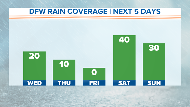
North Texas will continue to see daily rain chances and below normal temperatures as we head into late July along with below normal temperatures.
Not bad at all!
For Wednesday and Thursday, pop-up showers and storms will be possible mainly during the afternoon. Any rain will come to an end during the evening as the heat of the day goes away.

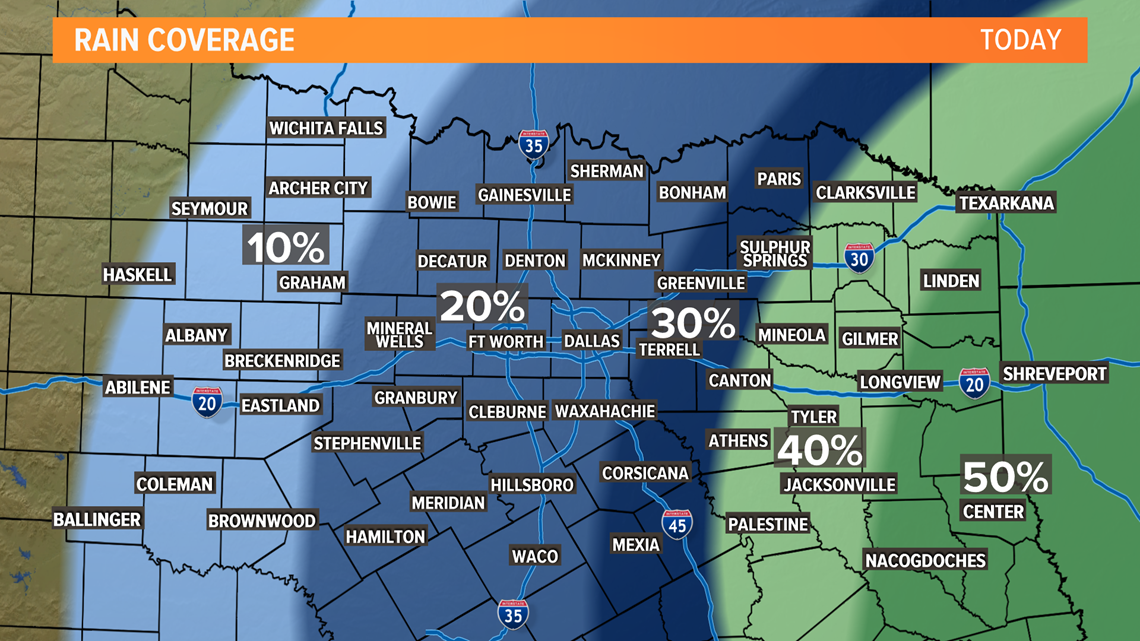
Not everyone will see rain, so enjoy it if you see it!
Best coverage looks to be from the D-FW area to the east, but even in those areas rain will be hit or miss.
These are the type of showers or storms that pop-up, rain heavily for usually not a long time, and then move on. Don't cancel any plans, but keep an eye on the sky!
Late week into the weekend
Thursday and Friday will stay relatively quiet, but we will be watching the Gulf of Mexico closely. There is currently a tropical disturbance producing a large area of thunderstorms over the Gulf of Mexico. The water temperatures in the Gulf are in the middle 80s right now, and this warm air could help fuel development.

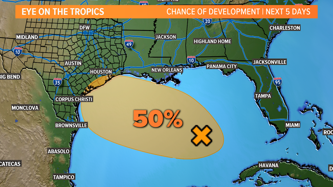
As of now, this disturbance has a 50% chance of developing into a tropical system over the next 5 days. Regardless of development, it looks to bring rounds of rain to the Texas coast and South Texas through this weekend.
What does this mean for North Texas?
It wouldn't mean much until at least Friday evening.
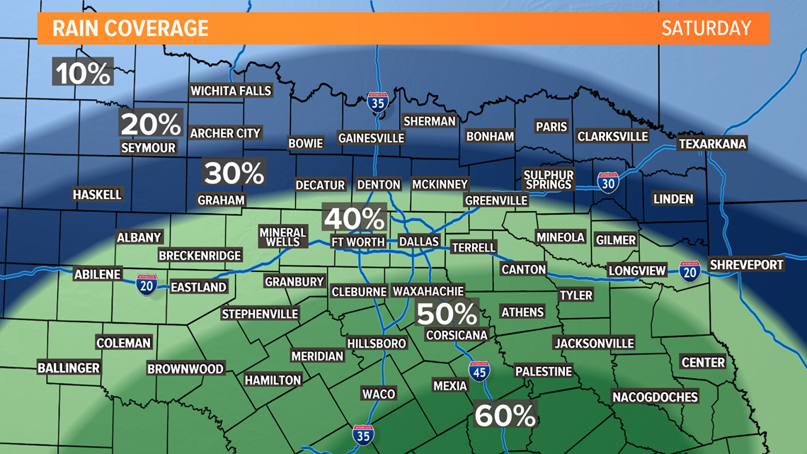
Friday night a surge of moisture will push north and along with daytime heating will bring back a good chance of scattered showers and thunderstorms Saturday afternoon and evening.

The WFAA weather team will keep you updated throughout the rest of the week.


