DALLAS — Perhaps you've heard about the possibility of an El Niño pattern emerging in the Pacific Ocean.
And perhaps you've started to wonder what that could mean for you, for your summer plans and for North Texas' weather at large.
Let me walk you through it!
First off: What is El Niño, anyway?
An El Niño-Southern Oscillation (ENSO) is a climate pattern that occurs in the tropical Pacific Ocean.
It's characterized by changes sea surface temperatures, atmospheric pressure and winds, and it can have significant impacts on weather patterns around the world, not only here in North Texas.
During El Niño years, the sea surface temperatures in the central and eastern Pacific Ocean are warmer than average. Conversely, during La Niña years, the ocean surface temperatures are cooler than average.

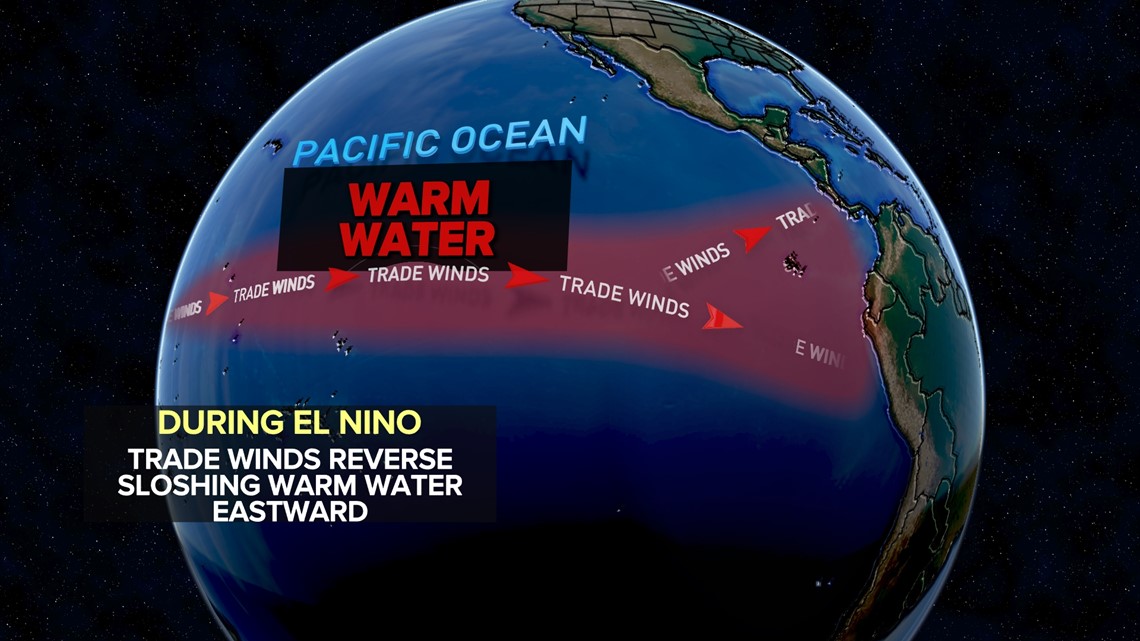
These temperature -- either above the average or below it -- changes can affect rainfall patterns, temperatures and other weather conditions.
The neutral phase of ENSO occurs when sea surface temperatures are close to average, which can lead to more typical weather patterns in affected regions.
Are we currently seeing an El Niño pattern developing?


The ENSO is currently in a neutral phase, but there's a high chance of El Niño developing by the end of July.
Look at the graph above. Anytime the line reaches or climbs above 0.5 on the left, we're officially in an El Niño .
As you can see, the trend lines show that we're nearing that now -- and we'll be firmly in a full-blown El Niño later on this summer.
By the winter months, we'll be in a moderate to strong El Niño system.
OK, but what does an El Niño pattern mean for Texas in terms of heat and rain?
Let's say this right off the bat: El Niño is not a huge driver of Texas weather -- at least not during the summer months.
In terms of the greater summer forecast, Texas is expected to experience above-normal temperatures this year.

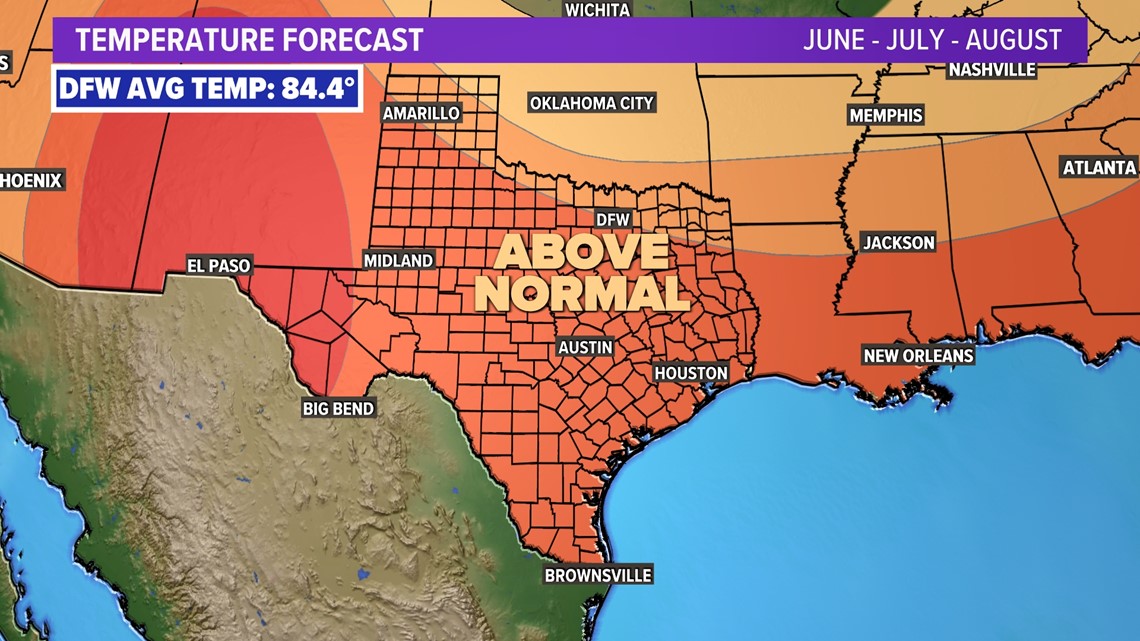
Does this mean enduring a summer as hot as the extreme summer of 2022? No, that's very unlikely.
Will it be a hot summer? Of course! All summers in North Texas are hot.
But I don't expect think we're in store for a record-setter.
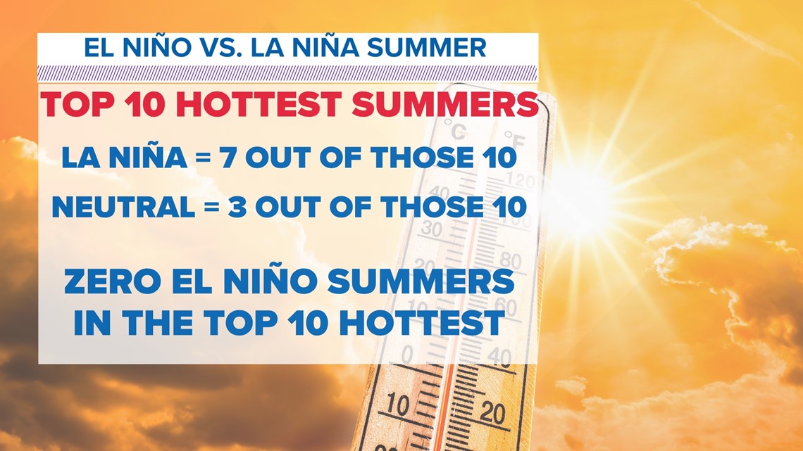
That's because the top 10 hottest summers on record here occur either during La Niña or ENSO Neutral patterns.
Not a single one of North Texas' top 10 hottest summers occurred with El Niño conditions present.

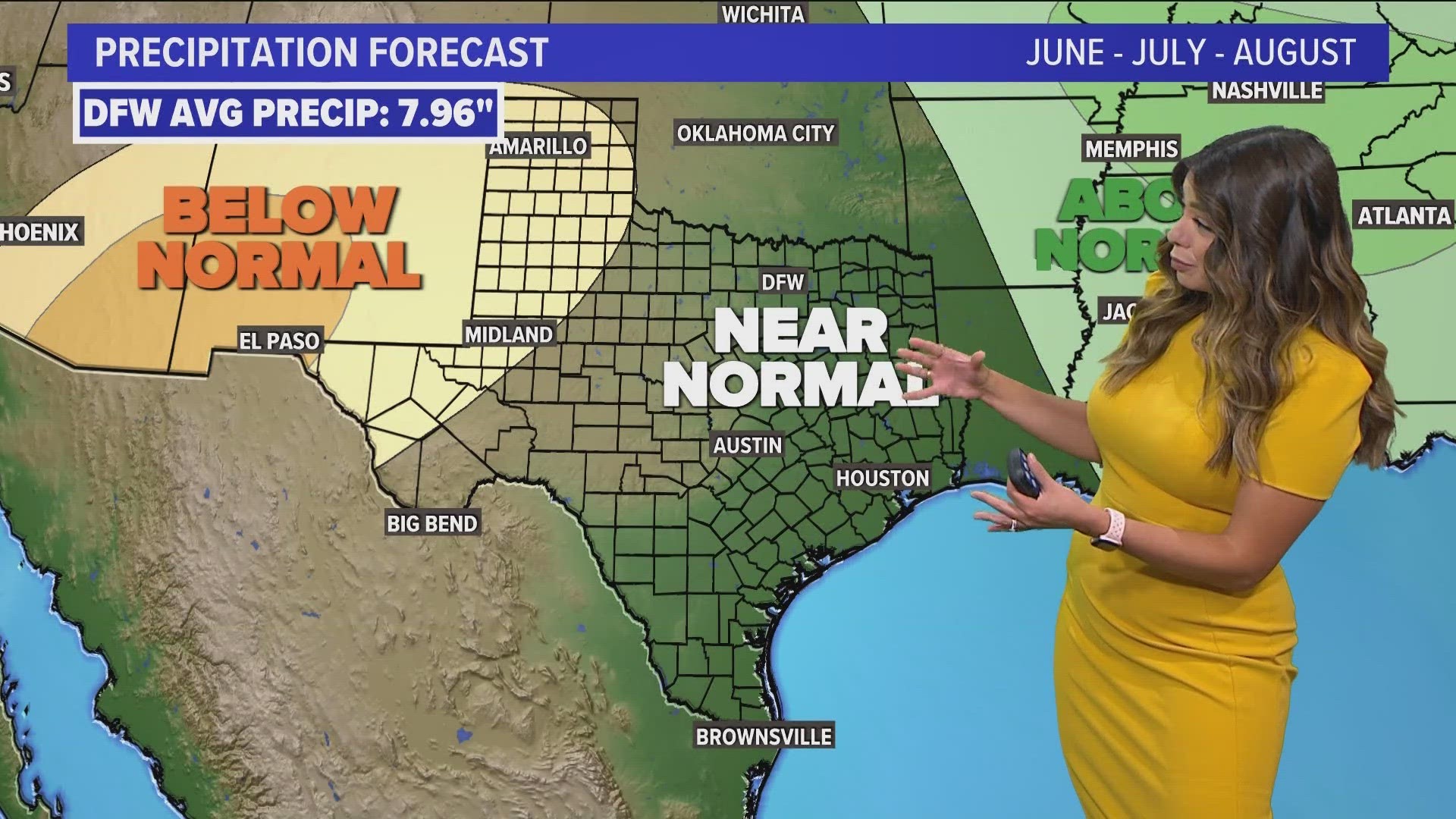
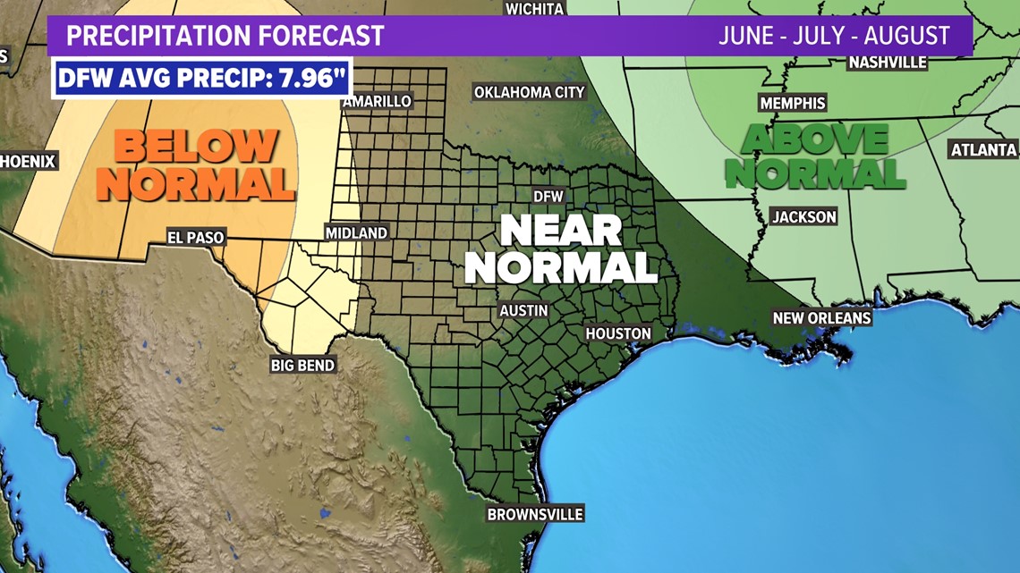
In terms of precipitation, Texas is likely to experience near-normal rainfall this summer. Once again, El Niño is not a big driver of summer rainfall historically.
There are, of course, many other factors that allow us to have near-normal rainfall across most of the state.
Near-normal rainfall, I should note, is not necessarily a good thing, because the summer months in Texas are typically pretty dry. But it's also not a bad thing, either, because normal rainfall is better than below-normal rainfall.

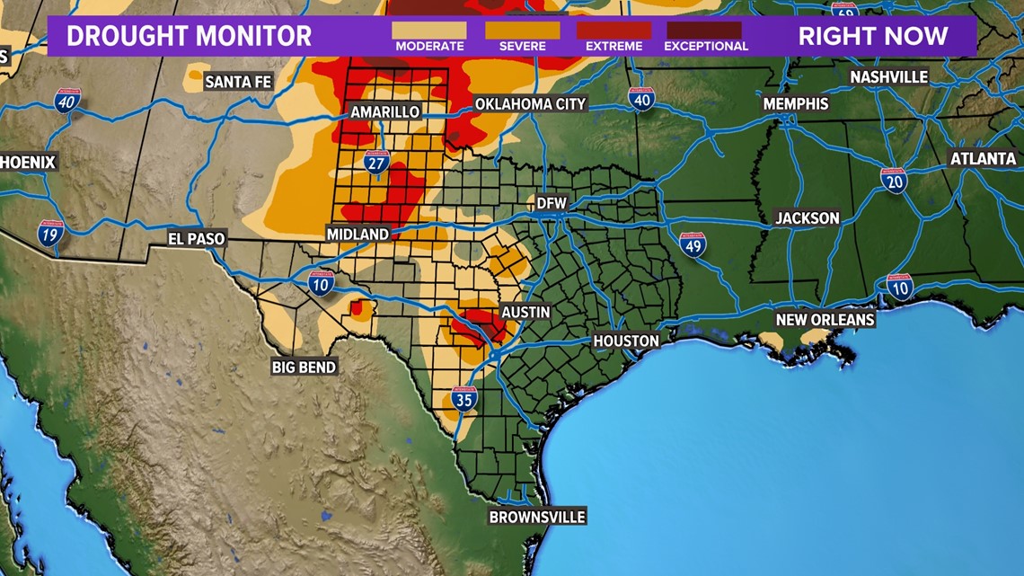
Drought conditions persist in many parts of the state currently, with nearly 30 percent of Texas experiencing moderate to extreme drought as of the end of May.
So, seeing any significant improvements in statewide drought conditions is unlikely.

While El Niño may not have a significant impact on Texas this summer, it's very likely to persist -- and possibly even strengthen -- into the winter months.
That's when its effects are the most notable.
El Niño typically brings wetter- and cooler-than-normal conditions during the winter.
That said, it's also important to remember that El Niño is not the answer to all long range forecasts.
While we do expect cooler- and wetter-than-normal conditions this winter, other factors can and will figure into the forecast.
So, as ever, the answer is the same: Stay tuned!

