DALLAS —
Large hail impacted parts of Texas on Wednesday afternoon. Smaller hail hit North Texas on Friday.
VERSIÓN EN ESPAÑOL: Clima en Dallas-Fort Worth: Más tormentas para empezar el fin de semana
Highlights
- Some rain will linger Saturday morning
- Most of the weekend will be dry and breezy
- Warmer Sunday
LIVE TIMELINE:
6:09 p.m.: Severe Thunderstorm Warning is in place for Rains county until 6:45 pm. A storm capable of producing 60+ mph winds and half dollar size hail is moving east at 20 mph.
6:15 p.m.: The severe threat is ending rapidly for the metroplex. Large hail potential is still there for areas east.


5:00 p.m.: The severe thunderstorm warning for DFW has expired. Very heavy rain is causing big evening commute problems in and around Dallas.
4:55 p.m.: Severe Thunderstorm Warning for Hill Co until 6pm. A storm capable of producing 60+ mph winds and quarter size hail is moving east at 20 mph.
4:05 p.m.: Severe Thunderstorm Warning now includes portions of DFW until 5pm. A strong storm over Keene will continue to move northeast at 45 mph. 60+mph winds and quarter size hail likely. This storm is headed for Tarrant and Dallas co.
4:00 p.m.: Erath, Palo Pinto and Wise counties have been removed from the Severe Thunderstorm Watch. Comanche County has been removed from the Tornado Watch.
3:15 p.m.: Severe Thunderstorm Warning for Bosque, Hill, Johnson and Somervell until 4pm. Storms could produce 60 mph and quarter size hail as they move east at 30 mph.
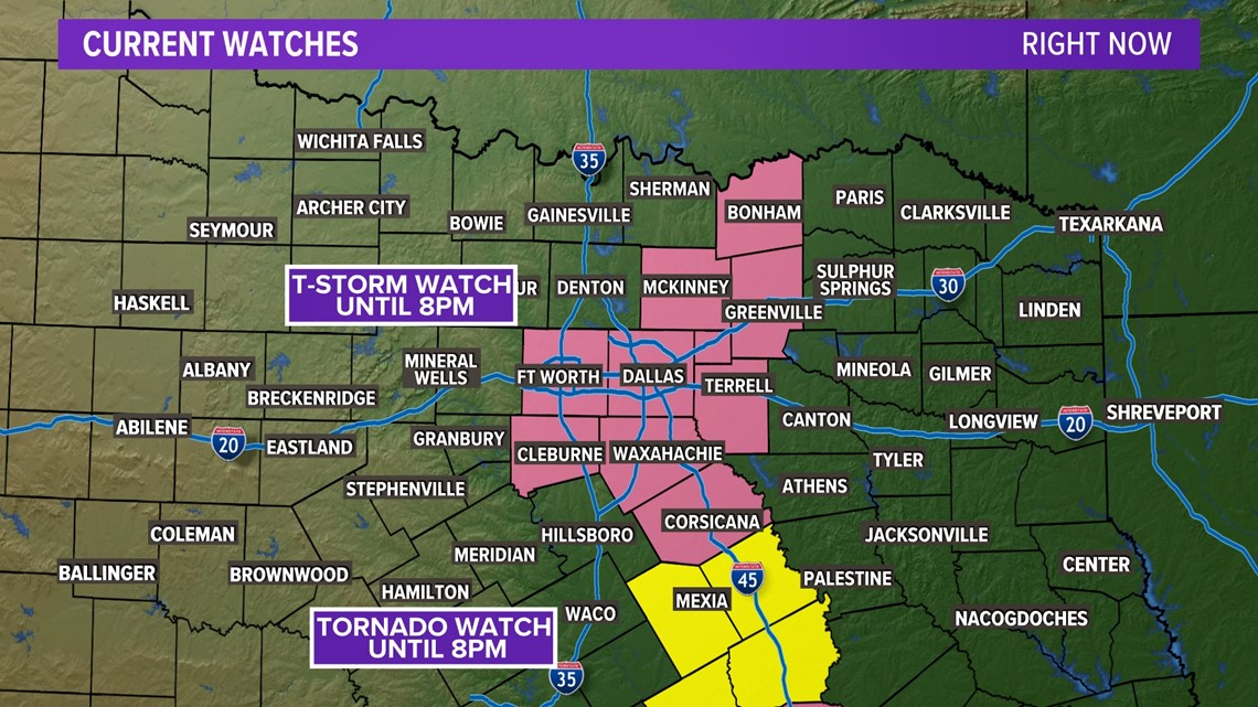
1:29 p.m.: A Severe Thunderstorm Watch has been issued for parts of North Texas including DFW until 8pm. Storms that develop or move into this area have the potential to produce large hail and strong winds.
1:18 p.m.: A Tornado Watch has been issued for southern North Texas and Central Texas until 8pm. Storms that develop or move into this area have the potential to quickly turn severe and produce a tornado.
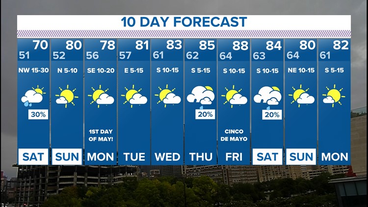
10-day forecast
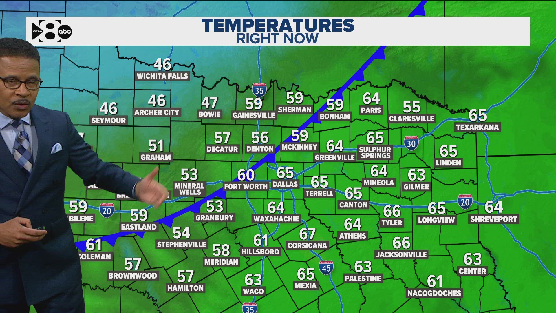
Cooler weather is expected as the rain clears out Saturday morning. Our unsettled pattern looks to continue for the first part of the weekend. The pattern looks to settle down for the end of the weekend as May arrives. Rain chances for the first week of May look low. Highs next week climb to the 80s.


