DALLAS — The ol' saying "March comes in like a lion, out like a lamb" does not hold true this year. March started active and has seen storms every week. This week is no different, but the severe threat is much lower, and the rain coverage is much lower this time around.
LIVE UPDATES:
6pm: THE SEVERE THREAT IS OVER
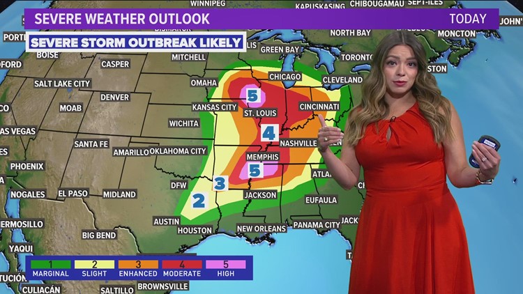
1:40 p.m.: A portion of North Texas (not including DFW) has been placed under a Tornado Watch until 9pm. This means that storms moving into this area or develop in the area could quickly turn severe and produce a tornado.


Here's what we're expecting:
Friday
As a front moves into North Texas, storms may form along that front from the D-FW to the east mainly during the early afternoon to mid-afternoons.
The threat of severe storms is low for D-FW but not zero. Can't rule out some storms with wind and hail.
As the front moves into eastern North Texas and East Texas during the afternoon into evening, storms are more likely along with severe storms. Storms and severe weather during this time will mainly be east of the WFAA viewing area.
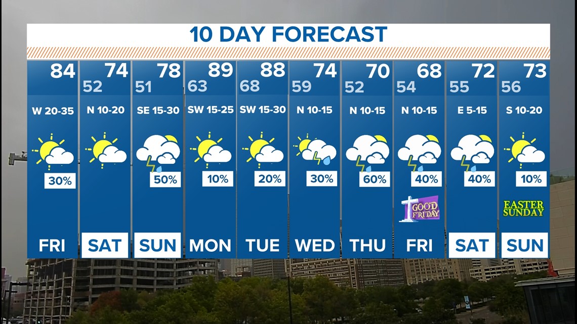
For most of North Texas, Friday afternoon will be warm, dry, and windy with highs in the 80s. Once the front clears, it'll be windy! Some western counties may even experience a low-end fire weather threat. The winds may kick up pollen and dust too.


This weekend and next week
Saturday is looking dry and seasonable with highs in the 70s.
Sunday brings back a chance for showers and storms. Right now, it doesn't look like it will rain all day long, but afternoon and evening scattered showers and storms are possible.


Our pattern stays active.
Next week an active weather pattern continues with almost daily chances for showers and storms somewhere in the area. We'll have to watch for the potential for severe storms as well.


The first part of the week looks very warm with highs near 90° and cooler weather possible in the second half of the week.


