DALLAS — Storm chances return to North Texas this week along with the threat for some strong to severe storms.
Here's a rundown of what we're expecting:
En español: Tiempo en Dallas-Fort Worth ahora: ¿Clima severo en DFW? Probabilidades de tormentas para esta semana
Thursday
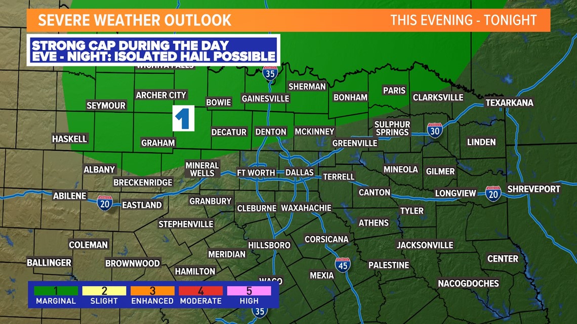
A strong cap will be in place Thursday which will likely limit storm potential. Some spotty showers or drizzle may be around during the day, but actual t-storms look hard to come by thanks to that strong cap. IF a storm or two can develop, chances are during the evening into nighttime hours mainly north of the D-FW area.
IF a storm can develop during that time, large hail looks to be the main threat.


Storm coverage lowers through the evening, but a few storms could return late into Friday morning.
Friday
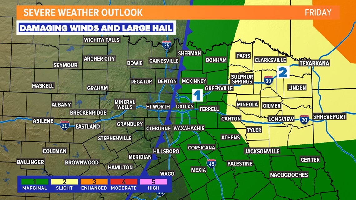
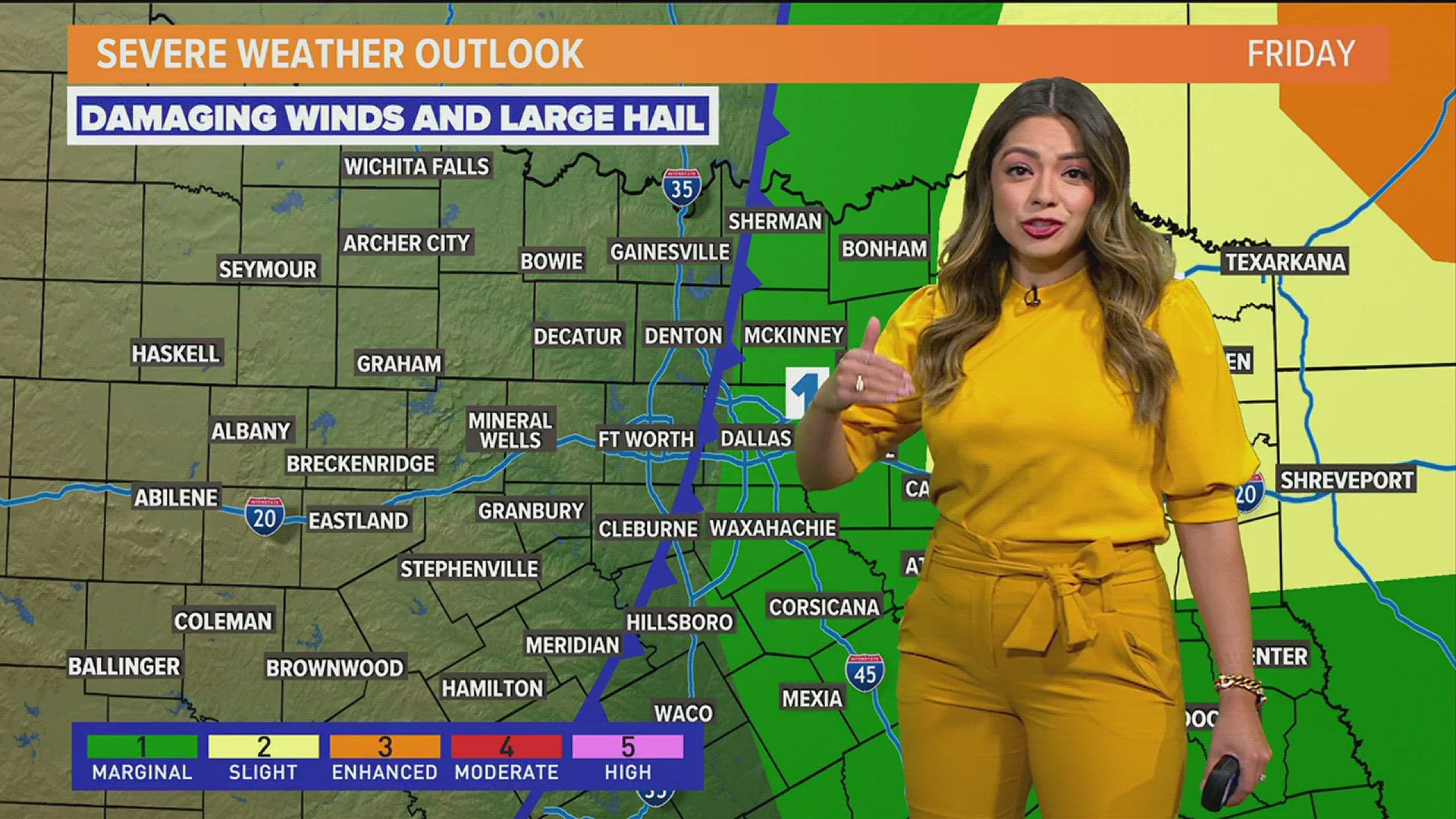
As a front moves into North Texas, storms may form along that front from the D-FW to the east mainly during the late morning to around the midday hours.
The threat of severe storms is low for D-FW but not zero. Can't rule out some storms with wind and hail.
As the front moves into eastern North Texas and East Texas during the afternoon into evening, storms are more likely along with severe storms. Storms and severe weather during this time will mainly be east of the WFAA viewing area.
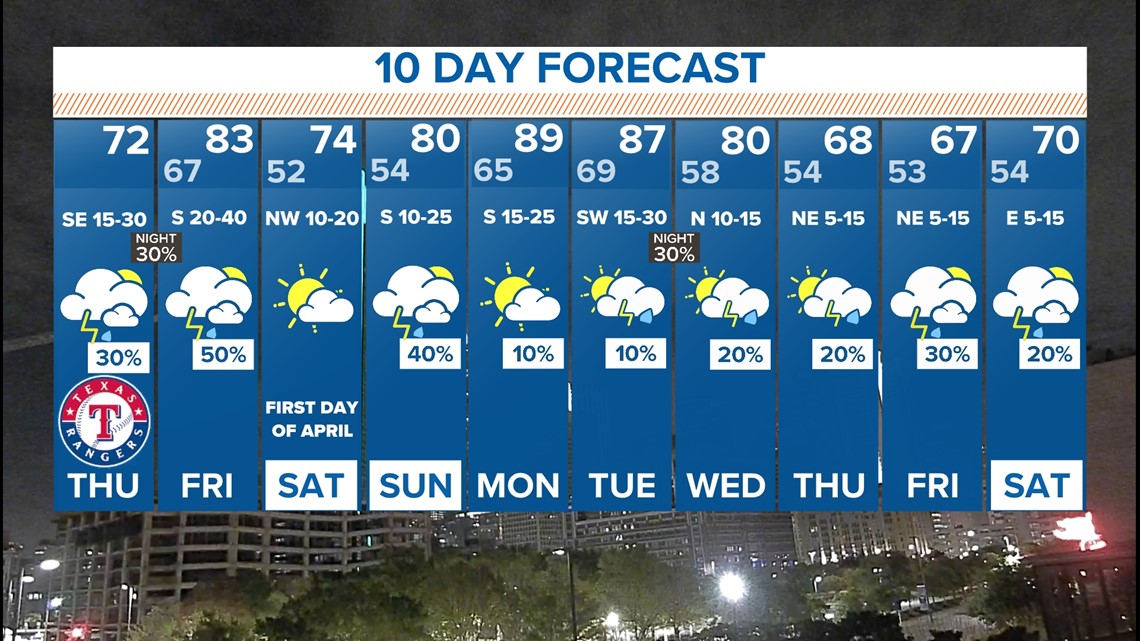
For most of North Texas, Friday afternoon will be warm, dry, and windy with highs in the 80s.


This weekend and beyond
Saturday is looking dry and seasonable with highs in the 70s.
Sunday brings back a chance for showers and storms. Right now, it doesn't look like it will rain all day long, but afternoon and evening scattered showers and storms are possible.
Next week an active weather pattern continues with almost daily chances for showers and storms somewhere in the area. We'll have to watch for the potential for severe storms as well.
The first part of the week looks very warm with highs near 90° and cooler weather possible the second half of the week.


More weather coverage from the WFAA team:

