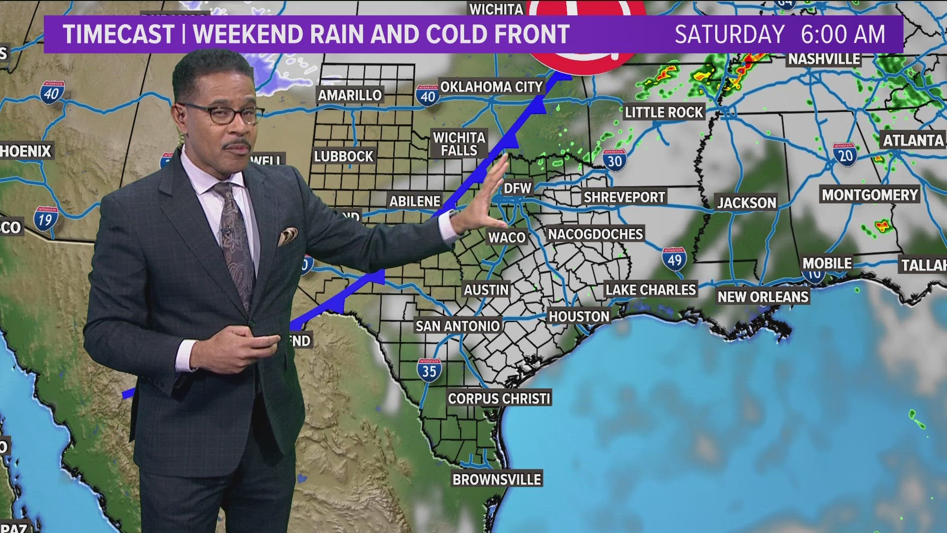
DALLAS — The first half of December is looking mild and mostly dry.
Quick Facts:
- Near record warmth Friday
- Low rain/storm chance Saturday
- Turning much cooler
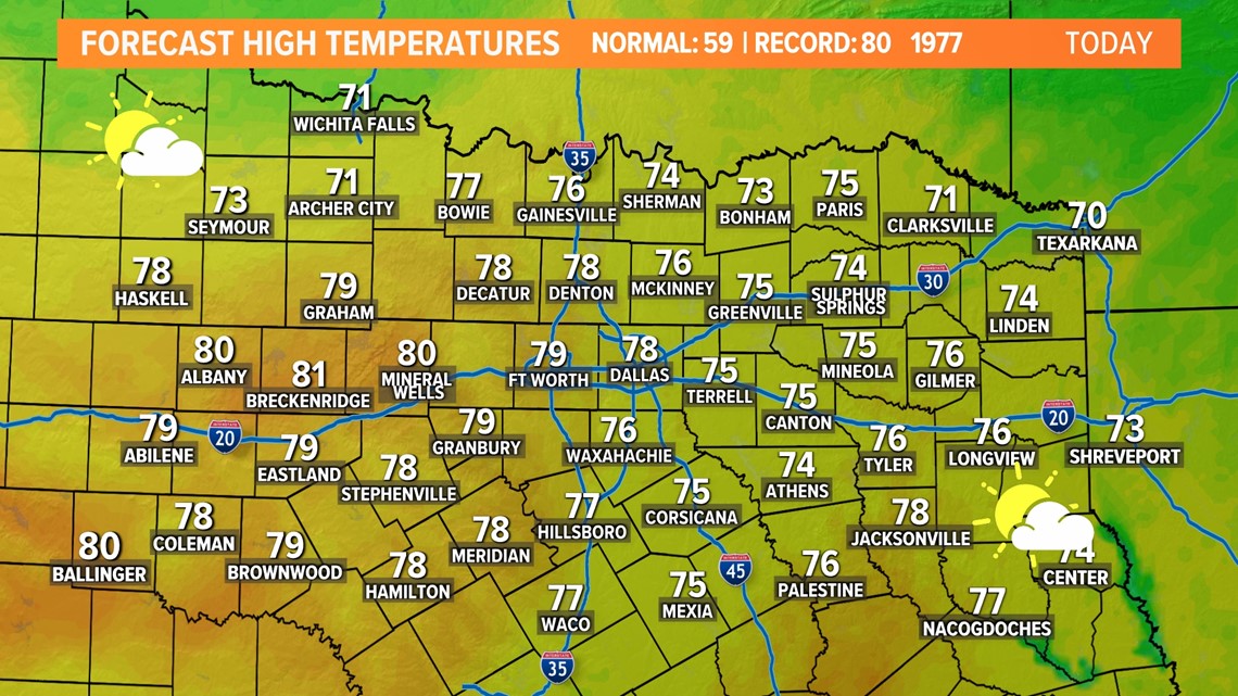
Warmer Friday
Not quite record warmth on Friday, but the strong southerly winds will help bring temps well into the 70s and even a few 80s.

Weekend cold front
Our next front looks to arrive on Saturday. As of now, it looks like it will move through during the day with showers and storms possible ahead of the front. Best chances look to be across the eastern half of North Texas into East Texas.
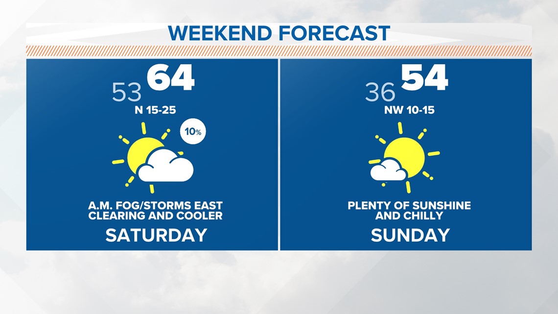
Most of Saturday will be windy and cooler. Temps will be in the 50s during the afternoon and dry weather will be likely for most.

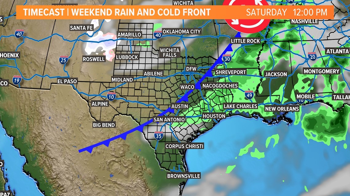
There could be some strong to severe storms as well mainly in East Texas and areas farther east, but exact details are not set in stone.


Sunday will be dry and more "winter-like" for North Texas. The morning will be in the 30s and the afternoon will be in the 50s.

December by the numbers
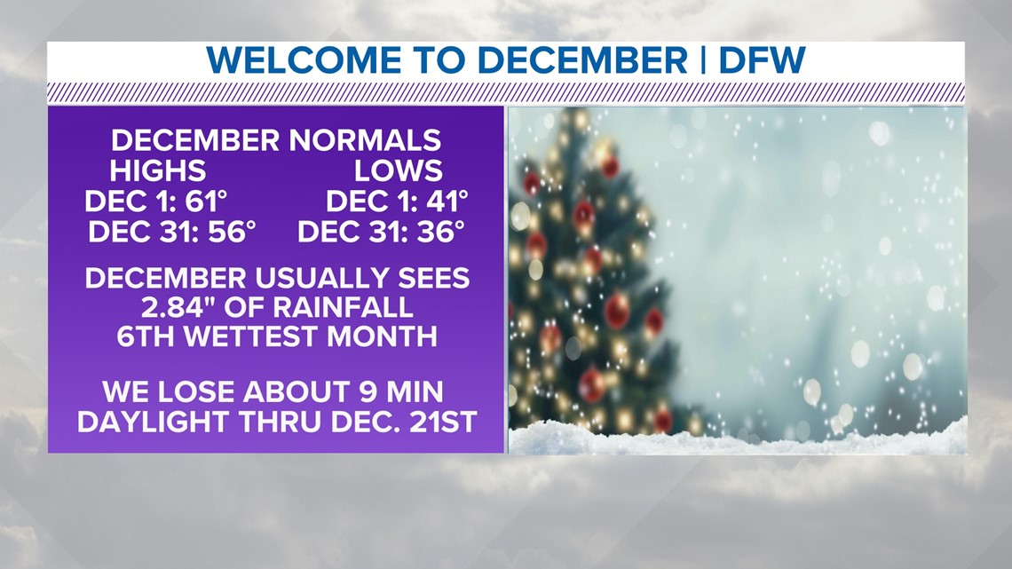
Dec. 1 is the start of meteorological winter, which includes December, January and February. The beginning of December brings normal highs near 61 and lows near 41. By the end of the month, normal morning lows drop to 36 with highs near 56. The average precipitation is less than 3 inches, making December the sixth wettest month of the year.
Daylight continues to decline, losing about 9 minutes of daylight between December 1st and winter solstice, Dec. 21st.

14 day forecast


