DALLAS — Be sure to download the WFAA app to track the latest forecast and get alerts from our team.
Quick facts:
- Cool start to Monday morning
- Temps warm quickly this week
- Storms and a severe weather threat Thursday
Widespread rain has ended
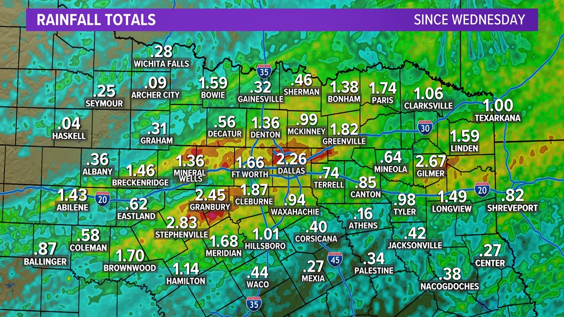
Widespread showers and storms from this past week left North Texas with beneficial rainfall.
Rain totals ranged from .50 inches to 2-plus inches for most of the area. The highest totals were in and around the DFW area and just to the west and southwest.
Officially, DFW picked up 2.78 inches of rain since Wednesday, with 2.67 inches of that falling on Thursday. That 2.67 inches was a record for the day (March 7), breaking the old record of 1.12 inches set in 1947.



This week
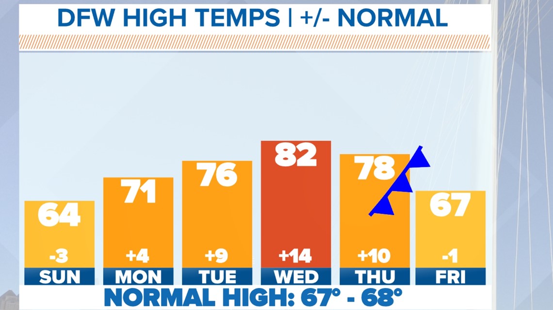
The official high Sunday was 64, but temps will warm quickly this week with 70s Monday and Tuesday. 80s look to make a return on Wednesday. A cold front and storm system arrives Thursday into Friday bringing a bit of a cool-down along with rain and storm chances.

Severe weather potential this week
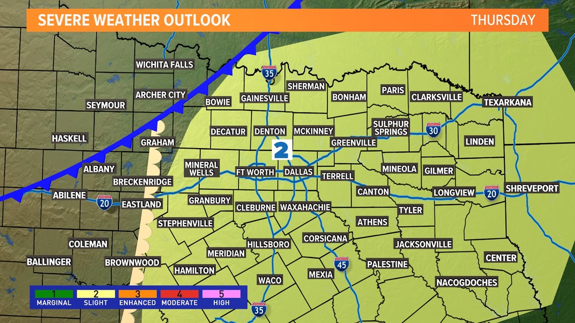
It is that time of the year. Our next good chance of rain and thunderstorms arrives Thursday. Some of those thunderstorms could be strong to severe. It's too early for timing or any more specifics, it's just a day to monitor for the potential for severe weather. Most of North Texas is already included in a level 2 (slight risk) for severe thunderstorms.

14-day outlook
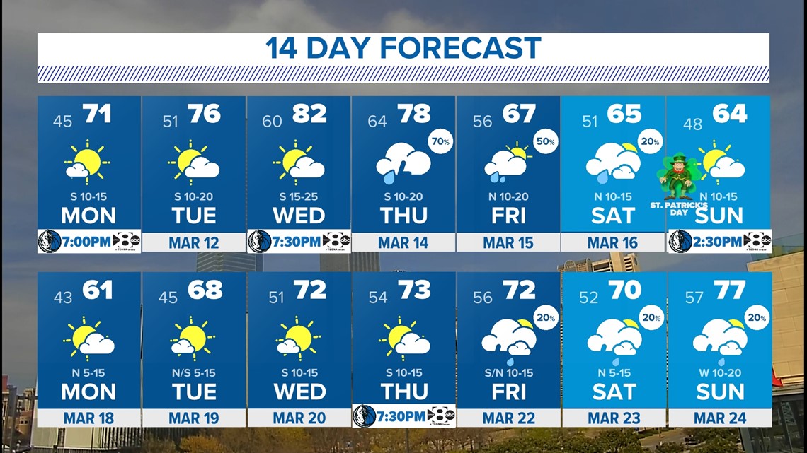
Spring break is upon us for most of North Texas! And the week ahead will feature some nice weather, but also rain as well. Temps warm quickly with 70s and 80s through Wednesday. By Thursday and Friday rain and storms return, so it may not be the best for outdoor spring break plans on those days.

