DALLAS — En español: Clima en Dallas Fort Worth ahora: Más cálido esta semana con riesgo de tormentas severas
Quick look:
- A big warmup this week
- Scattered, light rain with cloudy and breezy days
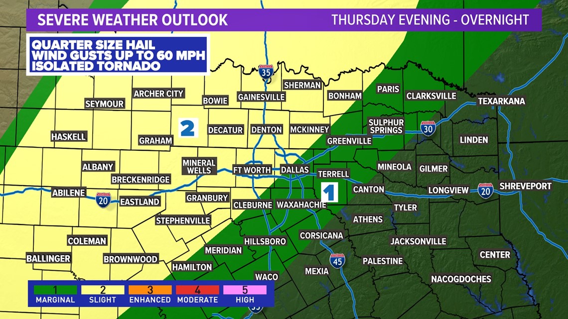
- Severe weather is possible late Thursday into Friday morning
Temps are on the climb!
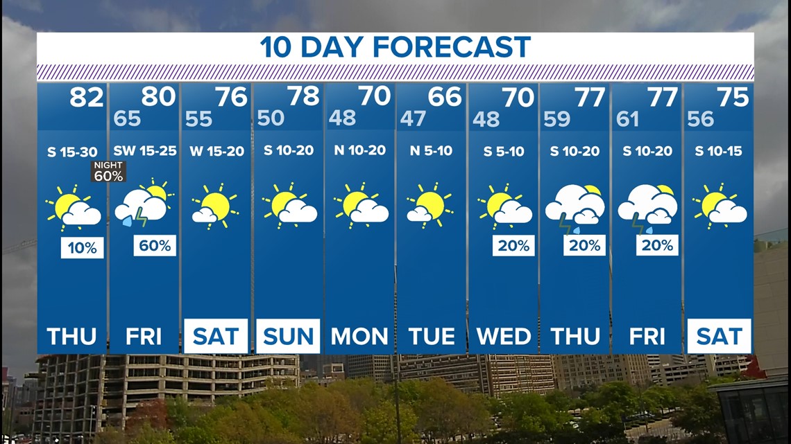
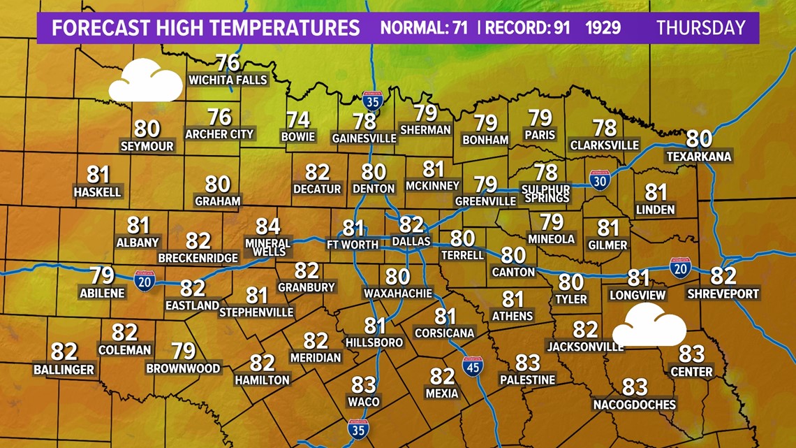
The next few days will feature breezy, cloudy and warmer weather. A strong south wind helps bring up temps and humidity as we approach the middle of the week. Highs on Thursday will be in the 80s!
A cold front arrives late Thursday into Friday morning, but temps won't change too much. Highs will still be in the 70s through the end of the week and throughout the weekend.

Rain chances come back!
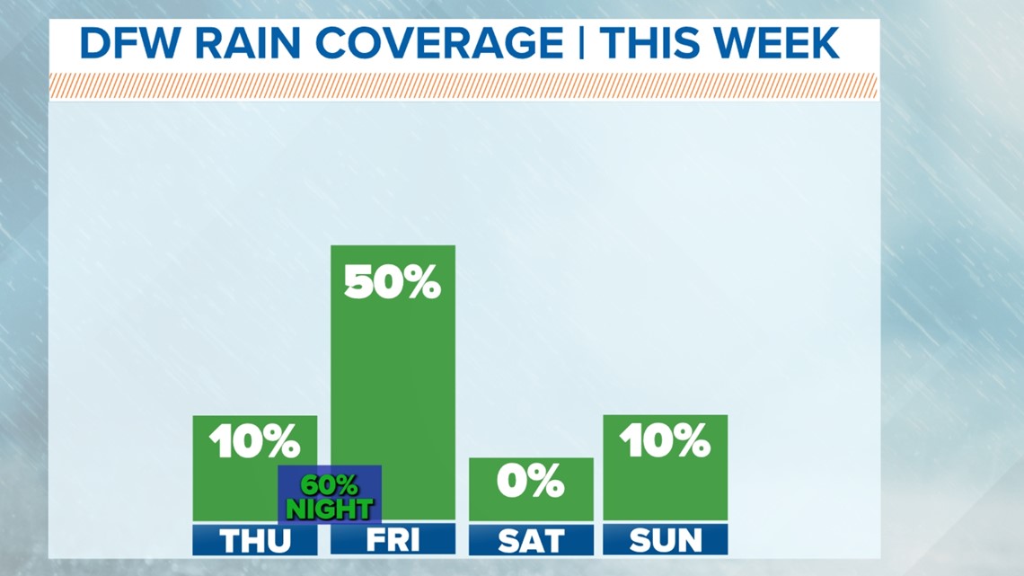
Moisture coming in from the Gulf allows for light, scattered rain the next couple of days -- but coverage will be low, meaning most of the area will not see rain until Thursday night.
Our approaching cold front will, however, spark showers and isolated storms. The best thunderstorm chances come along the front late Thursday night into Friday morning. The rain should end through the morning on Friday, with dry weather expected for the weekend.
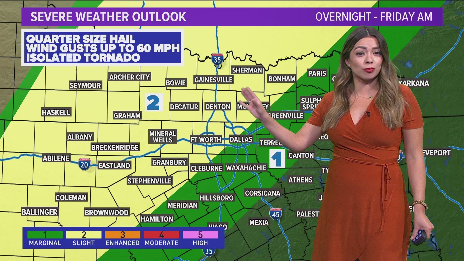
As of now, it looks like some severe storms could be possible as the front pushes through the area.

With these storms, hail and strong winds look to be the main concern, but severe weather doesn't look to be widespread.
Stick with us this week as we get more data and fine-tune the timing and impacts.

Next 10 Days
It's a spring-like 10-day forecast! Temps and rain chances are on the climb this week, but look at the weekend. The 70-degree temps, breezy conditions and drier weather all looks like the first full weekend of spring is bringing just what it's supposed to bring!

