DALLAS —
Warmer with rain chances
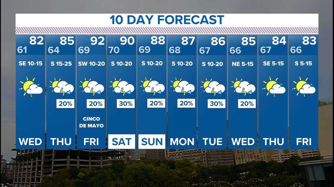
The end of the week brings much warmer air, higher humidity, and storm chances.
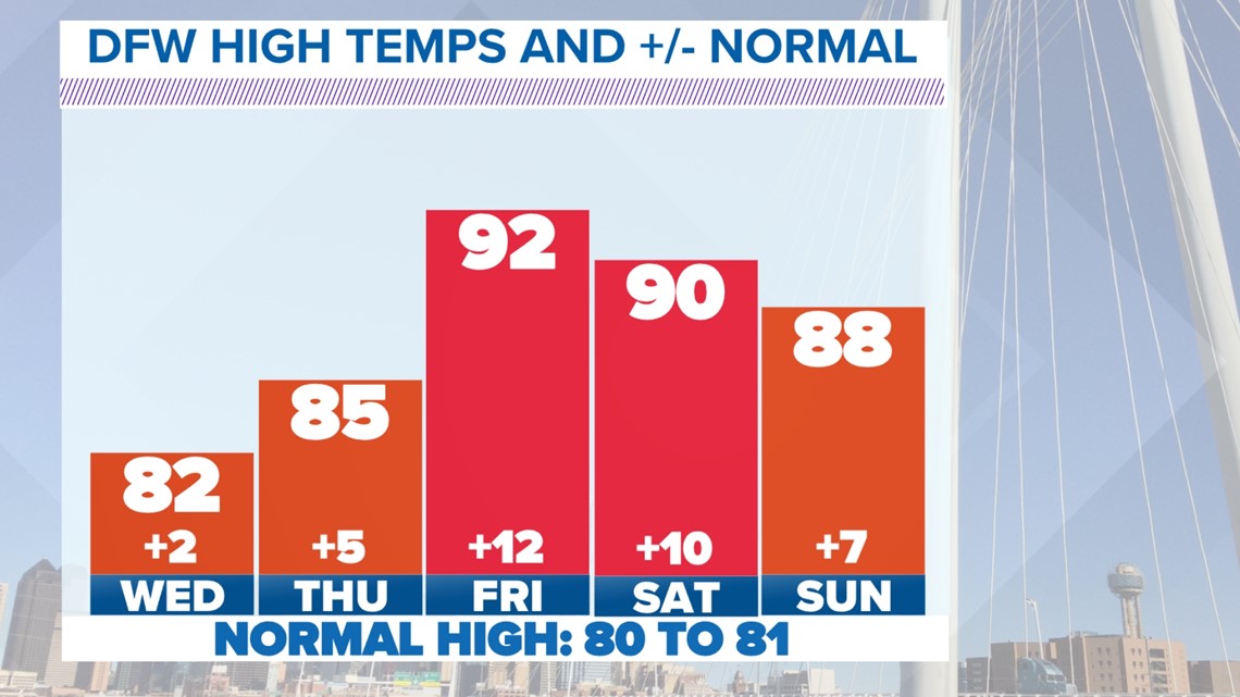
Those 90s by late week into the weekend could feature a heat index a few degrees above the temperature. Many locations will be trending upwards of ten degrees warmer than the norm for early May.

Ozone Action Day
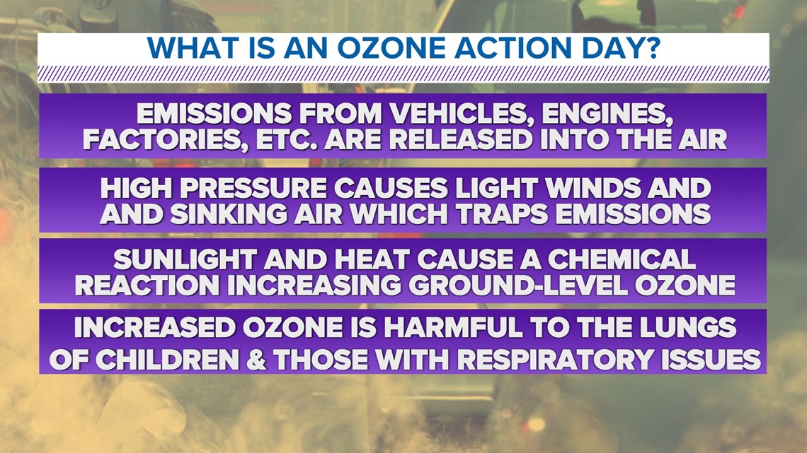
Wednesday is also an Ozone Action Day in North Texas. Weather conditions will contribute to higher amounts of ozone pollution in and around the D-FW area. Limit time spent outdoors for groups with sensitive respiratory issues.

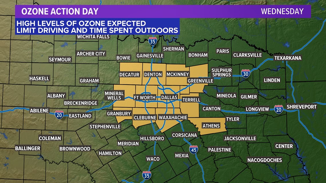
It has been a little while since we have had an Ozone Action Day, but they are common during the warm months when winds are lighter.

Thursday Storm Chances
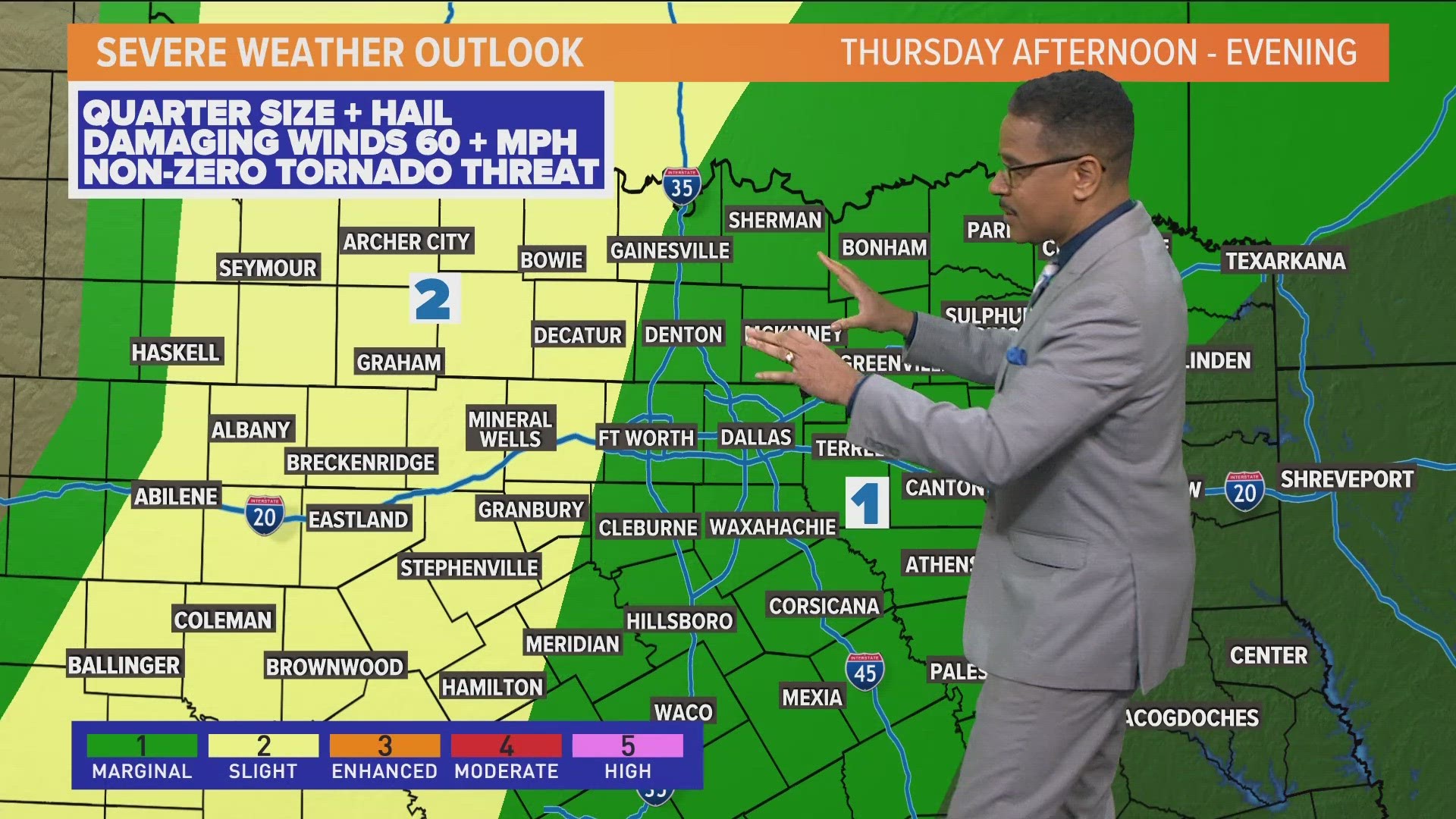
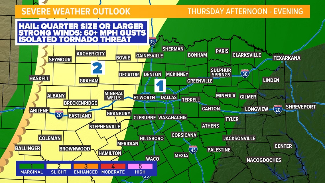
Storm chances return on Thursday as a dryline will cause scattered t-storms to develop across western North Texas and those storms will move east during the afternoon, evening, and into nighttime hours. Some of those storms could be severe with large hail and strong winds mainly west of D-FW.
Storm coverage does not look high, but any storms that form will likely be severe. It is not impossible for D-FW to see a decaying or dying severe storm. So severe chances for D-FW are not zero, but they look lower than western areas at this point.

10 Day Forecast
Keep checking back for updates as it continues to be severe weather season and things can always change quickly!

