DALLAS — The autumn equinox happened at 7:43 a.m. on Sunday, Sept. 22, kicking off the official start of fall... and a cold front will be following behind!
Here's what to expect in North Texas as we end summer and transition to fall:
Quick Notes:
- Cold front and rain chances Monday morning
- Near or below normal temps all of this week
- Warming up again eventually
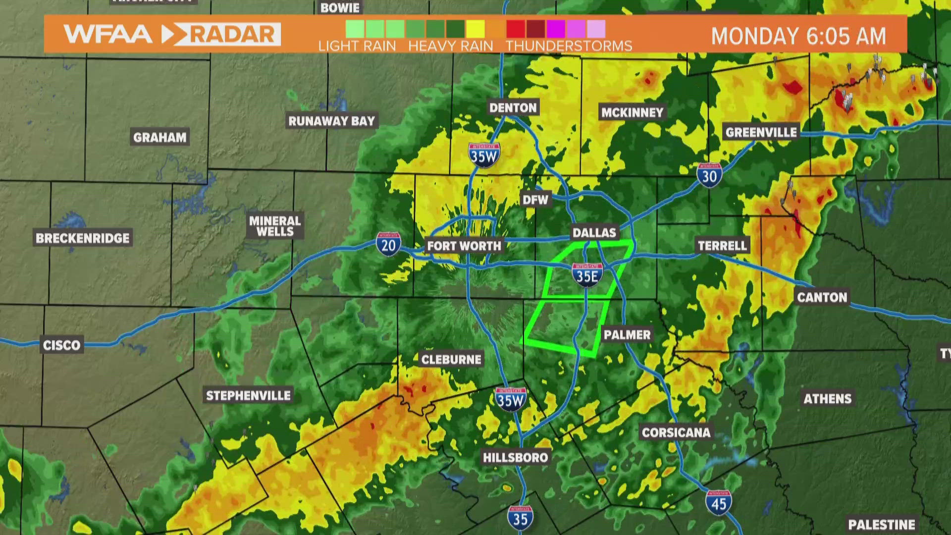
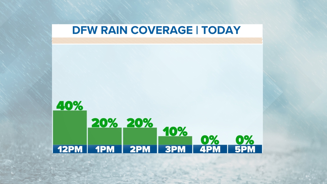
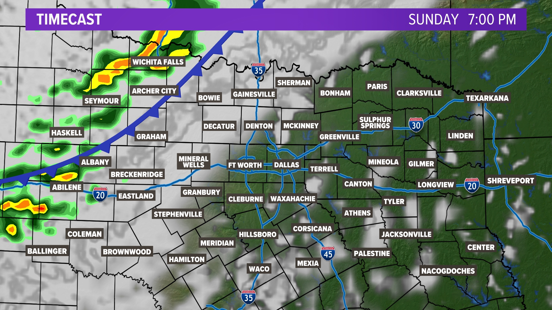
Rainy Monday!
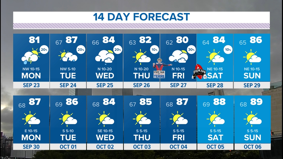
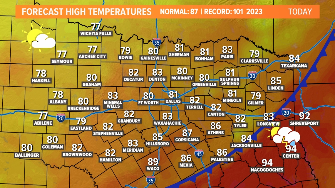
A cold front is set to bring some relief by Monday. The heat dome will shift east allowing for cooler air to settle in. Scattered showers and storms will be possible on Monday along the front. High temperatures on Monday will likely be in the low 80s!
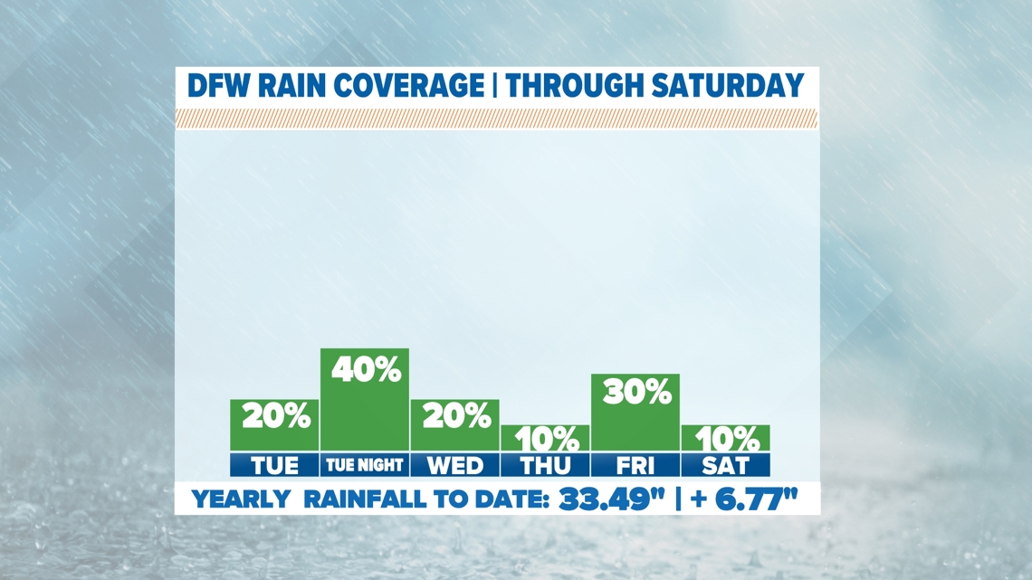
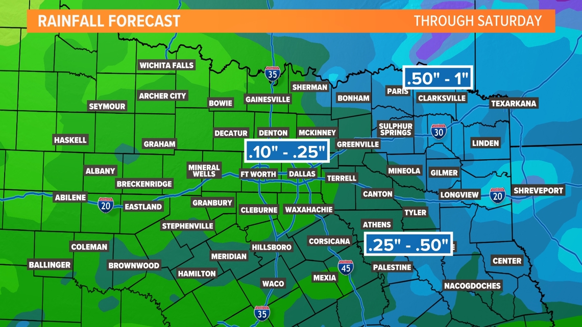
The front will eventually stall to the southeast as another disturbance moves in. This keeps scattered rain in the area through Wednesday. At this point, rain chances look low on Thursday and into next week.
Afternoon temps in the 80s and closer to normal for late September will be around all week. Rain is not guaranteed for everyone but there will be rain in parts of North Texas almost every day this next week.


More rain this week


14-Day Forecast