DALLAS — Be sure to download the WFAA app to track the latest forecast and get alerts from our team.
Here's a look at the forecast this week!
Versión en Español: ¡La primavera regresa esta semana!
Quick Facts:
- Turning even warmer Sunday
- Record warmth possible Monday and Tuesday
- Much cooler later this week
Record warmth in the forecast twice this week
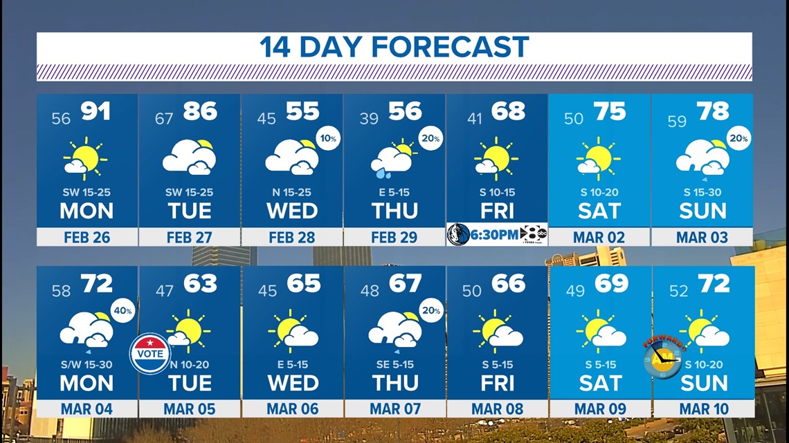
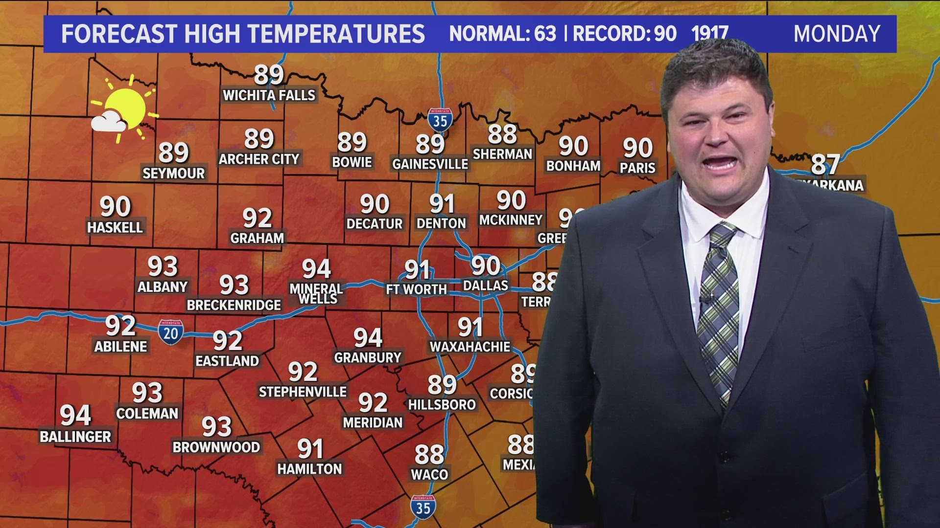
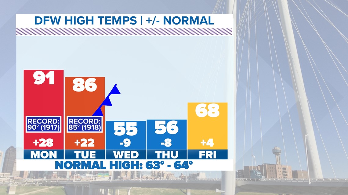
It gets even warmer to start the workweek with highs in the low 90s on Monday and mid to upper 80s on Tuesday. Those highs will threaten record-high temperatures from more than 100 years ago.


90s in February!?
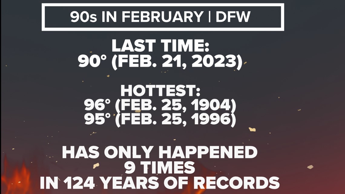
While rare, it may surprise you that we've seen them VERY recently. It was only last year that DFW saw a high of 90 degrees or above!
However, before last year, you have to go back to 1996 to find a high in the 90s. And if DFW can hit 91 degrees or higher on Monday, it will be the warmest February day since 1996.
DFW has only hit the 90s nine times since we've been keeping records (since 1899), so while rare, it is definitely not unheard of.

Fire Danger
The problem with very warm temps, breezy winds and low humidity is that fire danger will be elevated for the DFW area to the west Sunday, Monday and Tuesday.
This year started out wet, but things have dried out recently and grasses have yet to start to green up for the spring. Any fires that get started could spread quickly. Use caution with any open flames or sparks!


Rain and much cooler temps
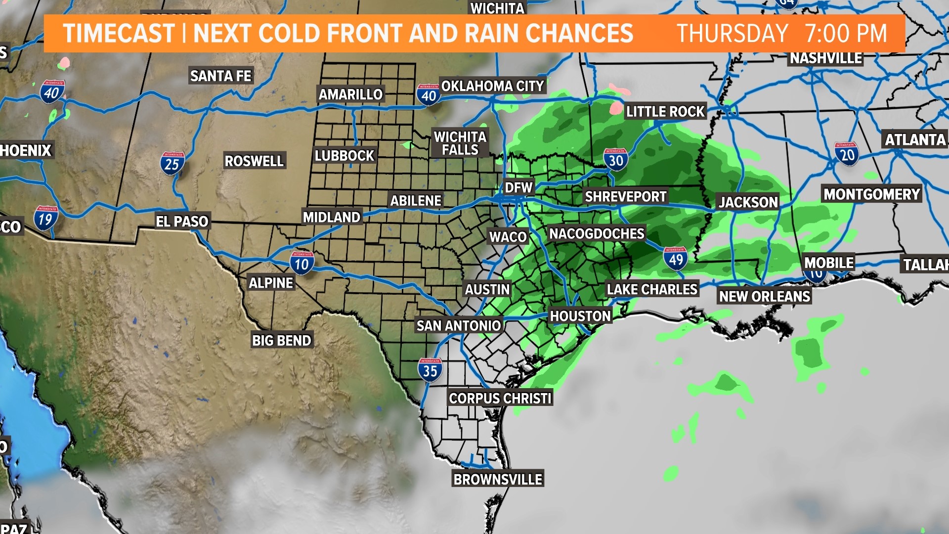
A front will move into the area Tuesday night into Wednesday morning. There could be a few showers or storms in eastern/northeastern North Texas during that time, but coverage looks low.
Some passing showers are possible Thursday as a disturbance moves overhead with scattered rain during the day.
Much cooler air will also move into North Texas with highs only in the 50s Wednesday and Thursday. Nothing Arctic, but definitely a big change from the record heat from the first couple days of the week.

14-day forecast

