DALLAS — EN ESPAÑOL: Regresa el clima cálido y ventoso el resto de la semana
Here's what to expect:
Rest of the week
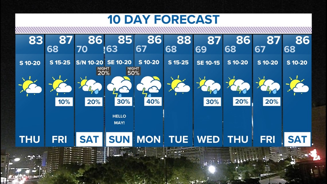
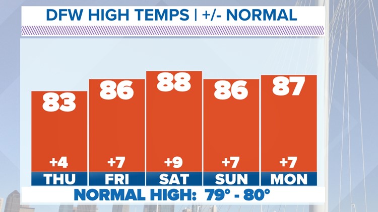
Southerly winds have returned. This brings back moisture and warmer temps.

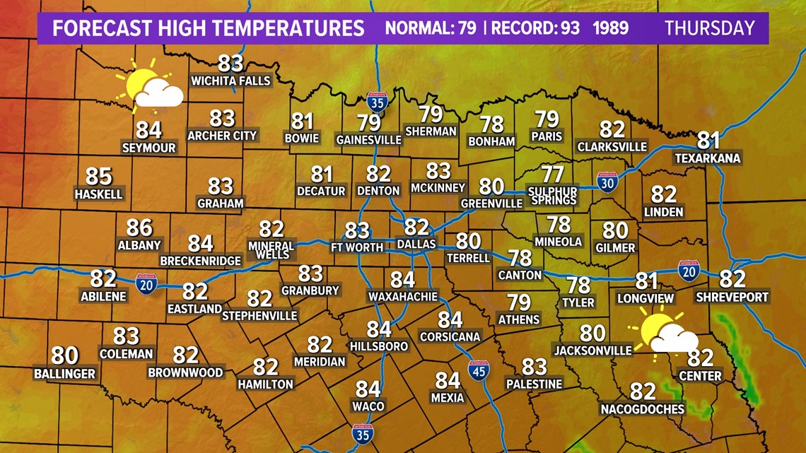
With added moisture means added cloud cover as both Thursday and Friday will start out fairly cloudy with clouds becoming partly cloudy by the afternoon.
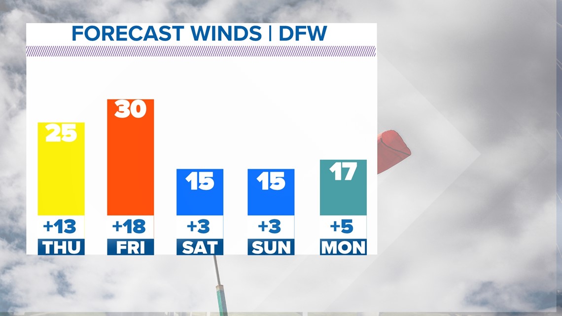
Winds stay gusty the rest of the week as well with gusts from the south between 25 - 35 mph.

Rain and storm chances stay low the rest of the workweek, but not completely zero. On Friday, an isolated storm may form across western or northwestern North Texas during the evening. However, a strong "cap" will be in place, so chances for any storms to form looks pretty low.
This weekend
Overall the weekend will be warm and breezy.
Some showers and storms will be possible as well, but definitely does not look to be a washout.
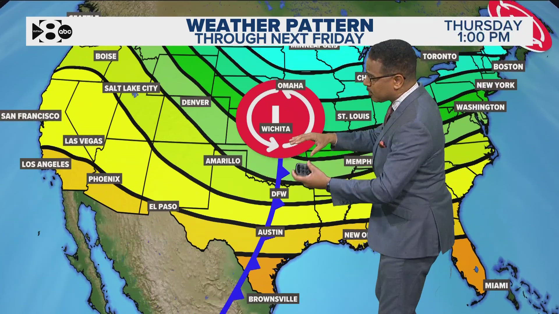
On Saturday, a weak "cold" front moving into the area may pop a couple storms during the afternoon into the evening, but coverage looks very low.
On Sunday, some scattered showers and storms look possible during the afternoon into evening.
Severe threat this weekend is not zero, but does not look overly high either. It's spring in North Texas, and anytime there are thunderstorms the chances for severe storms will almost always be there. Keep checking the forecast and stay weather aware through the weekend!

