DALLAS — Be sure to download the WFAA app to track the latest forecast and get alerts from our team.
Rain chances return and temps start to drop in North Texas this week. Here's the latest forecast:
Versión en Español: Las alertas de calor continúan en el Norte de Texas, pero es posible que veamos alivio
Quick Notes:
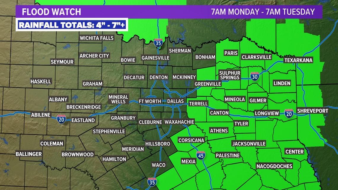
- Flood watch for eastern portions of NTX
- Heavy rain possible from Beryl
- Western portions of the area will see little to no rain
Rain Chances
Did you enjoy some rain on Friday? While not everyone saw it, many did. If you missed out, don't worry. There's more where that came from!
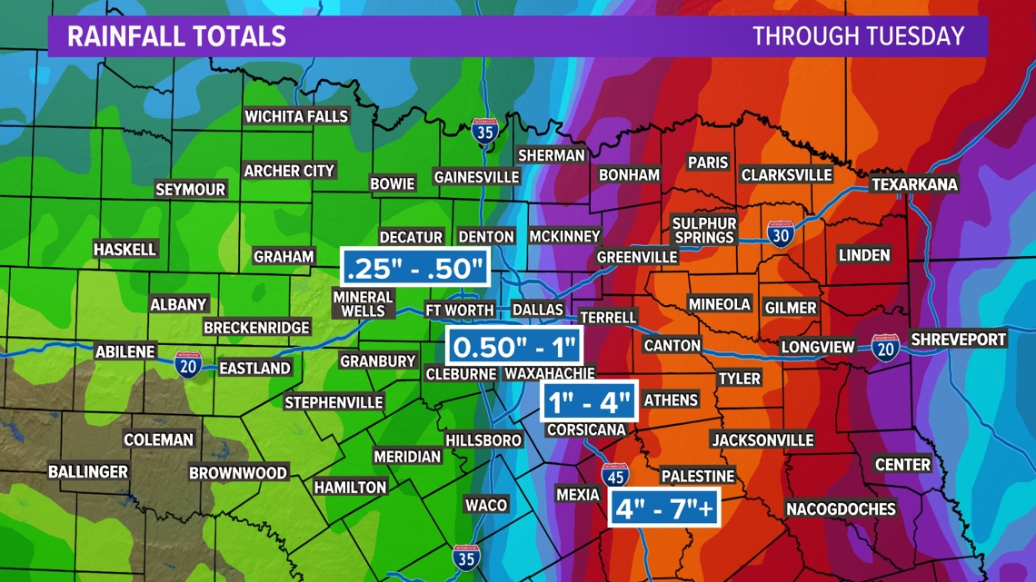
After Hurricane Beryl made landfall near Matagorda on the Texas coast early Monday, the remnants will begin to spread northward. Moisture from those remnants will bring heavy rain to eastern portions of NTX.. Scattered showers and storms are still possible in the metroplex, but much more rain will fall east.
The exact track of Beryl will be a HUGE factor in who sees the heaviest rain totals.
Rain totals over the next 48 hours look pretty solid for many in the state. It's obvious the highest rain totals are going to be in South Texas and along parts of the coast with the direct impacts from Beryl. That's where flash flooding could be a bigger problem. Here in North Texas, we cannot emphasize enough: The exact path will have HUGE impacts on who gets the heaviest rain totals. And the cutoff on those rain totals could be sharp.


14-Day forecast
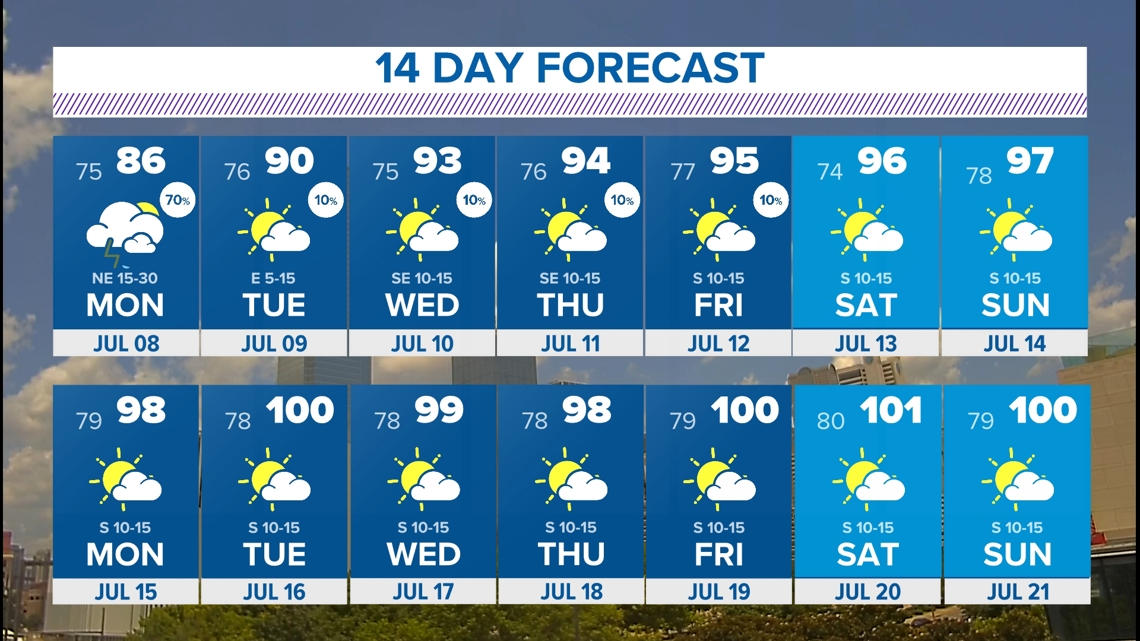
"Cool" is certainly not the right word, but a nice break from the high heat is coming! Over the next 7 days, highs will be near, or even below, normal! There may be even a day or here highs stay in the 80s for some. Enjoy the nice change while you can! We all know it's never long-lasting here in the middle of summer.


