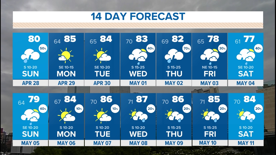
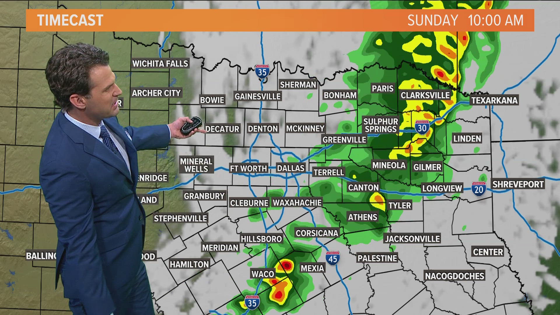
DALLAS — Heavy rain from overnight storms was moving east out of North Texas by daybreak Sunday, but some rain and storms were still in the area, and most of North Texas was under a flood watch until Sunday evening.
Below we're tracking the latest forecast, radar and updates.
Versión en Español: Sol para empezar la semana, pero tormentas para el fin de semana
Quick facts:
- Highest chances for storms Sunday is east of DFW
- Some storms could be severe
- Drying out Sunday evening and night
- More storms possible later this week
Tornado Watch
Rest of Sunday
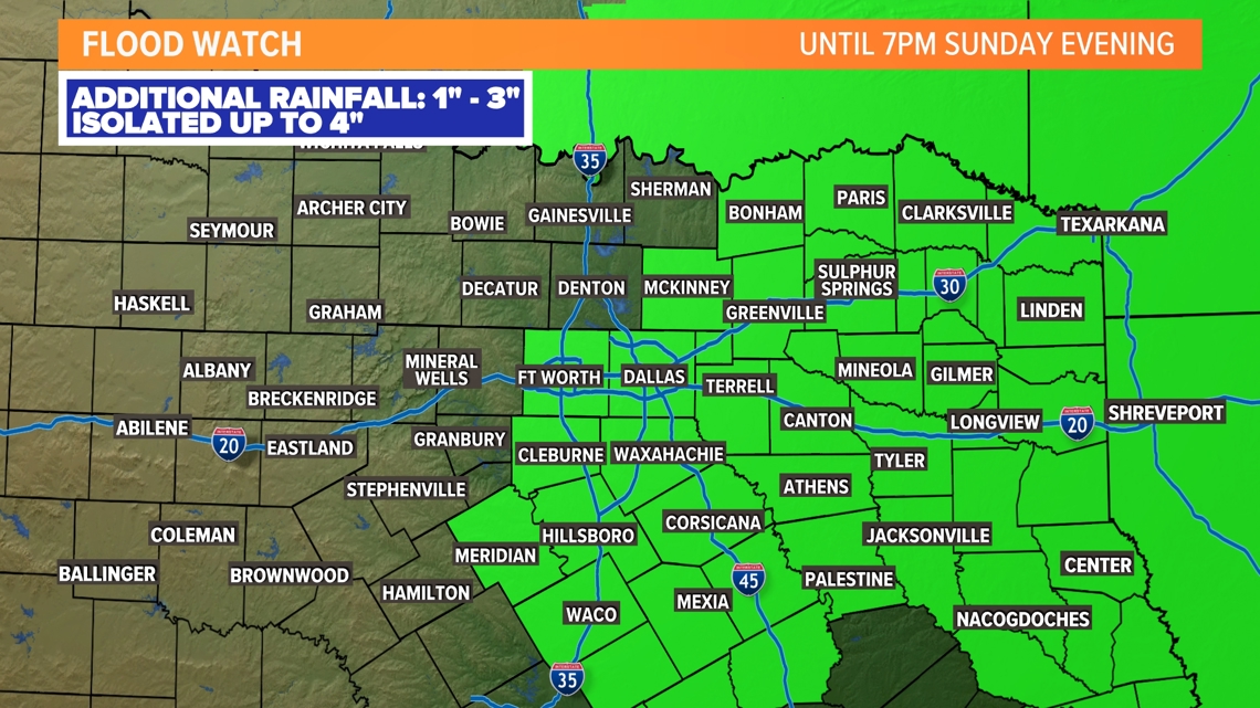
A FLOOD WATCH remains in effect through early this evening. from DFW to the east
While heavy rain has ended for DFW, lingering residual high water is possible in the wake of Sunday morning's storms. Additional flooding is not likely for DFW, but water may be slow to drain in some areas.
As heavy rain shifts east of DFW the rest of Sunday morning, additional flooding may be possible mainly in eastern North Texas and into East Texas.

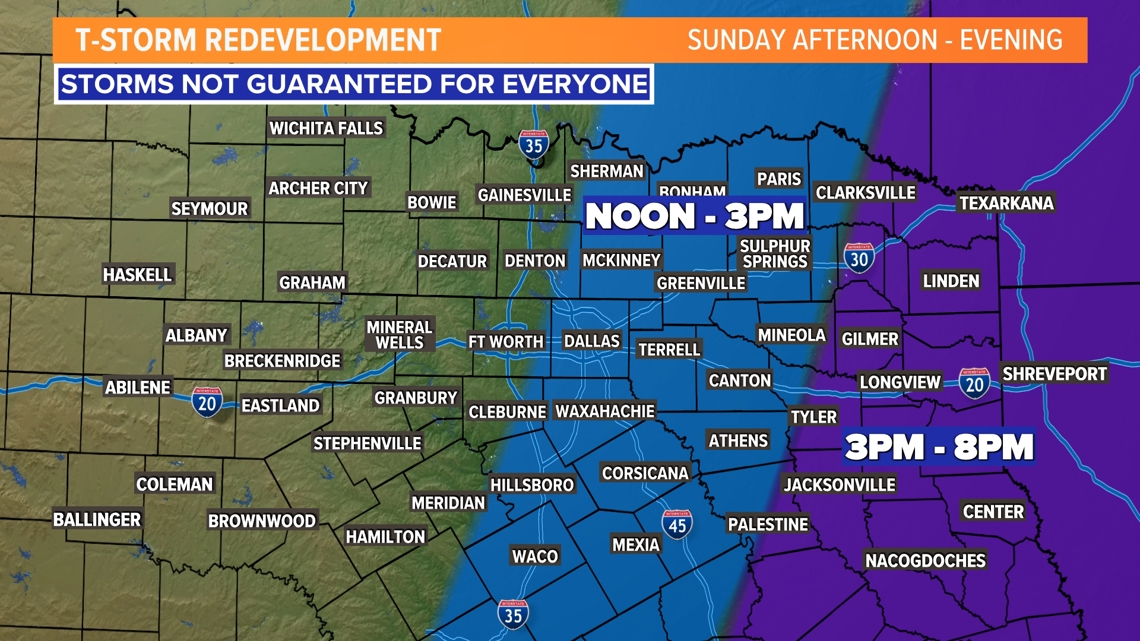
Parts of North Texas could see redevelopment of thunderstorms during the afternoon into evening hours. Simply, best chances will be in places that did not see the heaviest rain Sunday morning. Better chances will be in East Texas over into the ArkLaTex and Louisiana Sunday afternoon and evening.
In and around DFW it is not impossible for some isolated or scattered t-storms through mid-afternoon, but any activity will be hit or miss and storm chances as well as severe chances are low.
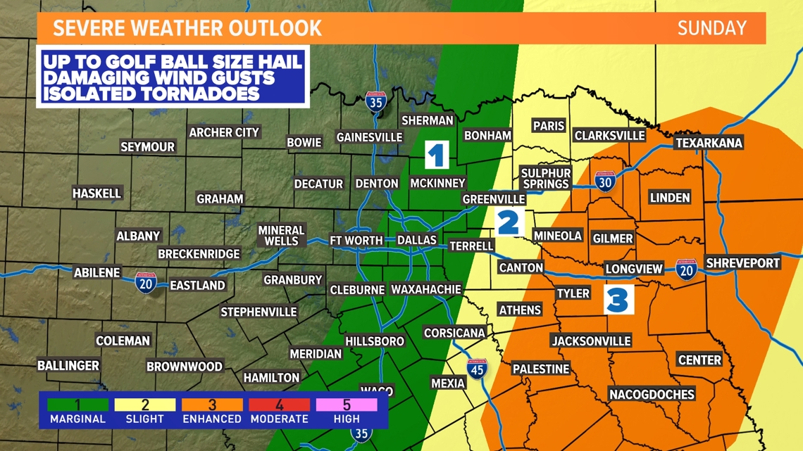
For eastern North Texas into East Texas, severe storms are possible during the afternoon with any thunderstorms that redevelop or move into the area. Main threats will be for damaging winds and hail up to the size of golf balls. The tornado threat in North Texas the rest of Sunday is low, but not completely zero.


14 Day

