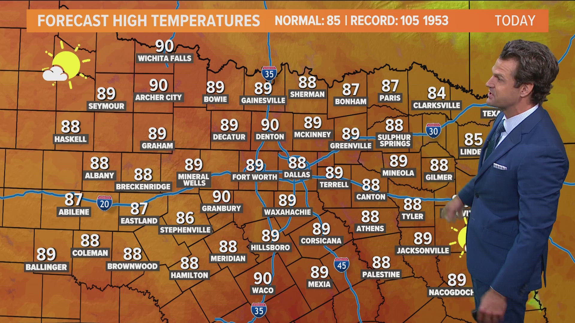
DALLAS — Fall-like weather has returned, but it will still be mostly above normal for this point in the season.
Here's the latest forecast:
Quick Notes:
- Cool mornings, warm afternoons
- No significant rain in North Texas for the foreseeable future
- Humidity stays low
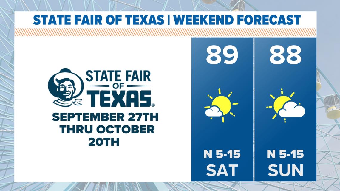
This weekend
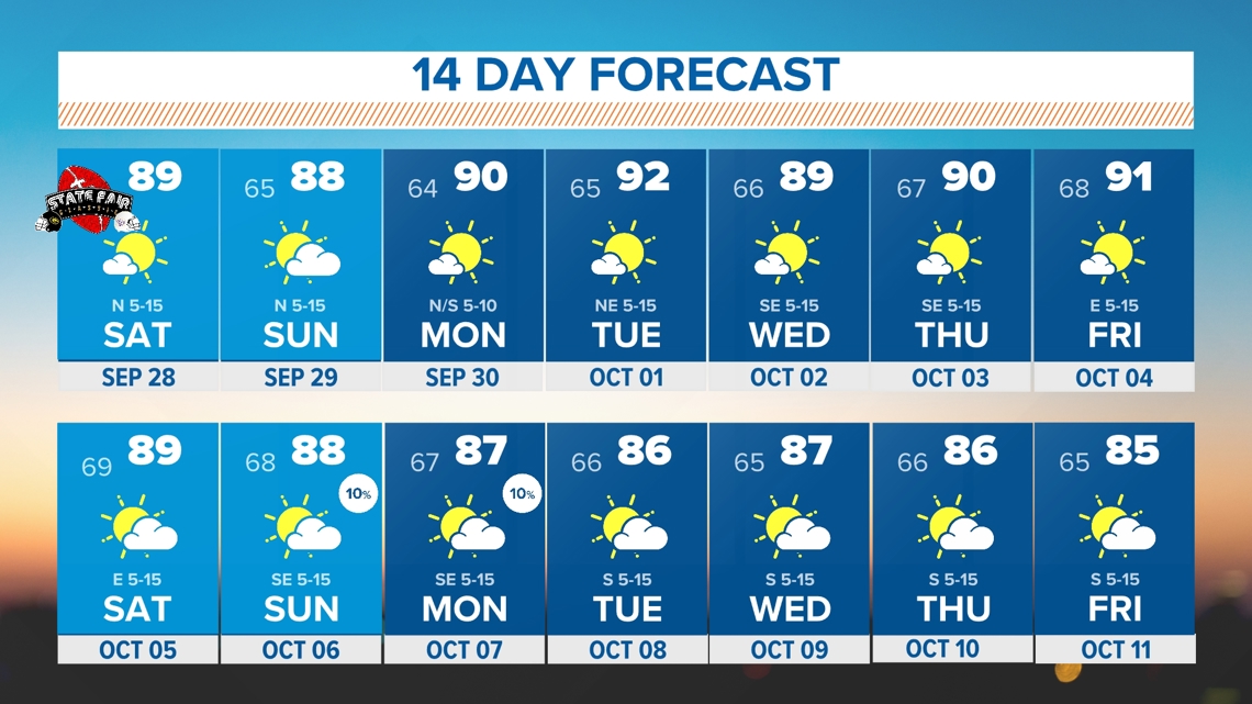
The mornings will be pleasant followed by warm afternoons. Outdoor plans at the fair, football games, etc. will be totally fine!
Humidity will stay low, so even though afternoons will be warmer than normal, it will still feel nice outside.
Sunday will feature some more clouds around the area but North Texas will stay dry.

Rain chances?
Not anytime soon!
Any showers and storms this weekend and through all of next week will stay well away from North Texas. Chances will be confined to areas well northeast and along the Texas coast.


14-day forecast