DALLAS — Be sure to download the WFAA app to track the latest forecast and get alerts from our team.
The heat continues, but rain chances return late week into this weekend.
Below is the latest forecast for this week and beyond.
Versión en Español: Las alertas de calor continúan en el Norte de Texas, pero es posible que veamos alivio
Quick Notes:
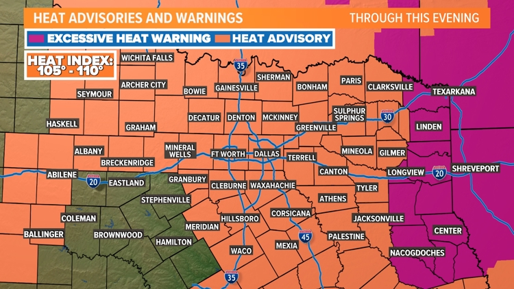
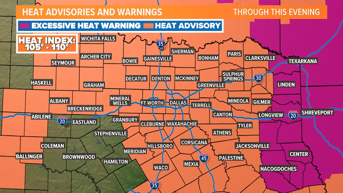
- Heat Advisories continue for one more day
- Temps at or around 100° with heat indices up to 105° - 110°
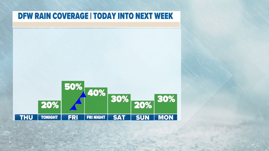
- Rain chances return along with cooler temps late this week into the weekend
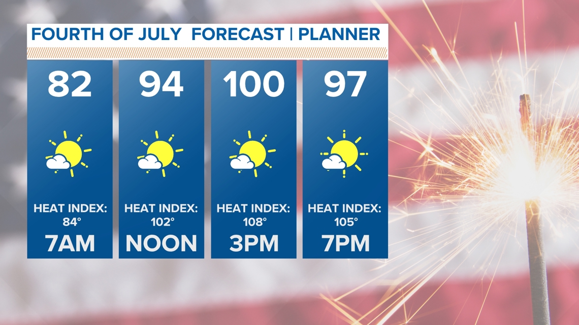
Heat Advisory for 4th of July
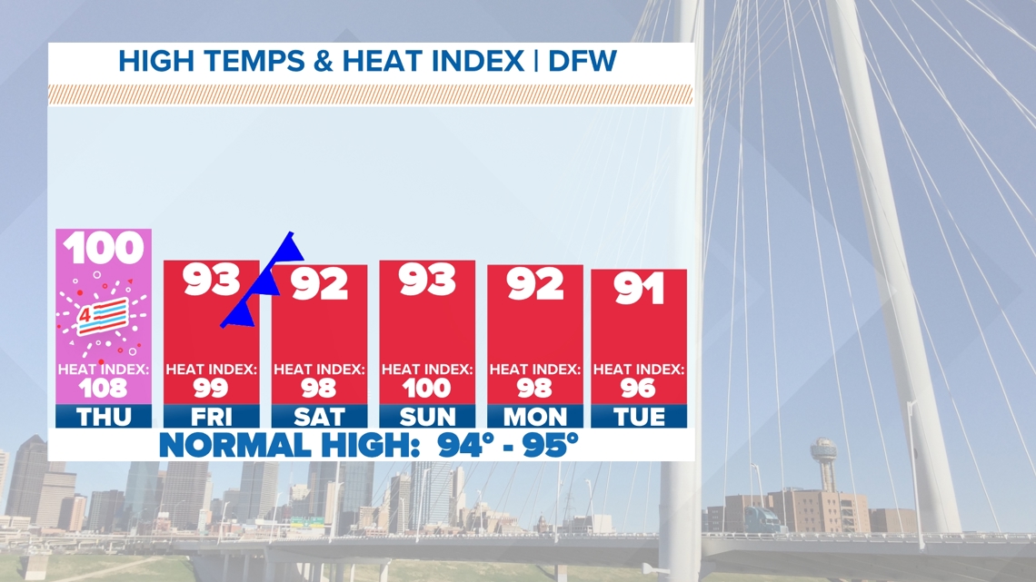
One last day where almost all of North Texas will be under a Heat Advisory today (July 4th). Highs will be at or around 100° and heat index values will be at or above 105° during the afternoon.
We'll also stay dry for any 4th of July plans or fireworks festivities during the evening.
There is a small chance for some showers along the Red River after 8pm, but most stay dry.
If you have outdoor plans, make sure to have a way to stay cool and stay hydrated!


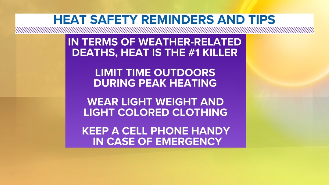
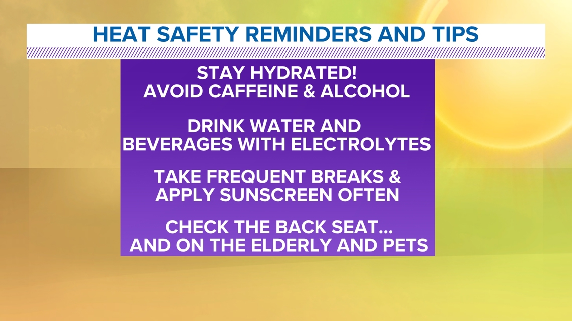
Heat Safety


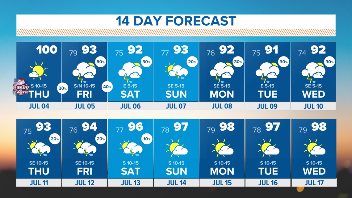
Relief and rain chances!
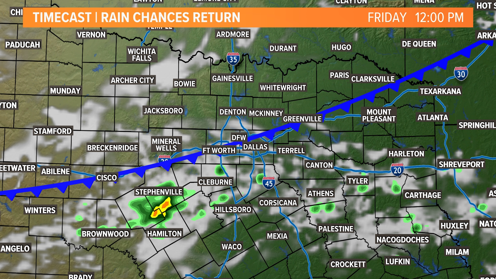
A weak cold front will move south into North Texas on Friday. As of now, this looks to bring scattered rain Friday, Saturday, and into Sunday with highest coverage Friday into Saturday morning. A few spots along the Red River may even see rain as early as Thursday evening, but most stay dry.
The severe threat looks low at this point and rain is not guaranteed for everyone. Regardless, the increased cloud cover and rain around the area will provide a respite from the triple digits.
Our pattern looks to stay active into next week with rain chances continuing and temps staying below 100°.


14 day forecast