DALLAS — Versión en Español: El Reporte del Tiempo en Dallas-Fort Worth: Calor peligroso continúa esta semana para el Norte de Texas
High heat continues for most of the state through the middle of July. Heat alerts continue for today.
Quick facts
- 100s return this week
- Rain chances slim to none
- Dog days of summer are here
Triple digits return Monday
After a break from the triple digits this weekend for most of North Texas, they will return on Monday. Highs will be at or above 100° from the DFW area to the west. Areas east of DFW may escape the triple digits, but the humidity will be higher so heat index values will likely be at or above 100°.

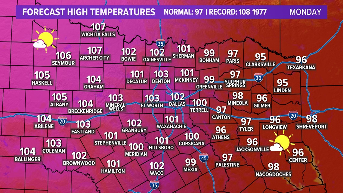
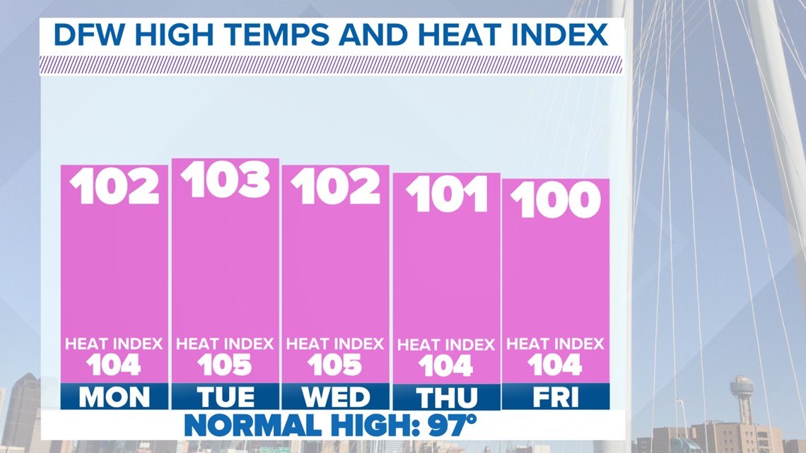
The one decent thing about Monday is the humidity will be on the lower end for most of North Texas. That keeps heat index values from not climbing into the 105° to 110° range, which is why NO Heat Advisories are in effect for Monday. However, it is possible they could be in effect later in the week.
Because of light winds, sunshine, and hot temps, Monday is also an Ozone Action Day for DFW and the surrounding area.
Relentless oppressive July heat
The "heat dome" moved away this weekend allowing for our cool-down, but looks to move back closer to Texas this week. That will bring a return of triple digits for the foreseeable future.


Fire Danger
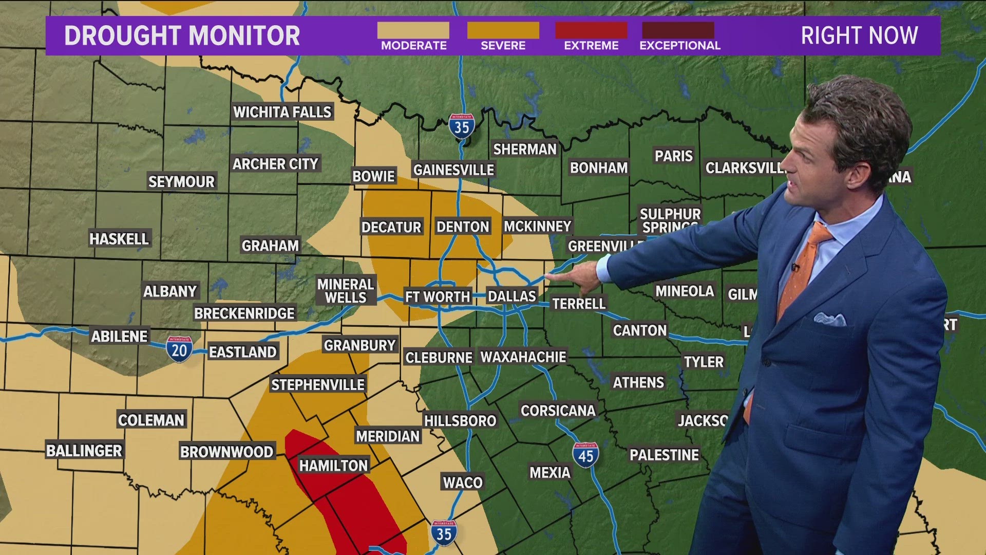
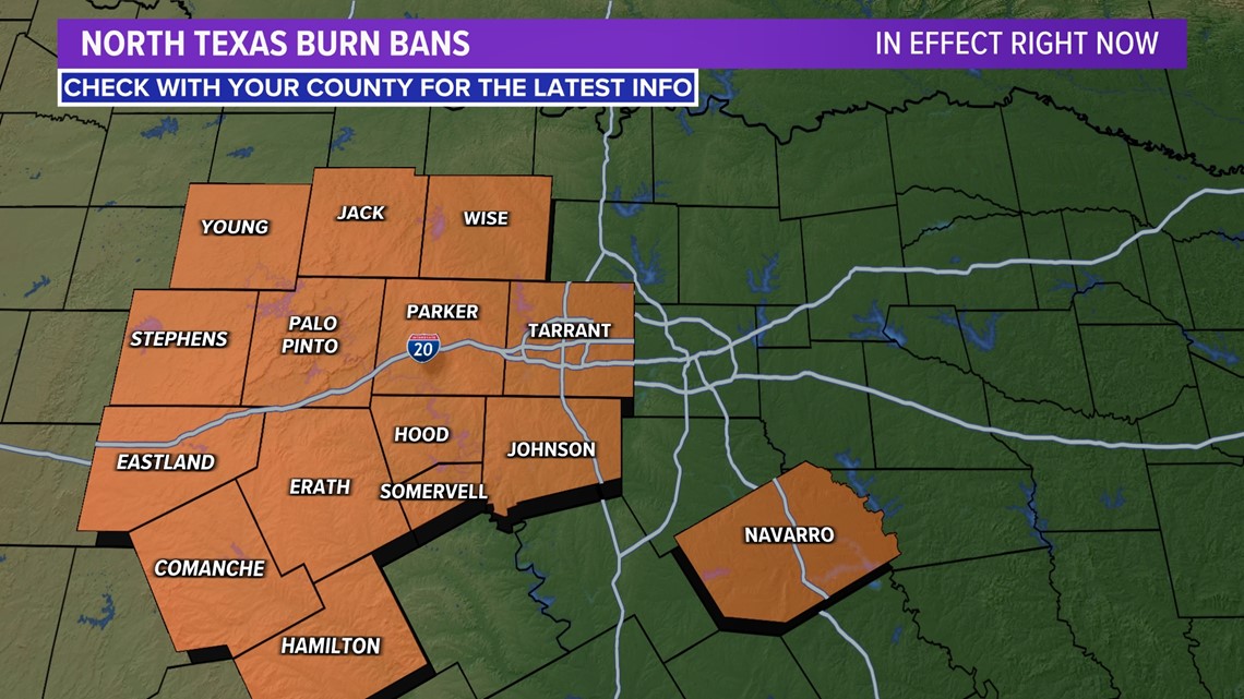
Because of drought and dry conditions, almost all counties in western North Texas are currently under burn bans. Always check with your county for the latest information as more counties could get added to burn bans at any time and some counties take it day by day.

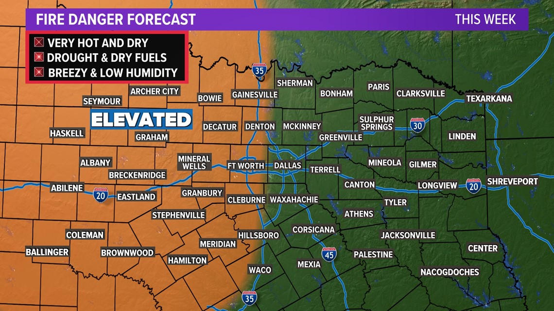
Fire danger will remain elevated for the western half of North Texas for the foreseeable future. Until these areas see rain, cooler temps, higher humidity, or a combination of all three, fire danger will continue.

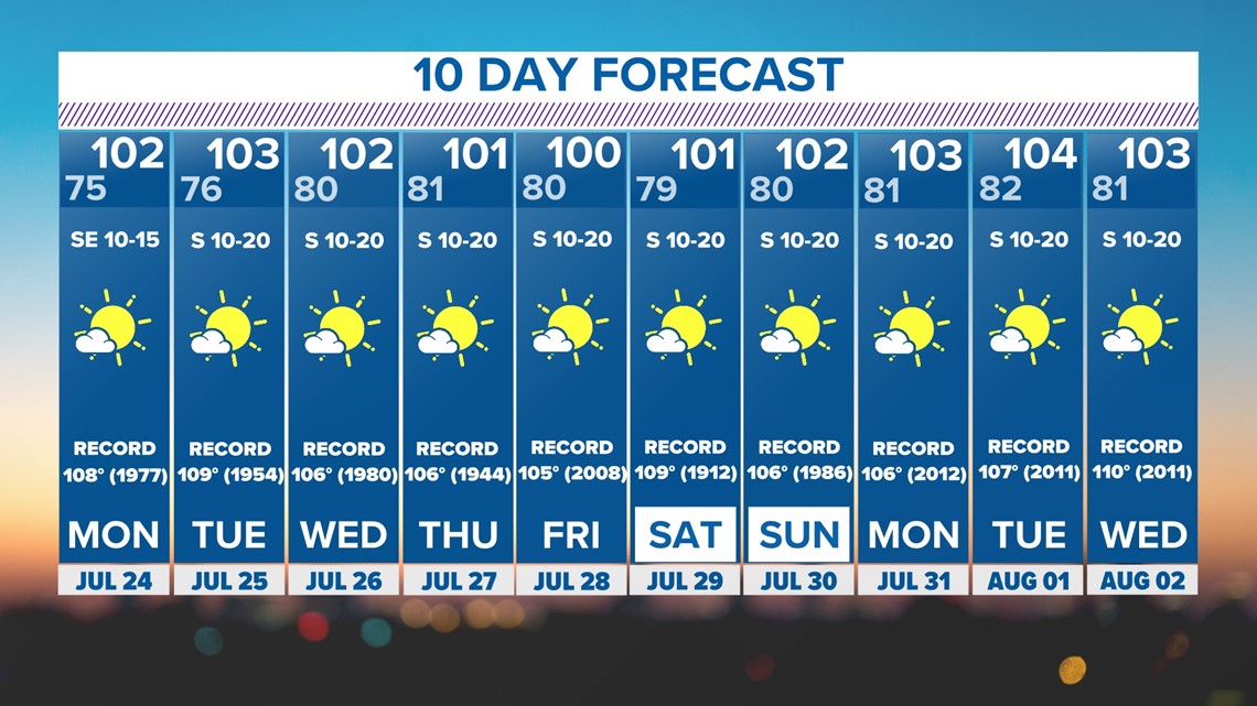
10-day forecast
After a break from the triple digits, they'll come back for the workweek and look to be sticking around through at least early August.

