DALLAS — Be sure to download the WFAA app to track the latest forecast and get alerts from our team.
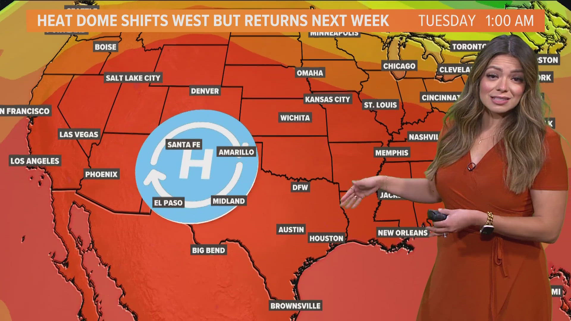
After a streak of below normal temps, real summer has returned to North Texas.
Versión en Español: Ha llegado el calor del verano. ¿Estás listo?
Quick Notes:
- Near or above normal temps through the weekend
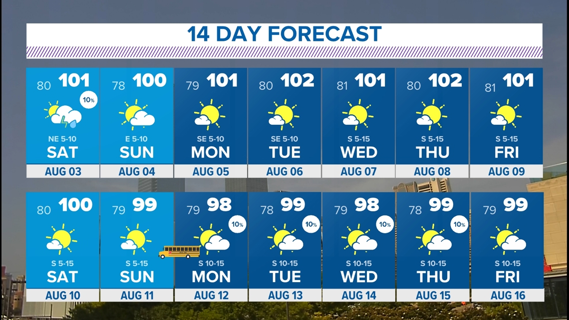
- Several triple digits in the forecast
- Maybe some rain chances this weekend
Summer is back!
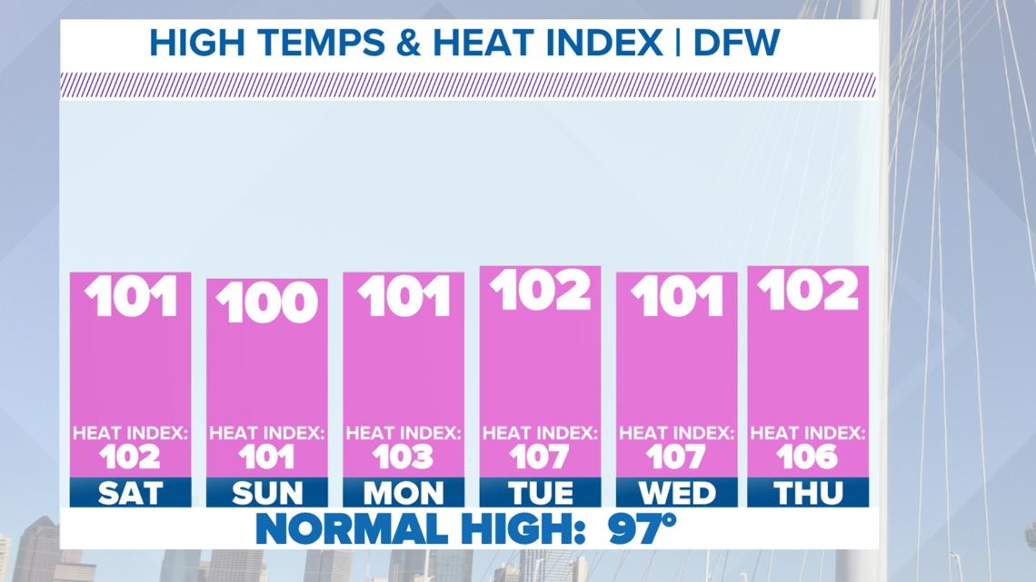
Highs to end the week will be around or above 100° and lasting through this upcoming weekend.
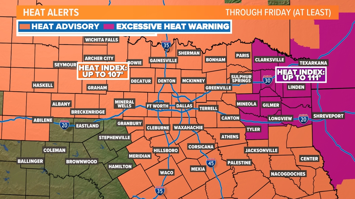
Of course, the humidity will be out there as well, so a Heat Advisory is in effect for most of North Texas through Friday. Heat Advisories are issued when afternoon heat index values top out between 105° and 110°. An Excessive Heat Warning will be in place for Friday afternoon east of DFW. The heat index there will be up to 112°.


Saharan dust
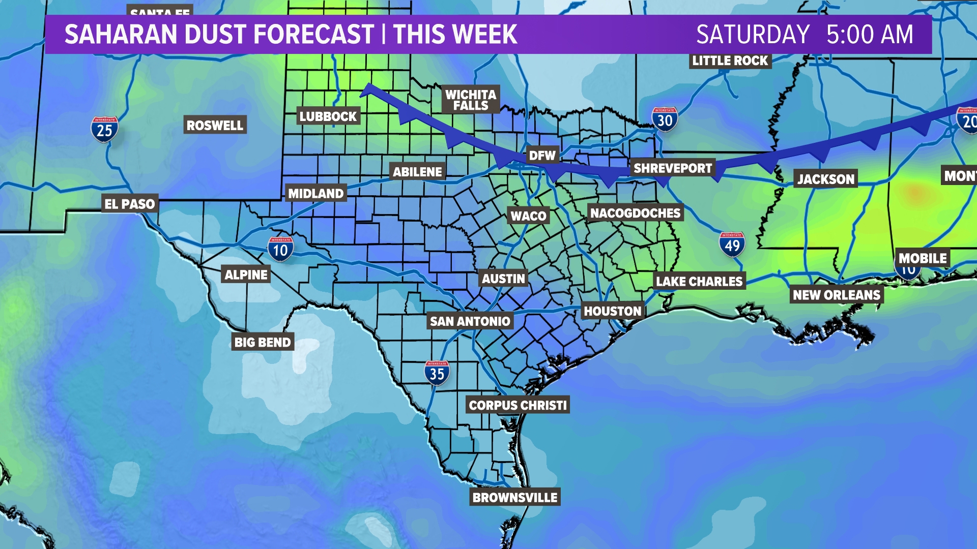
Saharan dust has returned this week. It is very typical this time of the year. Strong storms over the Saharan Desert haul dust into the atmosphere and it gets picked up by the trade winds. Those winds carry dust across the Atlantic and sometimes make it into Texas! A bigger, more dense plume has arrived. This may impact some allergy suffers! Dust is expected to last through Friday. Saturday's cold front will help push dust out of the region.
Rain?
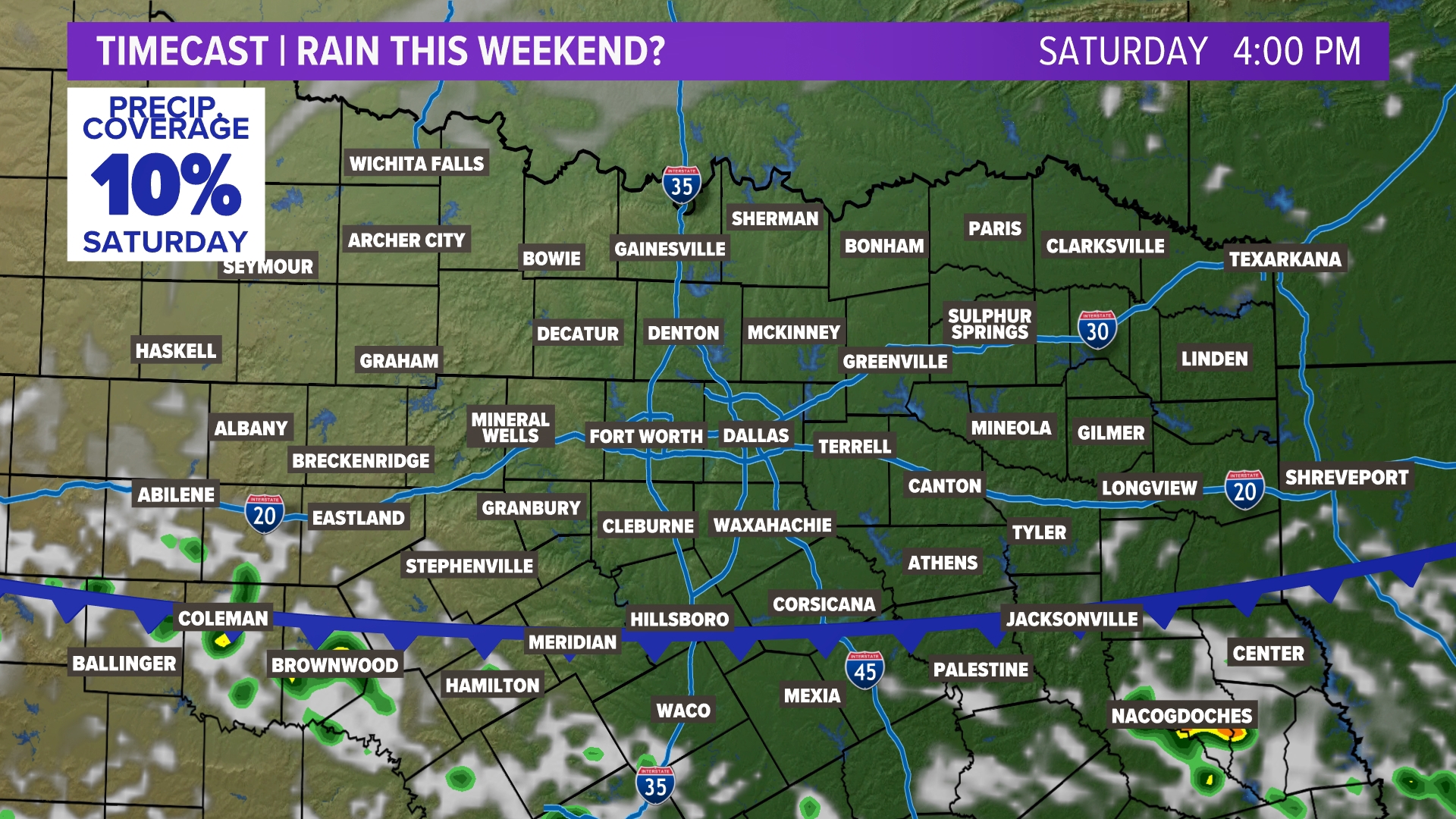
It is possible! It won't be for everyone and it won't be much. A weak cold front arrives this weekend before stalling south of DFW on Sunday. It won't cool us down much at all, but the front could help produced isolated showers and storms mainly on Saturday. As of now, rain coverage looks low and rain totals look minimal.
Basically, consider yourself very lucky if you happen to see a pop-up shower or storm this weekend.
The front will bring in slightly drier air. This makes the heat index stay below 105 and out of the heat advisory criteria.
14 Day

