Well, we asked for it.
After a brutal run of 100-degree days -- close to a record-setting pace, even! -- we got the break we asked for in the form of a rain system that copious amounts of precipitation overnight across the region. And it took another record-setting event to get us there.
The heavy, flooding rain has moved on, but high water remains in places.
- It's the second consecutive day in which we've seen record daily rainfall amounts at DFW Airport
- These back-to-back days of rain have already made August 2022 the second-wettest August on record
- The rain from this weekend has also already made August 2022 the wettest month DFW has seen on record since October 2018
- The overnight rain represents the second-highest rain total we've seen on record in a 24-hour period, with the just over nine inches already reported second only to the all-time high of 9.57 inches seen in September 4 and 5 of 1932
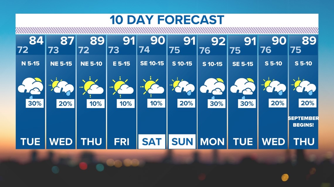
So, does this mean the end of triple-digit heat, officially? Not necessarily, but no such high temps are showing up on our 10-day forecast.
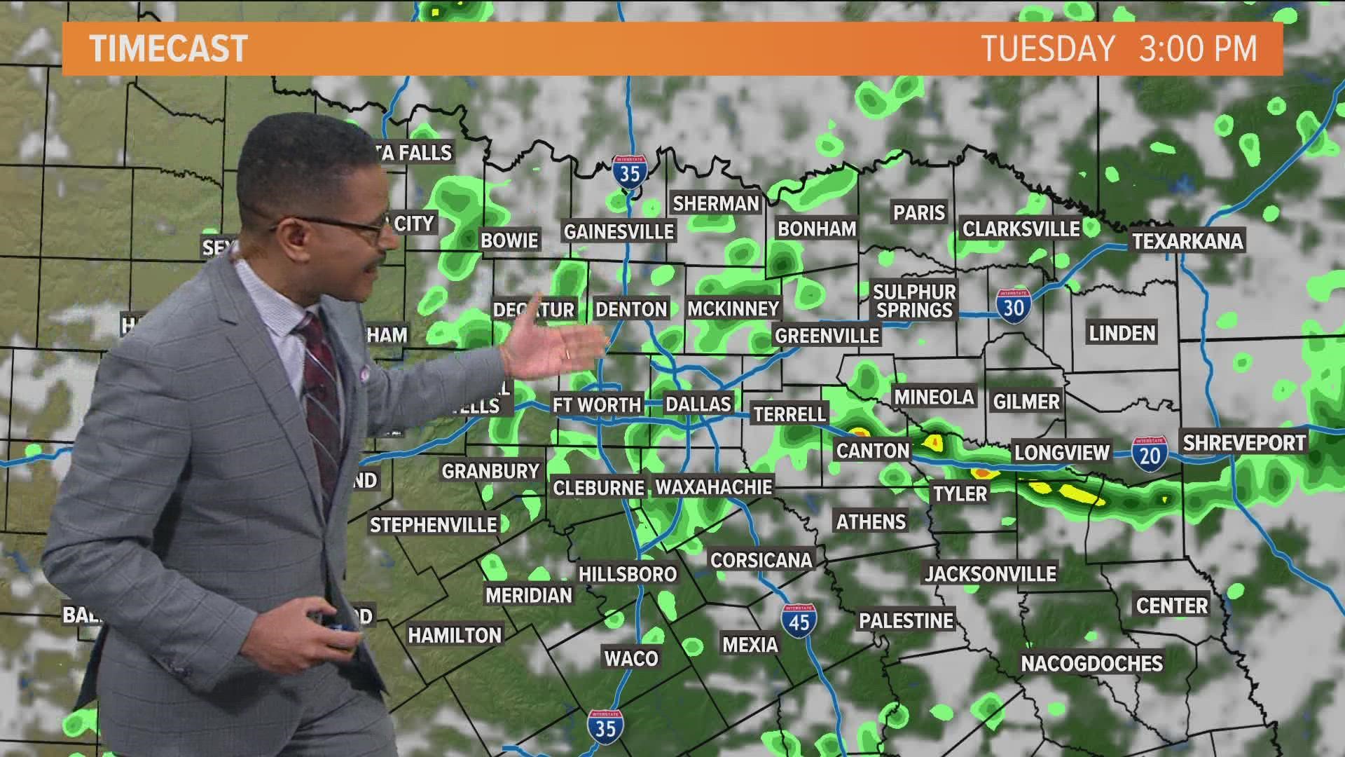
Meanwhile, what does the rest of the day -- and week -- look like in terms of additional rain?
Let's get into it.
Remember: NEVER DRIVE INTO OR THROUGH FLOODED ROADWAYS.
Tuesday - Wednesday
Scattered showers and storms are possible during the day, but these will be of the hit or miss variety. Any t-storms will also be moving, so hours of heavy rain is not likely.
So while some rain is possible, amounts causing additional flooding is very unlikely.


