DALLAS — It was a cool start to the week, but temps are now warming quickly as we head into Easter Weekend. Here are the latest forecast updates for this week.
Quick facts:
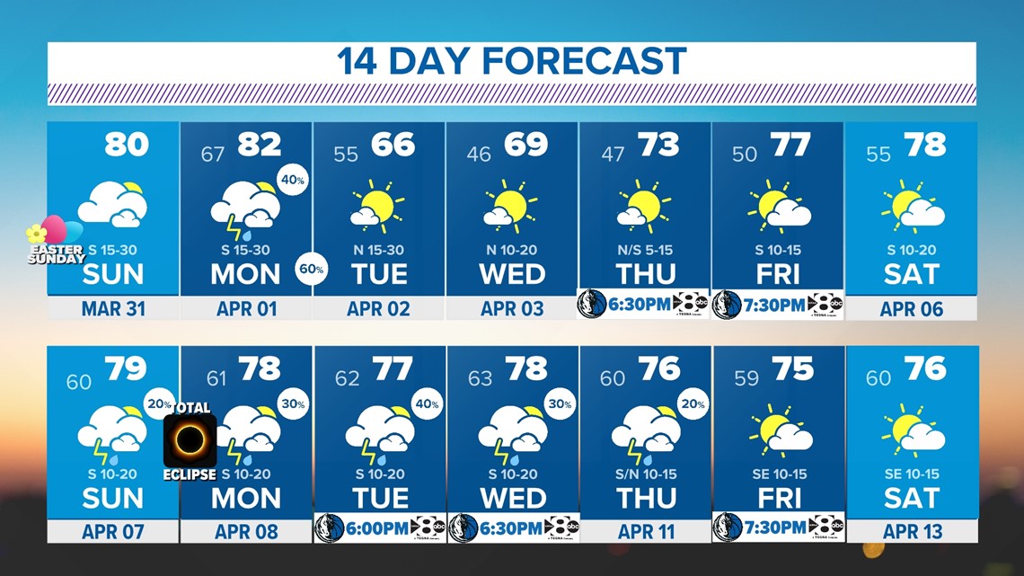
- 80-degree temps on Easter
- Breezy and dry for now
- Next chance for severe storms is Monday - Monday night
Easter Sunday
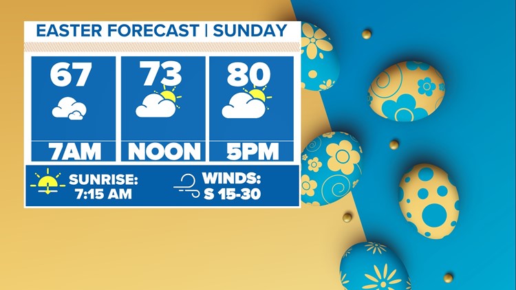
Overall, Easter is looking dry, warm, and breezy. The breeze may be annoying for any outdoor plans, but the forecast will remain dry.
Easter Sunday will start off with clouds and mild temps in the 60s. Clouds will not clear much during the day, but rain will not fall out of those clouds. Some peeks of sun are possible Easter Sunday afternoon, but don't count on much.


Monday Severe Storm Chances
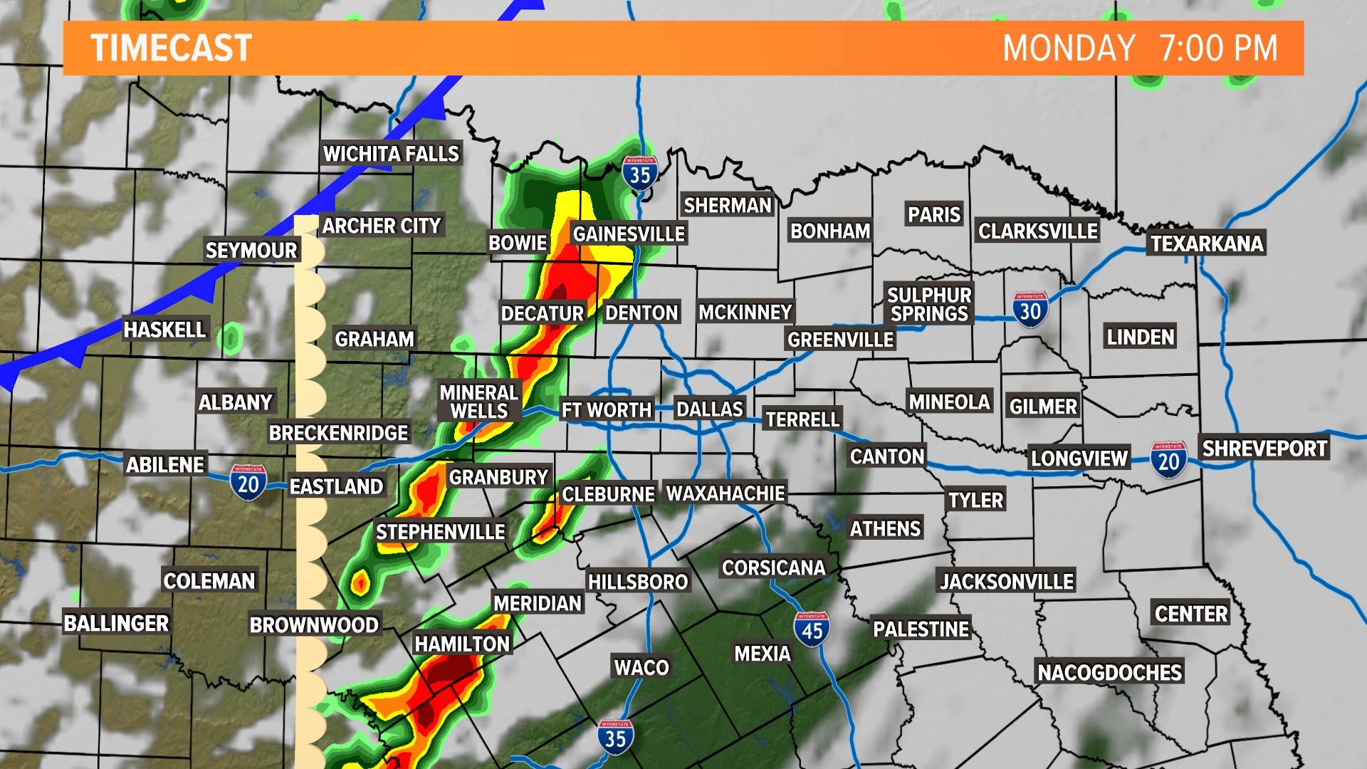
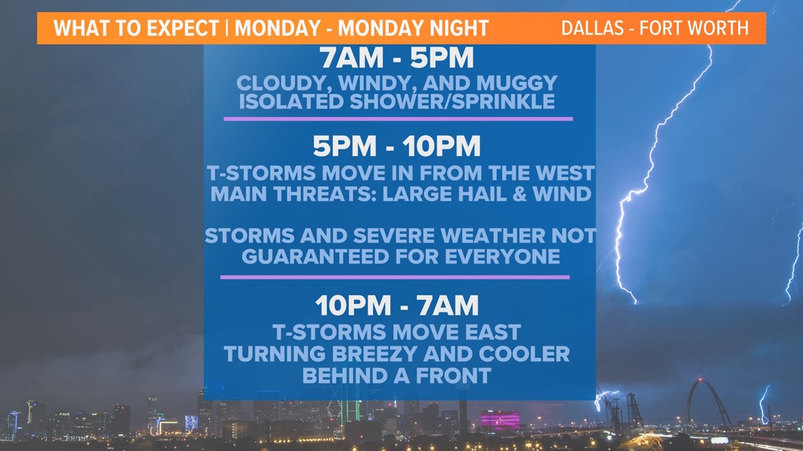
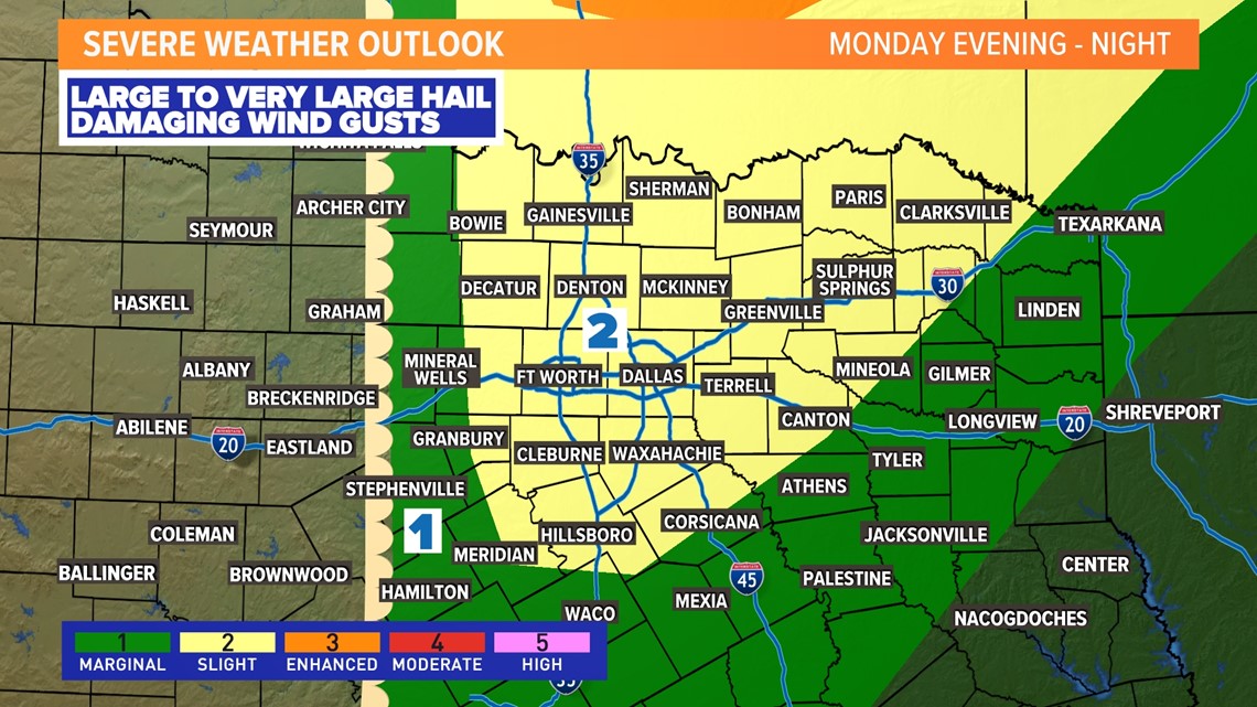
Our next chance for severe weather in North Texas will be Monday evening into night. At this time, a level 2 slight risk is in place for most of the area. The main concern is the potential for severe storms producing large hail and strong winds. The tornado threat with any storms is not zero, but it does look lower at this point. The higher threat is north of the Red River.
For DFW, chances for storms looks to be around 5 p.m. to 10 p.m. give or take. Storms and severe weather are not guaranteed for everyone, but any storms out there will likely be severe.
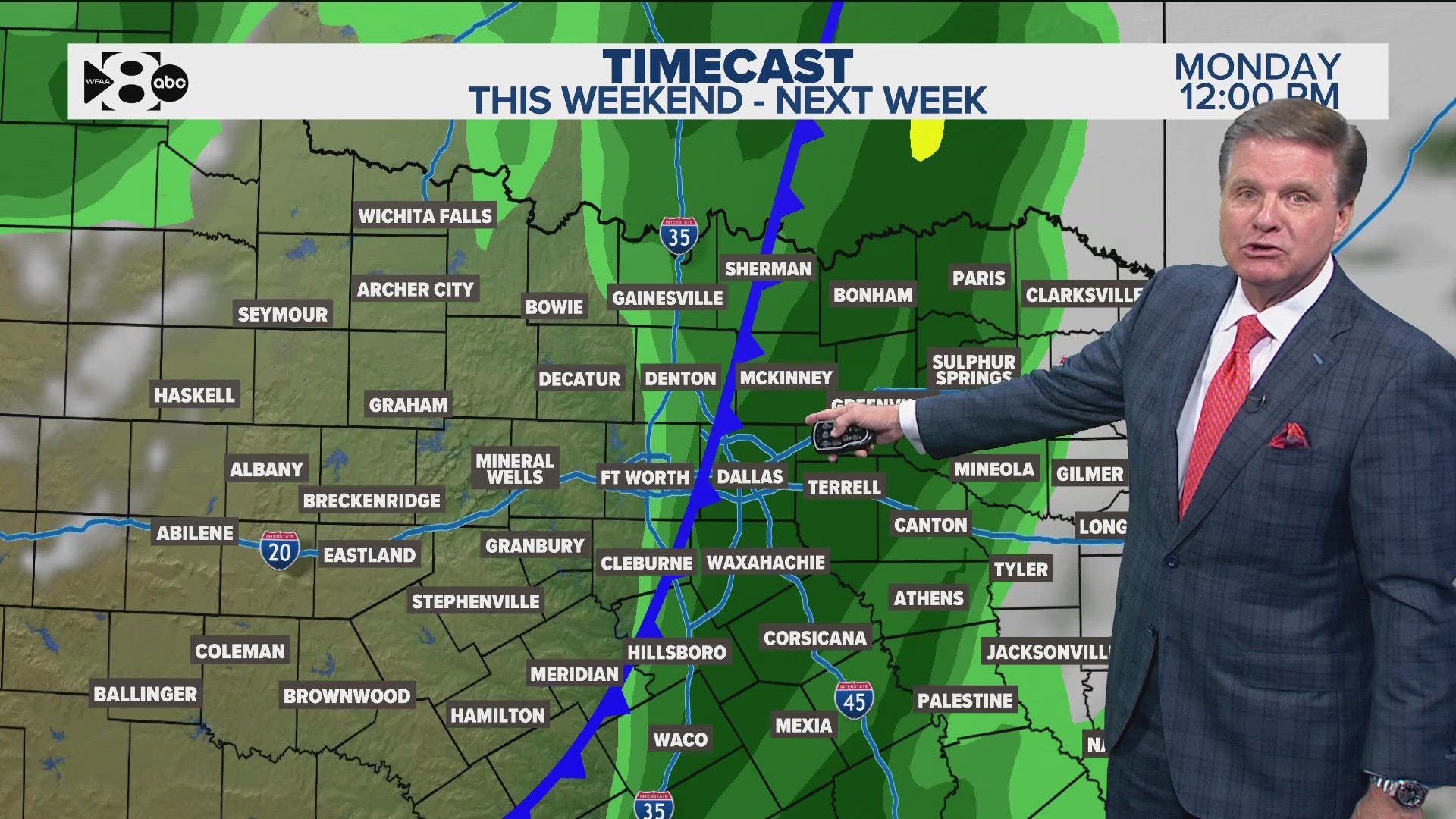
Storms will first form in western North Texas (3 p.m. - 5 p.m.) and then move east into DFW and the rest of North Texas. Heading into the late night hours (after 10 p.m.) storms will move out of North Texas or dissipate.




14-day forecast
Behind Monday's storm chances temps will be cooler for the middle part of next week. Some days will feature lows in the 40s again. After that, temps warm and the pattern turns a bit unsettled by next weekend into the following week. So... that means for the Solar Eclipse, which is almost a week away, the forecast could feature some rain. We'll keep you posted!

